10-Day Weather Forecast - Saint Clair, MI
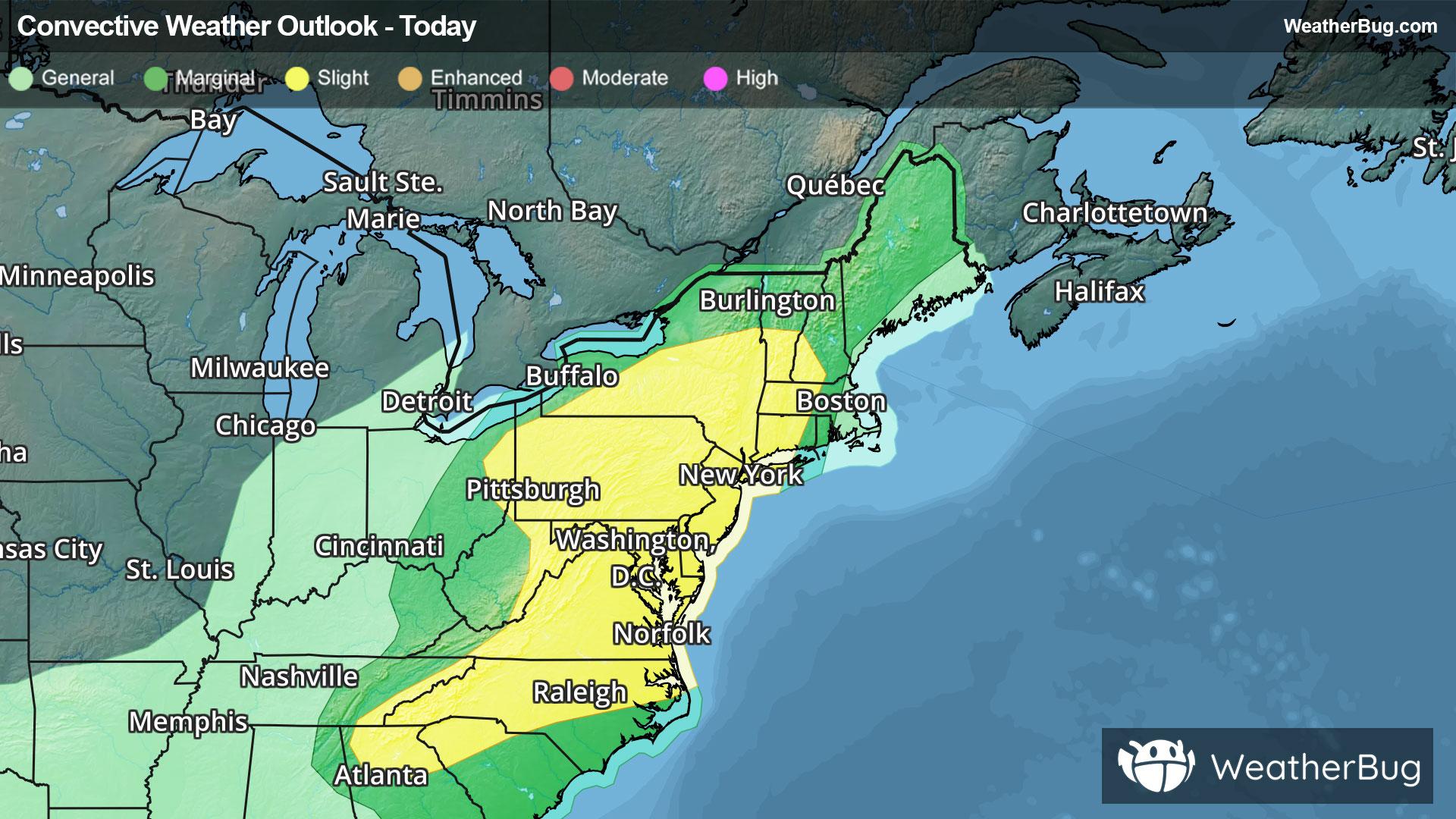
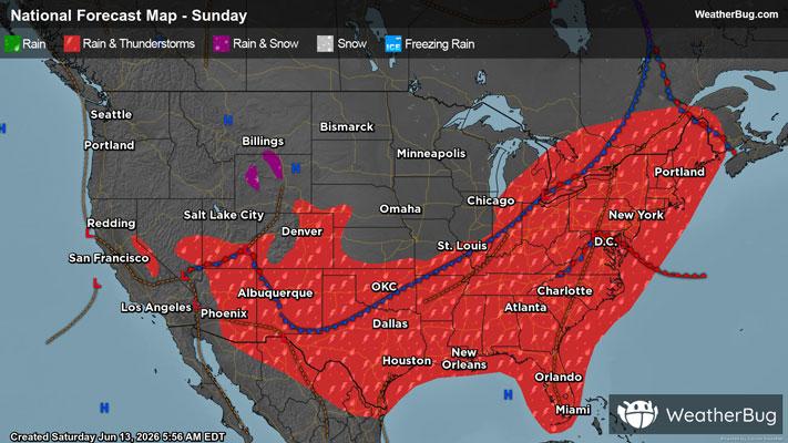
Weekend Weather
- |64°F
 ThunderstormsHourly details
Tonight
64°FShowers and a chance of thunderstorms early in the morning then a chance of showers and a slight chance of thunderstorms early in the morning. Temperatures rising into the in the upper 60s after midnight. West winds up to 10 mph becoming northeast early in the morning. Chance of rain 90 percent.
- 70|48°F
 ThunderstormsHourly details
Day
70°FShowers and a chance of thunderstorms until late afternoon then a chance of showers in the late afternoon. Highs in the lower 70s. Temperatures falling to around 60 in the afternoon. North winds up to 15 mph becoming northwest with gusts up to 25 mph in the late afternoon. Chance of rain 90 percent.
Night
48°F
Partly cloudy in the evening then clearing. Lows in the upper 40s. Northwest winds up to 10 mph with gusts up to 20 mph becoming west after midnight.
- 69|54°F
 Partly CloudyHourly details
Day
69°FPartly cloudy. Highs around 70. West winds 5 to 15 mph with gusts up to 25 mph.
Night
54°FPartly cloudy. Lows in the lower 50s. Southwest winds 5 to 10 mph.
- 73|58°F60% Chance of StormsHourly details
Day
73°FMostly sunny in the morning then showers likely and a chance of thunderstorms in the afternoon. Highs in the mid 70s. Southwest winds 5 to 15 mph with gusts up to 25 mph. Chance of rain 60 percent.
Night
58°FPartly cloudy. Showers likely and a chance of thunderstorms in the evening. Lows in the mid 50s. Chance of rain 70 percent.
- 72|58°F
 40% Chance Rain ShowersHourly details
Day
72°FPartly cloudy. A chance of showers in the afternoon. Highs in the mid 70s. Chance of rain 40 percent.
Night
58°FBreezy. Showers and a chance of thunderstorms. Lows in the upper 50s. Chance of rain 90 percent.
- 69|54°F50% Chance Rain ShowersHourly details
Day
69°FBreezy. Mostly cloudy with a chance of showers in the morning then partly cloudy with a chance of showers in the afternoon. Highs in the mid 70s. Chance of rain 50 percent.
Night
54°FPartly cloudy. Lows in the mid 50s.
- 73|56°F30% Chance Rain ShowersHourly details
Day
73°FMostly sunny. A chance of showers in the afternoon. Highs in the mid 70s. Chance of rain 30 percent.
Night
56°F
Mostly clear. Lows in the mid 50s.
Weekend Weather
- 73|55°F40% Chance Rain Showers
Day
73°FMostly sunny in the morning then partly cloudy with a chance of showers in the afternoon. Highs in the mid 70s. Chance of rain 40 percent.
Night
55°F
Mostly clear with a slight chance of rain. Chance of precipitation 30%. Low temperature around 55F. Dew point will be around 50F with an average humidity of 68%. Winds will be 4 mph from the NW.
- 69|55°F
 40% Chance of Rain
Day
69°FSunny with a chance of rain. Chance of precipitation 35%. High temperature around 69F. Dew point will be around 49F with an average humidity of 57%. Winds will be 4 mph from the N.
Night
55°FClear with a chance of rain. Chance of precipitation 40%. Low temperature around 54F. Dew point will be around 48F with an average humidity of 67%. Winds will be 4 mph from the NE.
- 70|55°F30% Chance of Rain
Day
70°FSunny with a slight chance of rain. Chance of precipitation 30%. High temperature around 70F. Dew point will be around 49F with an average humidity of 56%. Winds will be 5 mph from the N.
Night
55°F
Clear. Low temperature around 55F. Dew point will be around 49F with an average humidity of 67%. Winds will be 5 mph from the NE.