10-Day Weather Forecast - Troy, MI
- 87|69°F
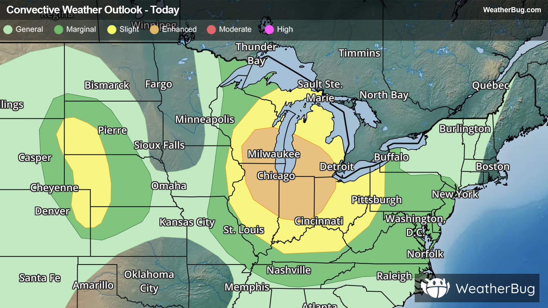
 40% Chance of StormsHourly details
Today
87°FPartly cloudy with scattered showers and thunderstorms. Highs in the mid 80s. Southwest winds 5 to 15 mph. Chance of rain 40 percent. Heat index readings heat index values up to 90.
Tonight
69°F
Mostly cloudy. Numerous showers and scattered thunderstorms in the evening then scattered showers and isolated thunderstorms after midnight. Lows in the mid 60s. Southwest winds 5 to 10 mph becoming northwest with gusts up to 20 mph after midnight. Chance of rain 60 percent.
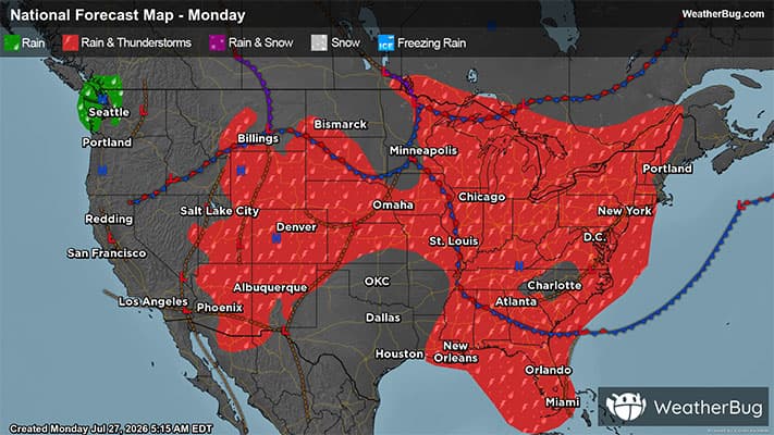
- 77|63°F
 Partly CloudyHourly details
Day
77°FMostly cloudy in the morning then becoming partly cloudy. Highs in the upper 70s. North winds 10 to 15 mph with gusts up to 25 mph.
Night
63°F
Mostly clear. Lows around 60. North winds 5 to 15 mph with gusts up to 25 mph.
- 78|59°F
 Mostly SunnyHourly details
Day
78°FMostly sunny. Highs in the upper 70s. North winds 10 to 15 mph with gusts up to 25 mph.
Night
59°F
Clear. Lows in the upper 50s.
- 82|62°F
 SunnyHourly details
Day
82°FSunny. Highs in the lower 80s.
Night
62°FMostly clear. Lows in the lower 60s.
- 83|70°F
 30% Chance Rain ShowersHourly details
Day
83°FPartly cloudy. A chance of showers in the afternoon. Highs in the mid 80s. Chance of rain 30 percent.
Night
70°F
Mostly cloudy with a 30 percent chance of showers. Lows in the mid 60s.
Weekend Weather
- 83|65°F50% Chance of StormsHourly details
Day
83°FMostly cloudy in the morning then partly cloudy with a chance of showers and thunderstorms in the afternoon. Highs in the lower 80s. Chance of rain 50 percent.
Night
65°FMostly cloudy with a chance of showers in the evening then partly cloudy after midnight. Lows in the lower 60s. Chance of rain 30 percent.
- 81|65°FPartly Cloudy
Day
81°FPartly cloudy. Highs in the lower 80s.
Night
65°F
Clear with a 35% chance for rain and thunderstorms. Low temperature around 65F. Dew point will be around 61F with an average humidity of 75%. Winds will be 3 mph from the N.
- 82|67°FSunny
Day
82°FSunny. High temperature around 82F. Dew point will be around 63F with an average humidity of 65%. Winds will be 3 mph from the NW.
Night
67°FClear. Low temperature around 67F. Dew point will be around 63F with an average humidity of 75%. Winds will be 3 mph from the SW.
- 83|68°FSunny
Day
83°FSunny with widely scattered thunderstorms. Chance of storms 25%. High temperature around 83F. Dew point will be around 64F with an average humidity of 66%. Winds will be 5 mph from the SW.
Night
68°FMostly clear with a 30% chance for rain and thunderstorms. Low temperature around 68F. Dew point will be around 64F with an average humidity of 75%. Winds will be 5 mph from the SW.