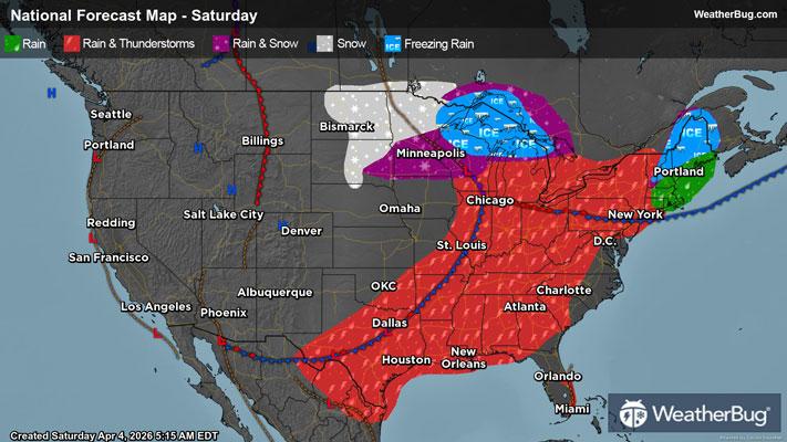
Gusty Thunderstorms Stretch From the Eastern Lakes to the South
Gusty thunderstorms will stretch from the eastern Great Lakes to Texas today.
Read More
Weather Station:Richard Bong Arpt Superior
32degrees Fahrenheit
Feels like:23°F
Hi: 34Lo: 25
80% Chance Frozen Mix
Hi34°F
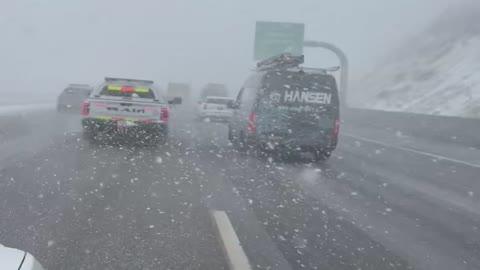
A slight chance of freezing rain and sleet this morning. Snow. Additional snow and sleet accumulation of 1 to 3 inches. Ice accumulation of up to a tenth of an inch. Highs in the mid 30s. Northeast winds 10 to 15 mph becoming northwest 5 to 10 mph this afternoon. Chance of precipitation near 100 percent.
Lo25°F
Mostly cloudy. Snow likely in the evening. Additional snow accumulation around an inch. Total snow accumulation 1 to 6 inches. Lows in the mid 20s. Northwest winds 5 to 10 mph with gusts up to 20 mph. Chance of snow 70 percent.
25 | Fair
0.5 Low
Closest strike in the last 30 minutes:510.1 miles
No Lightning Nearby