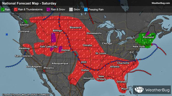
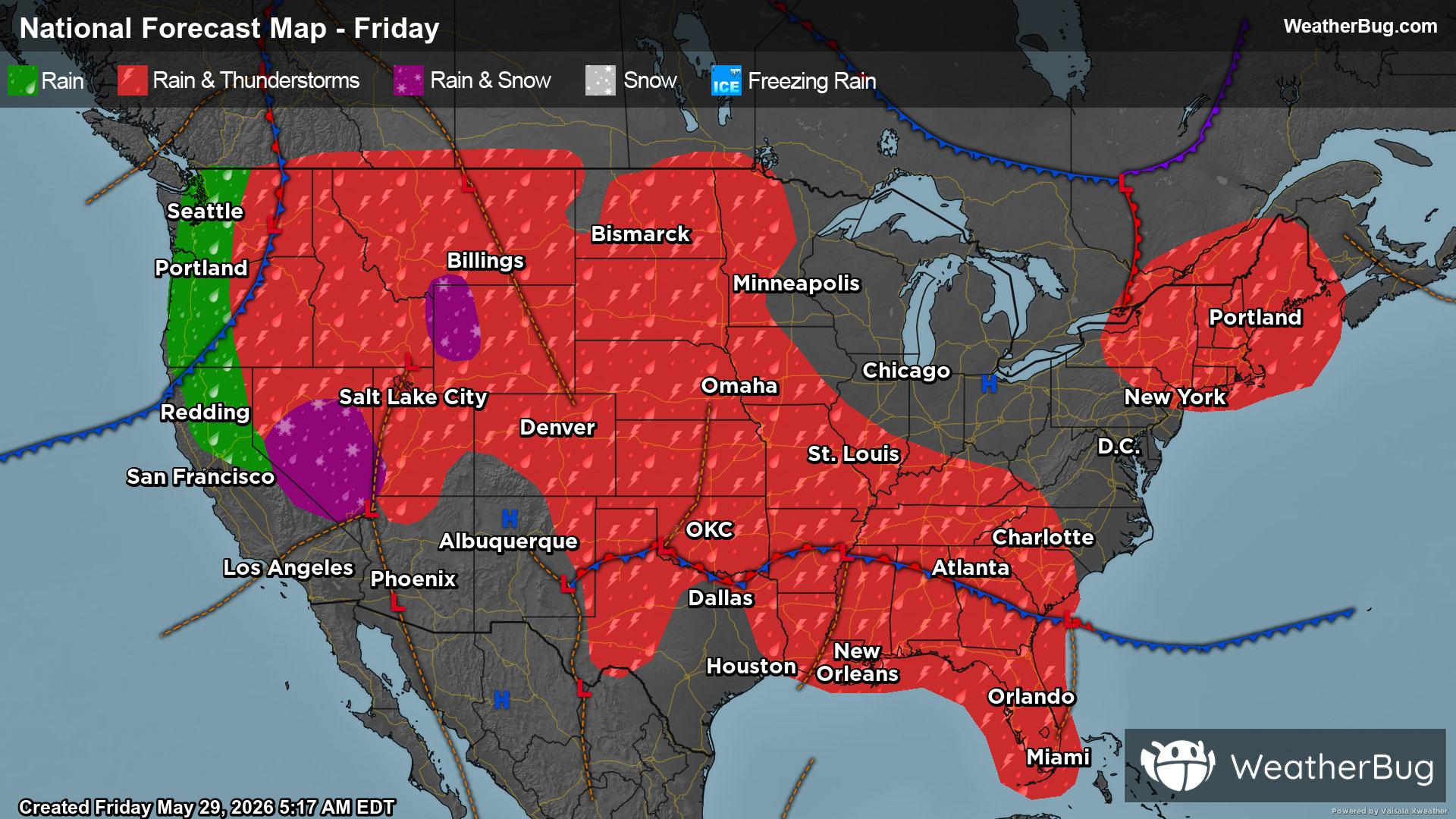
Blue Lake Springs, CA Weather

As of

Weather Station:COLUMBIA

Open weather station selector modal

45degrees Fahrenheit

Feels like:42°F

Hi: 46Lo: 31

80% Chance of Snow

Live Weather Radar

Blue Lake Springs, CA weather radar map

Current Weather Details

Windchill
42°
Daily Rain
0.01"
Dew point
41°
Monthly Rain
2.75"
Humidity
87%
Avg. Wind
5 mph
Pressure
29.85" →
Wind Gust
5 mph
Sunrise
6:30 AM
Moon
Waning Crescent
Sunset
7:34 PM
UV Index
1 (Low)

Weather Forecast

  • Tonight

    Lo

    Mostly cloudy with likely rain-snow mix. Chance of precipitation 100%. Low temperature around 31F. Dew point will be around 34F with an average humidity of 94%. Winds will be 9 mph from the S.

  • Tomorrow

    Hi

    Heavy rain and snow early in the morning then a slight chance of thunderstorms in the late morning and early afternoon. Heavy snow showers in the late morning and afternoon. Rain showers in the afternoon. A chance of thunderstorms late in the afternoon. Highs 25 to 40 higher elevations. . . 36 to 46 lower elevations. Snow accumulation 3 to 5 inches lower elevations. . . Except 10 to 16 inches higher elevations. Snow level 4500 feet. Prevailing south winds 5 to 15 mph with gusts to around 35 mph. . . Except south 10 to 30 mph with gusts to around 45 mph over ridges.

Blue Lake Springs, CA 10-day weather forecast

AIR QUALITY

23 | Fair

Top Triggers:pm25
Air quality data provided by Ambee
View Today's Air Quality details for Blue Lake Springs, CA

POLLEN COUNT & ALLERGY FORECAST

1 Low

Predominant Pollen:Oak, Mulberry and Ash.
View the Pollen forecast details

LIGHTNING MAP

Closest strike in the last 30 minutes:1146.0 miles

No Lightning Nearby

Real-time lightning alerts & live Map