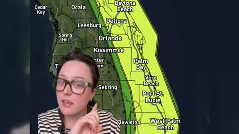
Florida Faces Another Round of Heavy Rain and Flash Flooding
Parts of Florida's East Coast could see significant flooding this week as repeated rounds of heavy rain move through the state.
Read More
44degrees Fahrenheit

Feels like:37°
Hi:47°Lo:44°
50% Chance of Light Rain
Hi

Slight chance of rain and snow early in the morning, then rain and snow in the late morning and early afternoon. Rain showers and slight chance of thunderstorms late in the afternoon. Snow accumulation up to 4 inches. Highs 41 to 49. Southeast winds 5 to 15 mph. Gusts up to 35 mph increasing to 45 mph in the afternoon. Chance of precipitation near 100 percent.
Lo

Rain showers and slight chance of thunderstorms. Near steady temperature in the lower 40s. Southeast winds 5 to 15 mph. Gusts up to 45 mph decreasing to 30 mph after midnight. Chance of precipitation near 100 percent.

Light rain continuing for the next hour.
Closest strike in the last 30 minutes:1786.3 miles
No Lightning Nearby


Parts of Florida's East Coast could see significant flooding this week as repeated rounds of heavy rain move through the state.