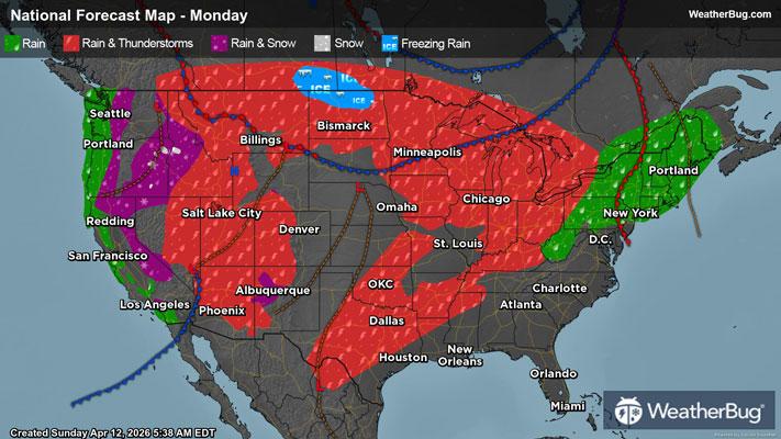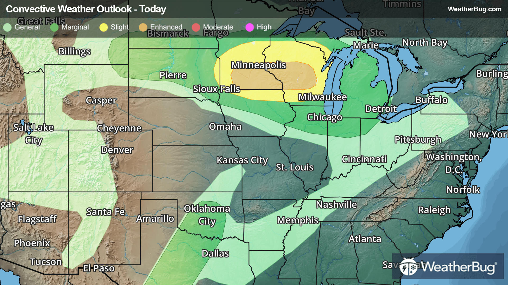
Parade Of Storms Hits The Plains, Midwest
The workweek will be filled with chances for severe thunderstorms in the middle of the country.
Read More
Weather Station:OSCODA/WURTSMITH
59degrees Fahrenheit
Feels like:59°F
Hi: 67Lo: 48
70% Chance Rain Showers
Hi67°F
Mostly cloudy with a 30 percent chance of rain showers early then mostly sunny in the afternoon. Highs in the upper 60s. West winds 5 to 15 mph with gusts to around 25 mph.
Lo48°F
Numerous rain showers and scattered thunderstorms early then numerous rain showers and isolated thunderstorms after midnight. Some thunderstorms may produce heavy rainfall early. Some thunderstorms may produce heavy rainfall after midnight. Lows in the upper 40s. Southeast winds up to 10 mph. Gusts up to 20 mph after midnight. Chance of precipitation 70 percent.
25 | Fair
8.9 Medium-High
Closest strike in the last 30 minutes:510.0 miles
No Lightning Nearby