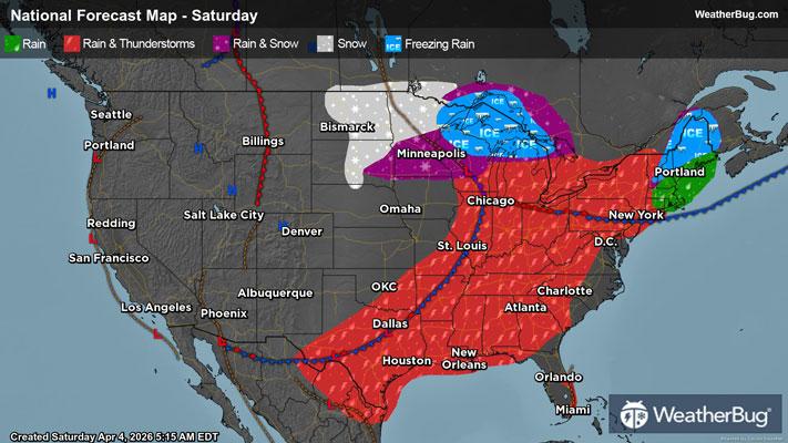
Dows, IA Weather

As of

Weather Station:H&R Block

Open weather station selector modal

5degrees Fahrenheit

Feels like:-10°F

Hi: 7Lo: 5

70% Chance of Snow

Live Weather Radar

Dows, IA weather radar map

Current Weather Details

Windchill
--
Daily Rain
--
Dew point
--
Monthly Rain
--
Humidity
--
Avg. Wind
--
Pressure
--
Wind Gust
--
Sunrise
7:40 AM
Moon
Waning Crescent
Sunset
5:08 PM
UV Index
1 (Low)

Weather Forecast

  • Tonight

    Lo

    Mostly cloudy with a chance of snow. Chance of precipitation 45%. Low temperature around 6F. Dew point will be around 2F with an average humidity of 57%. Winds will be 19 mph from the NW.

  • Tomorrow

    Hi

    Snow early this morning then a slight chance of snow this afternoon. Little or no snow accumulation. Breezy and much cooler. Near steady temperature around 10 above. Northwest winds 15 to 25 mph with gusts up to 35 mph. Chance of snow 80 percent.

Dows, IA 10-day weather forecast

AIR QUALITY

11 | Excellent

Top Triggers:pm25
Air quality data provided by Ambee
View Today's Air Quality details for Dows, IA

POLLEN COUNT & ALLERGY FORECAST

0.1 Low

Predominant Pollen:None
View the Pollen forecast details

LIGHTNING MAP

Closest strike in the last 30 minutes:1893.7 miles

No Lightning Nearby

Real-time lightning alerts & live Map