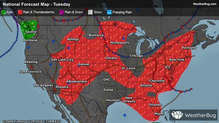
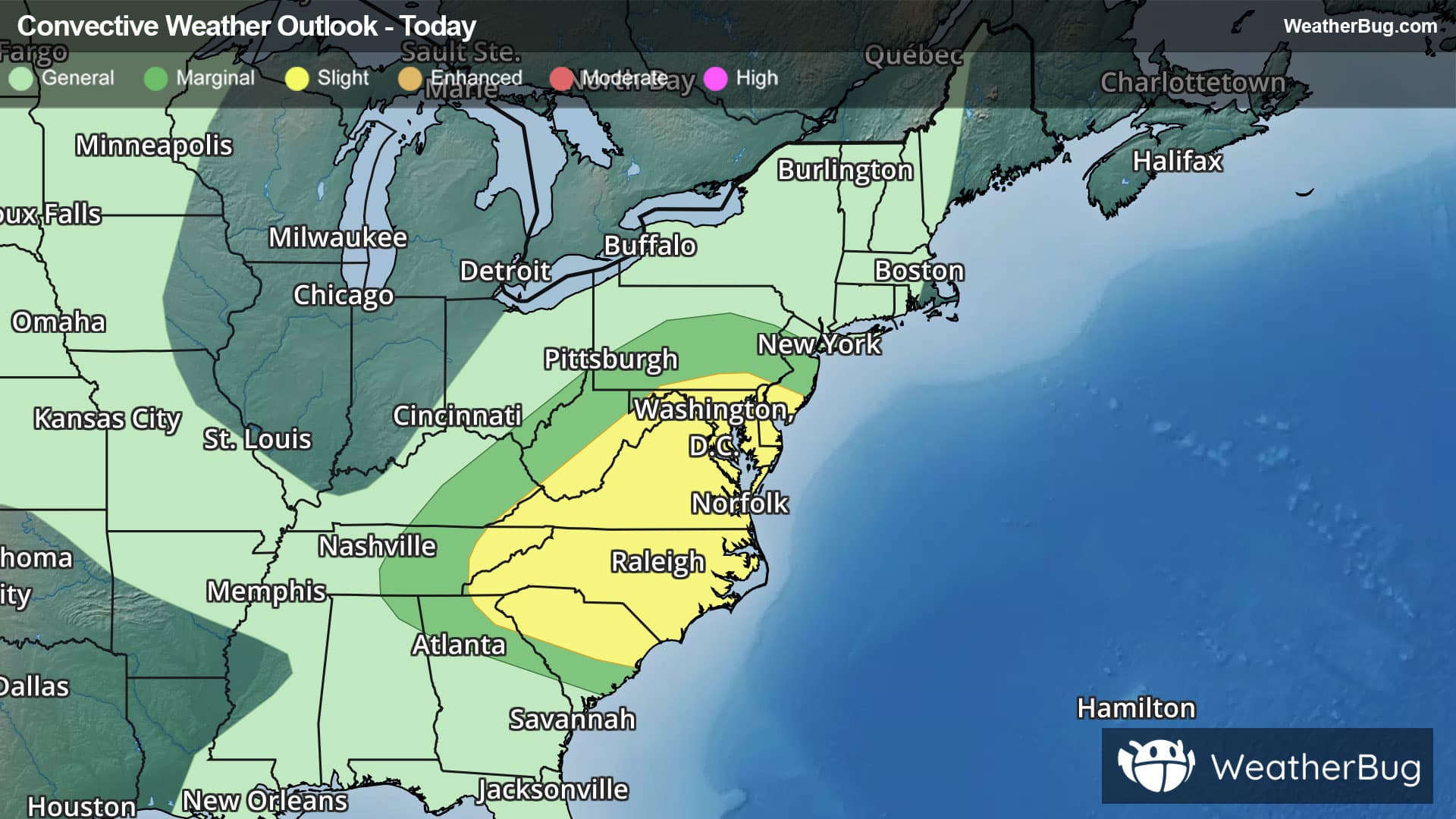
Elgin, IL Weather

As of

Weather Station:Harriet Gifford Elem School

Open weather station selector modal

8degrees Fahrenheit

Feels like:-1°F

Hi: 15Lo: 4

Mostly Cloudy

Live Weather Radar

Elgin, IL weather radar map

Current Weather Details

Windchill
-1°
Daily Rain
0"
Dew point
Monthly Rain
0.94"
Humidity
76%
Avg. Wind
SW 8 mph
Pressure
30.01" →
Wind Gust
SW 10 mph
Sunrise
7:17 AM
Moon
Sunset
4:50 PM
UV Index
1 (Low)

Weather Forecast

  • Today

    Hi

    Mostly cloudy. Snow likely late. Snow accumulation around half an inch. Highs around 19. Southwest winds 10 to 15 mph. Chance of precipitation 70 percent. Wind chill values as low as 9 below.

  • Tonight

    Lo

    Cloudy. Snow mainly in the evening. Snow accumulation around an inch. Blustery with lows around 1 below. West winds 15 to 20 mph becoming northwest 15 to 25 mph after midnight. Gusts up to 35 mph. Chance of precipitation 90 percent. Wind chill values as low as 22 below after midnight.

Elgin, IL 10-day weather forecast

AIR QUALITY

17 | Excellent

Top Triggers:pm25
Air quality data provided by Ambee
View Today's Air Quality details for Elgin, IL

POLLEN COUNT & ALLERGY FORECAST

0.1 Low

Predominant Pollen:None
View the Pollen forecast details

LIGHTNING MAP

Closest strike in the last 30 minutes:960.7 miles

No Lightning Nearby

Real-time lightning alerts & live Map