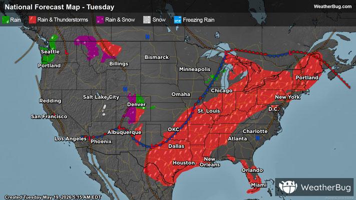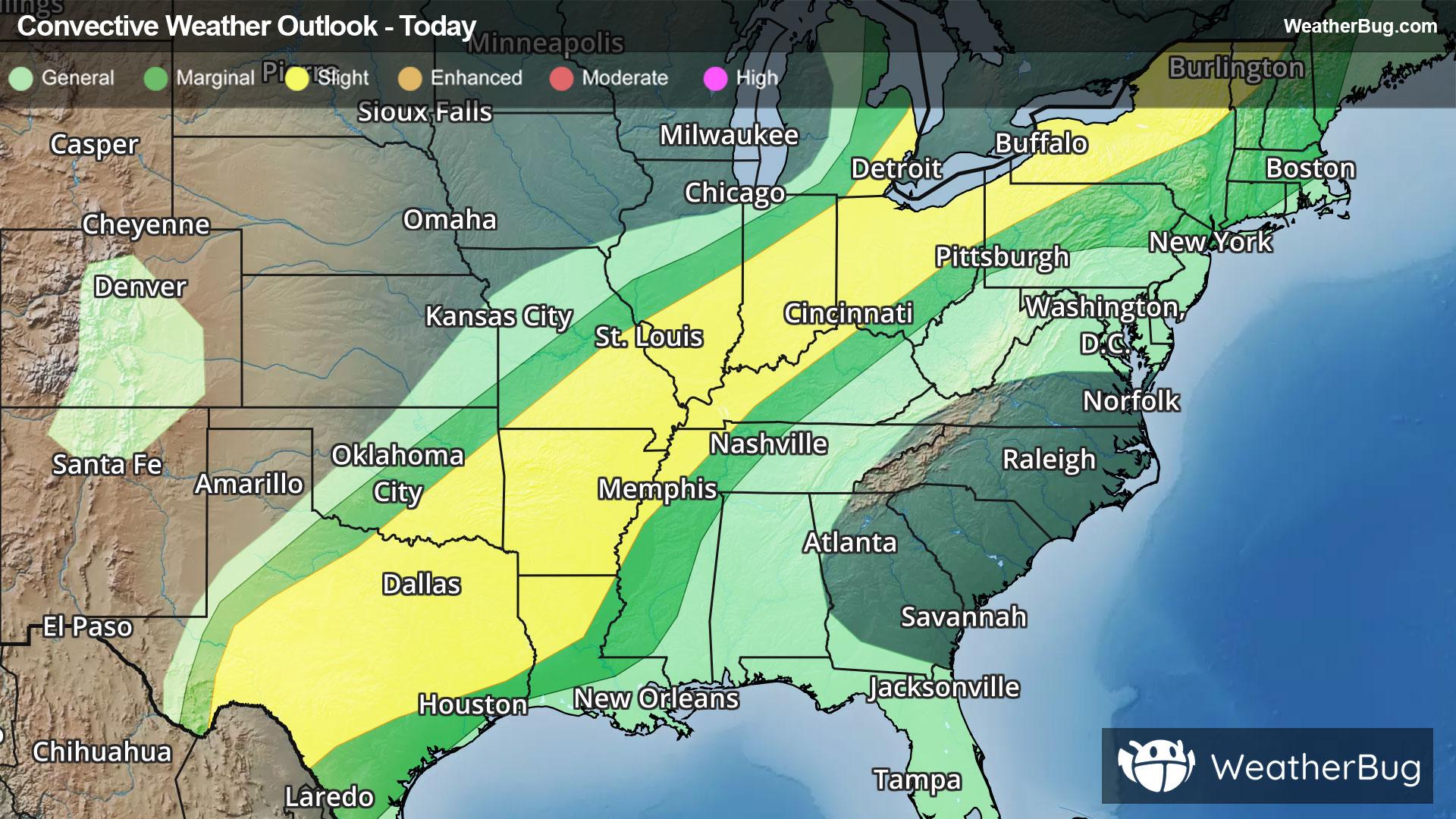
Severe Storms Stretch From the S. Plains to the Northeast
Severe thunderstorms are likely today from the southern Plains to the Great Lakes and Northeast.
Read More

Feels like:66°
Current Weather Condition70% Chance Rain Showers
Lo

Partly cloudy with a 75% chance for rain and thunderstorms. Low temperature around 65F. Dew point will be around 63F with an average humidity of 94%. Winds will be 12 mph from the S.
Hi

Mostly cloudy with a chance of thunderstorms. Showers mainly this morning. Some thunderstorms may produce heavy rainfall. Highs in the upper 70s. Southwest winds 10 to 15 mph with gusts up to 25 mph. Chance of rain 90 percent.

Closest strike in the last 30 minutes:18.9 miles
Storms Approaching