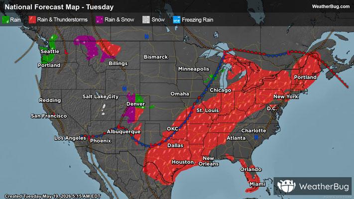
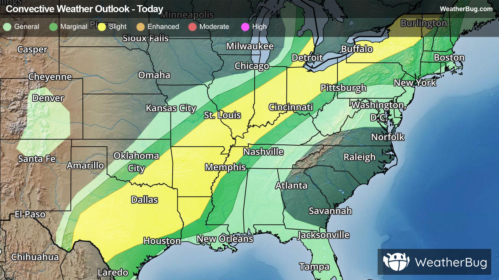
Forman, ND Weather

As of

Weather Station:WeatherBug

Open weather station selector modal

34degrees Fahrenheit

Feels like:23°F

Hi: --Lo: 31

70% Chance Frozen Mix

Live Weather Radar

Forman, ND weather radar map

Current Weather Details

Windchill
23°
Daily Rain
--"
Dew point
34°
Monthly Rain
1.03"
Humidity
100%
Avg. Wind
E 16 mph
Pressure
--"
Wind Gust
-- mph
Sunrise
7:10 AM
Moon
Full
Sunset
7:58 PM
UV Index
2 (Low)

Weather Forecast

  • Tonight

    Lo

    Light snow and a slight chance of light rain. New snow accumulation of 1 to 2 inches. Lows 25 to 30. East winds around 10 mph increasing to around 20 mph after midnight. Chance of precipitation 90 percent.

  • Tomorrow

    Hi

    Snow. New snow accumulation of 1 to 3 inches. Total snow accumulation 2 to 5 inches. Highs in the mid 30s. Brisk. Northeast winds 15 to 25 mph. Chance of snow near 100 percent.

Forman, ND 10-day weather forecast

AIR QUALITY

25 | Fair

Top Triggers:pm25
Air quality data provided by Ambee
View Today's Air Quality details for Forman, ND

POLLEN COUNT & ALLERGY FORECAST

1.6 Low

Predominant Pollen:Cedar/Juniper and Elm.
View the Pollen forecast details

LIGHTNING MAP

Closest strike in the last 30 minutes:496.4 miles

No Lightning Nearby

Real-time lightning alerts & live Map