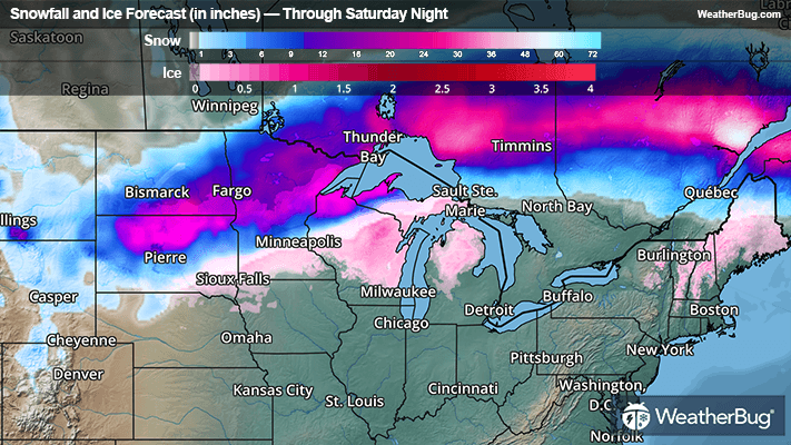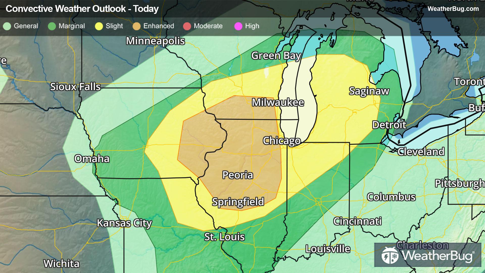
Severe Weather Heads for Midwest & Great Lakes
A potent low pressure system tracking into The Midwest and Great Lakes will provide ample energy for severe thunderstorms today.
Read More
Weather Station:EMIGRANT GAP
30degrees Fahrenheit
Feels like:23°F
Hi: 46Lo: 30
Foggy
Hi53°F
Mostly cloudy with a chance of rain and snow early in the morning then mostly sunny in the late morning and afternoon. Highs 35 to 50 higher elevations. . . 48 to 58 lower elevations. No snow accumulation lower elevations. . . Up to 1 inch higher elevations. Snow level 4500 feet in the morning. Prevailing west winds up to 10 mph. Gusts up to 45 mph decreasing to 25 mph in the afternoon. Over ridges. . . Prevailing southwest winds 20 to 30 mph becoming west 5 to 15 mph in the afternoon.
Lo41°F
Clear. Lows 19 to 34 higher elevations. . . 33 to 45 lower elevations. Prevailing northeast winds up to 15 mph with gusts to around 35 mph.

23 | Fair
8.5 Medium-High
Closest strike in the last 30 minutes:471.4 miles
No Lightning Nearby