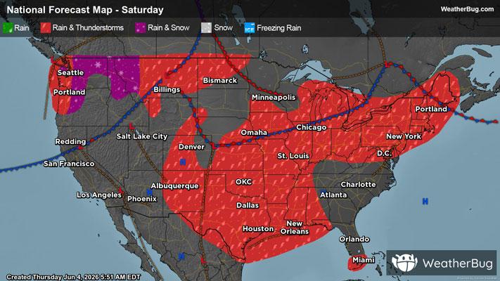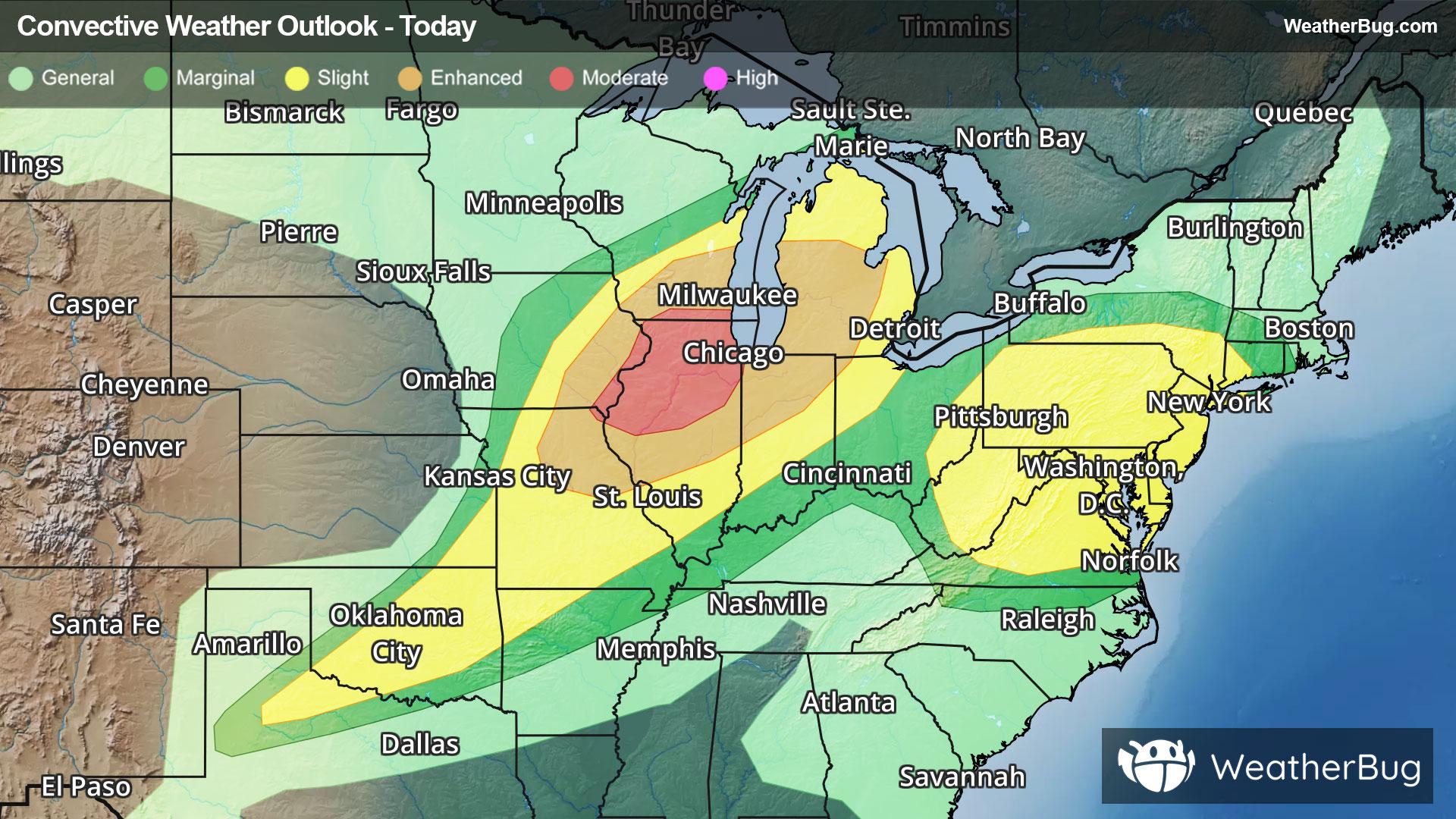
High-Impact Severe Weather Expected Across Midwest & Mid-Atlantic
A low pressure system and an upper level disturbance will bring two areas of severe weather today.
Read More

Feels like:70°
Current Weather Condition60% Chance of Light Rain
Lo

Mostly cloudy in the evening then clearing. Showers with thunderstorms likely early in the evening then a chance of showers and thunderstorms late in the evening. Some thunderstorms may be severe with heavy rainfall. Locally heavy rainfall possible early in the evening. Breezy. Lows in the upper 50s. Southwest winds 15 to 20 mph with gusts up to 35 mph becoming west 10 to 15 mph after midnight. Chance of precipitation 90 percent.
Hi

Sunny. Highs in the upper 70s. West winds 10 to 15 mph. Gusts up to 25 mph in the afternoon.


Closest strike in the last 30 minutes:10.8 miles
Storms Approaching