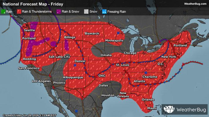
Dangerous Storms Expected Over The Ohio Valley & High Plains
An area of low pressure riding along a cold front over the Ohio and Mississippi Valleys will trigger thunderstorms, some which may be severe.
Read More
68degrees Fahrenheit

Feels like:68°
Hi:75°Lo:67°
70% Chance of Light Rain
Hi

Showers. A chance of thunderstorms this morning then thunderstorms likely this afternoon. Some thunderstorms may produce heavy rainfall this morning. Some thunderstorms may produce heavy rainfall this afternoon. Highs in the upper 70s. Southeast winds 5 to 10 mph. Chance of rain near 100 percent.
Lo

Mostly cloudy. A chance of showers and thunderstorms in the evening. Some thunderstorms may produce heavy rainfall in the evening. Lows in the lower 60s. North winds 5 to 10 mph. Chance of rain 50 percent.


Closest strike in the last 30 minutes:185.5 miles
No Lightning Nearby