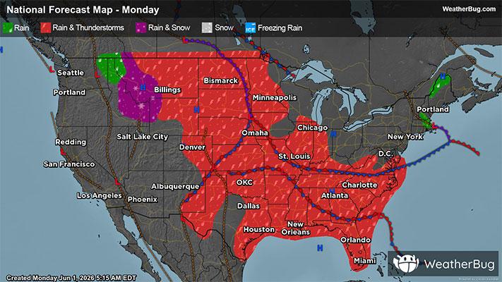
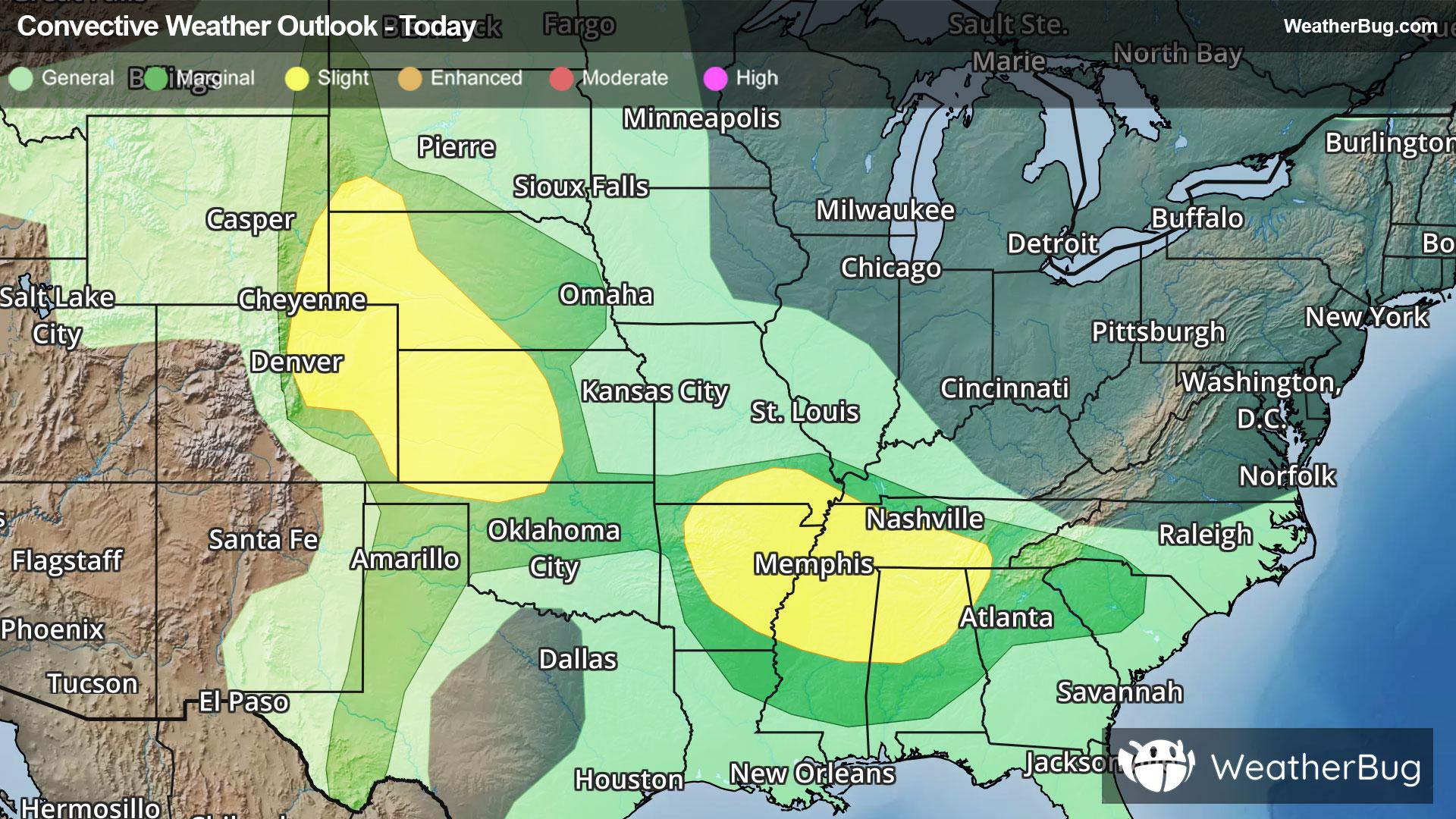
Image, WA Weather

As of

Weather Station:WeatherBug

Open weather station selector modal

50degrees Fahrenheit

Feels like:45°F

Hi: 50Lo: 43

Light Rain

Live Weather Radar

Image, WA weather radar map

Current Weather Details

Windchill
45°
Daily Rain
--"
Dew point
45°
Monthly Rain
0.92"
Humidity
82%
Avg. Wind
SSW 14 mph
Pressure
--"
Wind Gust
-- mph
Sunrise
6:26 AM
Moon
Waning Crescent
Sunset
7:55 PM
UV Index
1 (Low)

Weather Forecast

  • Today

    Hi

    Rain. Highs in the lower 50s. South wind 10 to 15 mph. Chance of rain near 100 percent. Rainfall amounts around a tenth of an inch.

  • Tonight

    Lo

    Rain. Lows in the upper 30s. South wind 10 to 15 mph becoming northwest after midnight. Chance of rain near 100 percent. Rainfall amounts around three quarters of an inch.

Image, WA 10-day weather forecast

AIR QUALITY

23 | Fair

Top Triggers:pm25
Air quality data provided by Ambee
View Today's Air Quality details for Image, WA

POLLEN COUNT & ALLERGY FORECAST

9.2 Medium-High

Predominant Pollen:Alder, Cedar/Juniper and Birch.
View the Pollen forecast details

LIGHTNING MAP

Closest strike in the last 30 minutes:635.0 miles

No Lightning Nearby

Real-time lightning alerts & live Map