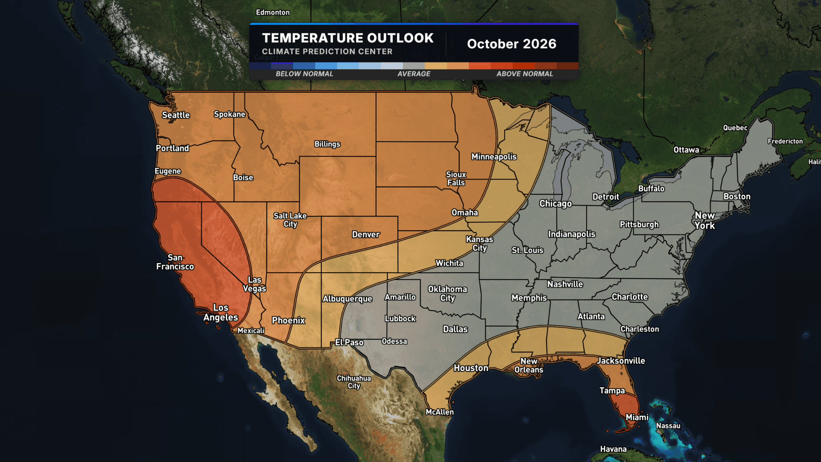
Summer's Not Done With Us Yet: Warmth Is Coming Back for Much of the Country
After a brief cold snap, NOAA's latest outlook says much of the country is about to swing right back toward warm.
Read More
73degrees Fahrenheit

Feels like:73°
Hi:80°Lo:72°
Mostly Clear
Hi

Breezy. Mostly sunny with scattered showers. Highs 70 to 82. East winds 10 to 20 mph. Chance of rain 40 percent.
Lo

Breezy. Partly cloudy with isolated showers in the evening, then mostly cloudy with scattered showers after midnight. Lows 59 to 75. East winds 10 to 20 mph. Chance of rain 30 percent.


Closest strike in the last 30 minutes:2295.7 miles
No Lightning Nearby


After a brief cold snap, NOAA's latest outlook says much of the country is about to swing right back toward warm.