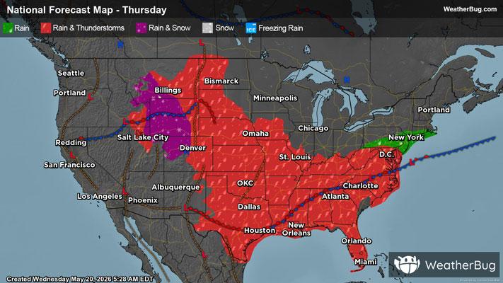
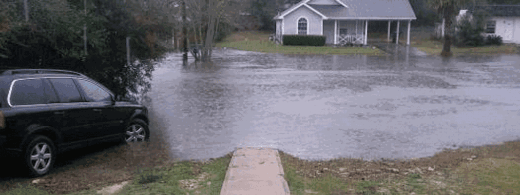
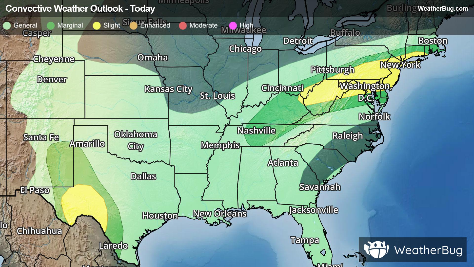
Lake Como, WI Weather

As of

Weather Station:WeatherBug

Open weather station selector modal

46degrees Fahrenheit

Feels like:39°F

Hi: 60Lo: 42

80% Chance of Rain

Live Weather Radar

Lake Como, WI weather radar map

Current Weather Details

Windchill
39°
Daily Rain
--"
Dew point
46°
Monthly Rain
5.68"
Humidity
100%
Avg. Wind
SE 12 mph
Pressure
--"
Wind Gust
-- mph
Sunrise
6:35 AM
Moon
Waning Gibbous
Sunset
7:20 PM
UV Index
1 (Low)

Weather Forecast

  • Today

    Hi

    Warmer. Rain showers and chance of thunderstorms. Highs in the mid 60s. South winds 10 to 20 mph. Gusts up to 35 mph in the afternoon. Chance of precipitation near 100 percent.

  • Tonight

    Lo

    Cloudy. Rain showers and thunderstorms in the evening then chance of light rain showers and thunderstorms late in the evening. Lows in the upper 30s. Southwest winds 10 to 20 mph with gusts to around 35 mph. Chance of precipitation 80 percent.

Lake Como, WI 10-day weather forecast

AIR QUALITY

25 | Fair

Top Triggers:pm25
Air quality data provided by Ambee
View Today's Air Quality details for Lake Como, WI

POLLEN COUNT & ALLERGY FORECAST

0.9 Low

Predominant Pollen:Cedar/Juniper and Elm.
View the Pollen forecast details

LIGHTNING MAP

Closest strike in the last 30 minutes:278.3 miles

No Lightning Nearby

Real-time lightning alerts & live Map