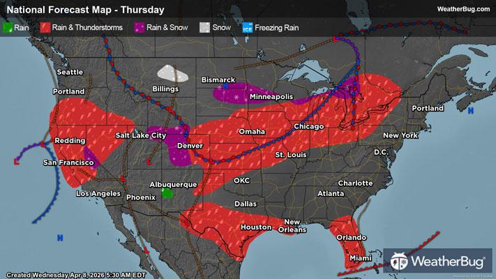
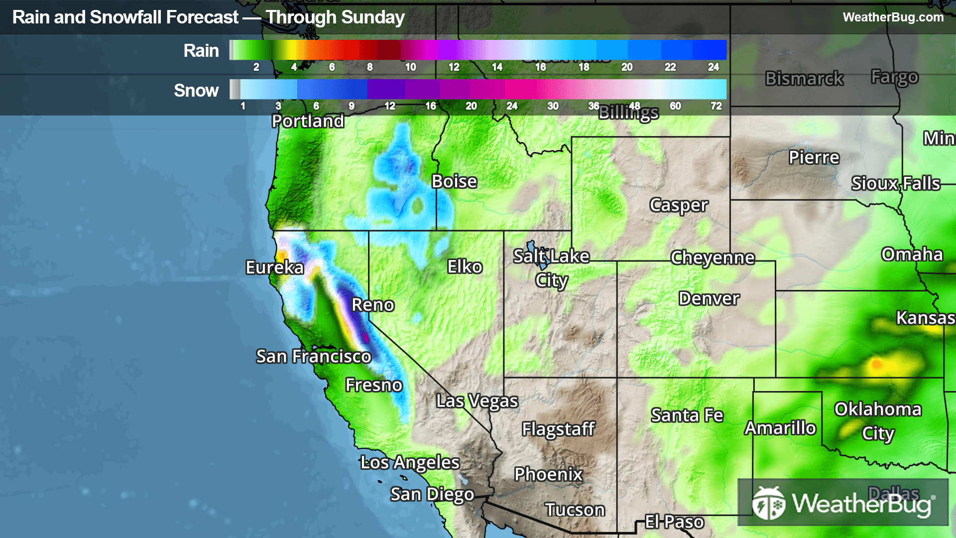
Lake Superior Estates, MI Weather

As of

Weather Station:Sault Ste Marie Michigan Municipal Arpt

Open weather station selector modal

11degrees Fahrenheit

Feels like:11°F

Hi: 12Lo: 2

40% Chance of Flurries

Live Weather Radar

Lake Superior Estates, MI weather radar map

Current Weather Details

Windchill
11°
Daily Rain
0.08"
Dew point
Monthly Rain
2.82"
Humidity
92%
Avg. Wind
N 0 mph
Pressure
29.56" →
Wind Gust
0 mph
Sunrise
8:14 AM
Moon
Waxing Crescent
Sunset
5:22 PM
UV Index
1 (Low)

Weather Forecast

  • Today

    Hi

    Light snow showers likely early then chance of light snow showers in the afternoon. Total daytime snow accumulation of 1 to 2 inches. Highs around 13. Northwest winds 5 to 15 mph with gusts to around 30 mph. Chance of snow 70 percent. Wind chill readings 4 below to 14 below zero.

  • Tonight

    Lo

    Mostly cloudy with a 50 percent chance of snow showers. Lows around 9 below. West winds up to 10 mph shifting to the north after midnight. Gusts up to 20 mph. Wind chill readings 9 below to 19 below zero.

Lake Superior Estates, MI 10-day weather forecast

AIR QUALITY

17 | Excellent

Top Triggers:pm25
Air quality data provided by Ambee
View Today's Air Quality details for Lake Superior Estates, MI

POLLEN COUNT & ALLERGY FORECAST

0.1 Low

Predominant Pollen:None
View the Pollen forecast details

LIGHTNING MAP

Closest strike in the last 30 minutes:2389.3 miles

No Lightning Nearby

Real-time lightning alerts & live Map