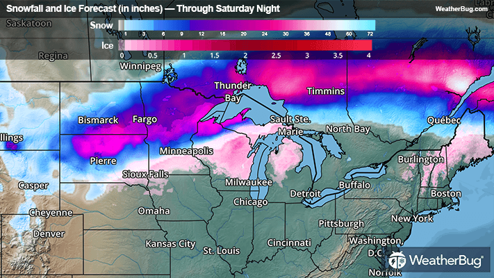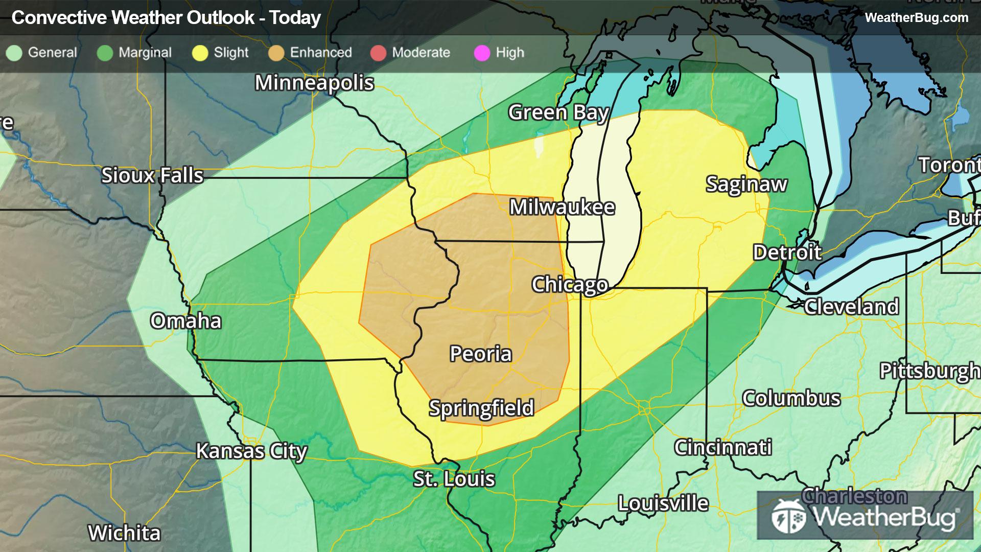
Severe Weather Heads for Midwest & Great Lakes
A potent low pressure system tracking into The Midwest and Great Lakes will provide ample energy for severe thunderstorms today.
Read More
Weather Station:Hall High School
39degrees Fahrenheit
Feels like:32°F
Hi: 40Lo: 39
80% Chance of Light Rain
Lo41°F
Mostly cloudy with likely rain. Chance of precipitation 100%. Low temperature around 41F. Dew point will be around 37F with an average humidity of 90%. Winds will be 16 mph from the E.
Hi68°F
Showers with a chance of thunderstorms. Breezy and much warmer with highs in the lower 70s. Southeast winds 15 to 20 mph with gusts up to 30 mph becoming south around 25 mph with gusts up to 45 mph this afternoon. Chance of rain near 100 percent.

23 | Fair
0.9 Low
Closest strike in the last 30 minutes:11.0 miles
Storms Approaching