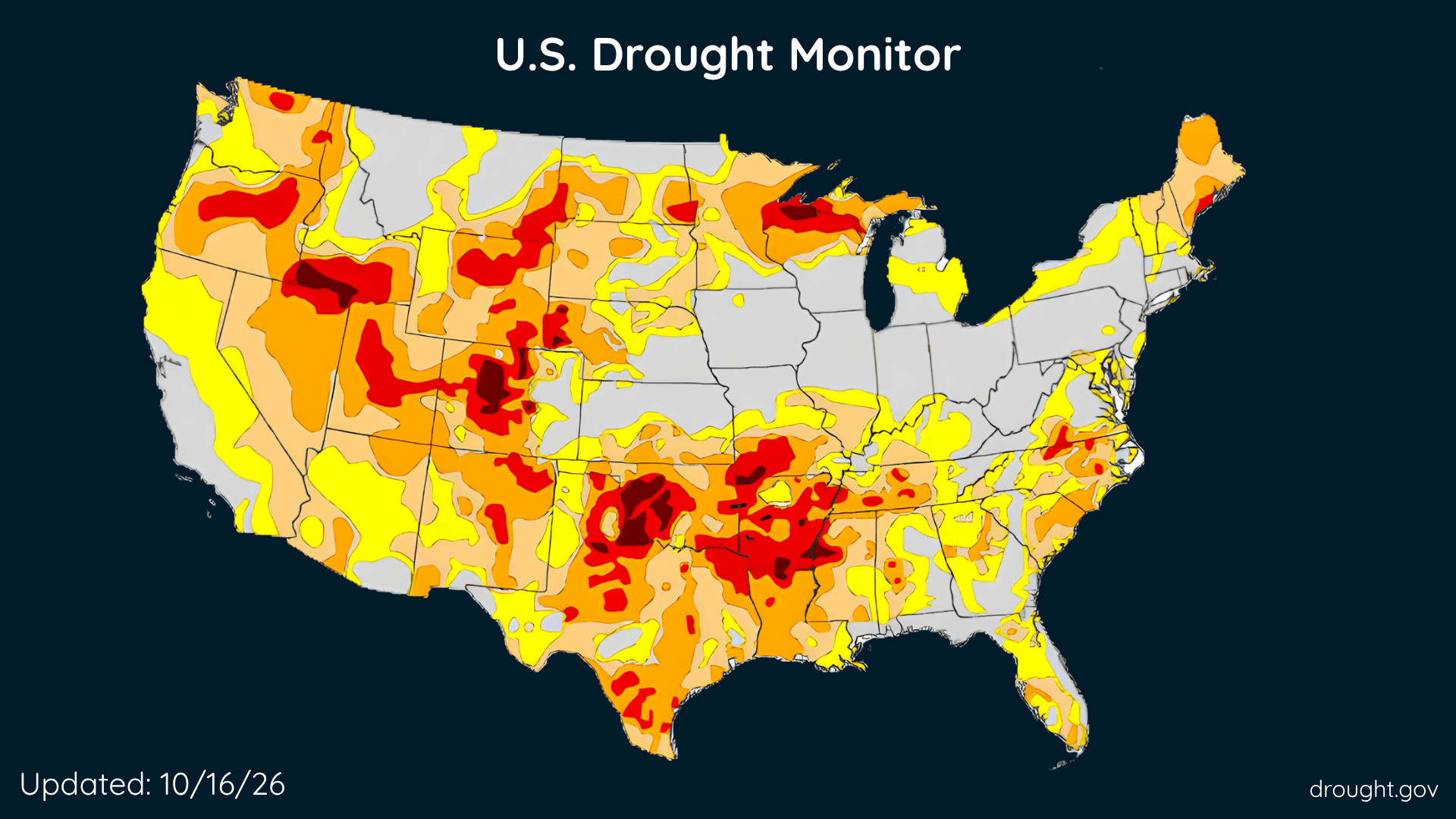
U.S. Drought Improves, Rain Brings Relief, but Some Areas Get Drier
The Southeast and parts of the West made progress this week, while drought deepened across portions of the country’s middle.
Read More
54degrees Fahrenheit

Feels like:54°
Hi:55°Lo:42°
30% Chance of Light Rain
Hi

Mostly cloudy with a chance of rain. Chance of precipitation 35%. High temperature around 55F. Dew point will be around 51F with an average humidity of 79%. Winds will be 19 mph from the NW.
Lo

Mostly cloudy with a chance of showers this evening, then mostly clear after midnight. Cooler with lows in the upper 30s. North winds 15 to 20 mph. Chance of rain 30 percent.

Rain starting in 20 minutes, ending in 29 minutes.
Closest strike in the last 30 minutes:709.8 miles
No Lightning Nearby


The Southeast and parts of the West made progress this week, while drought deepened across portions of the country’s middle.