


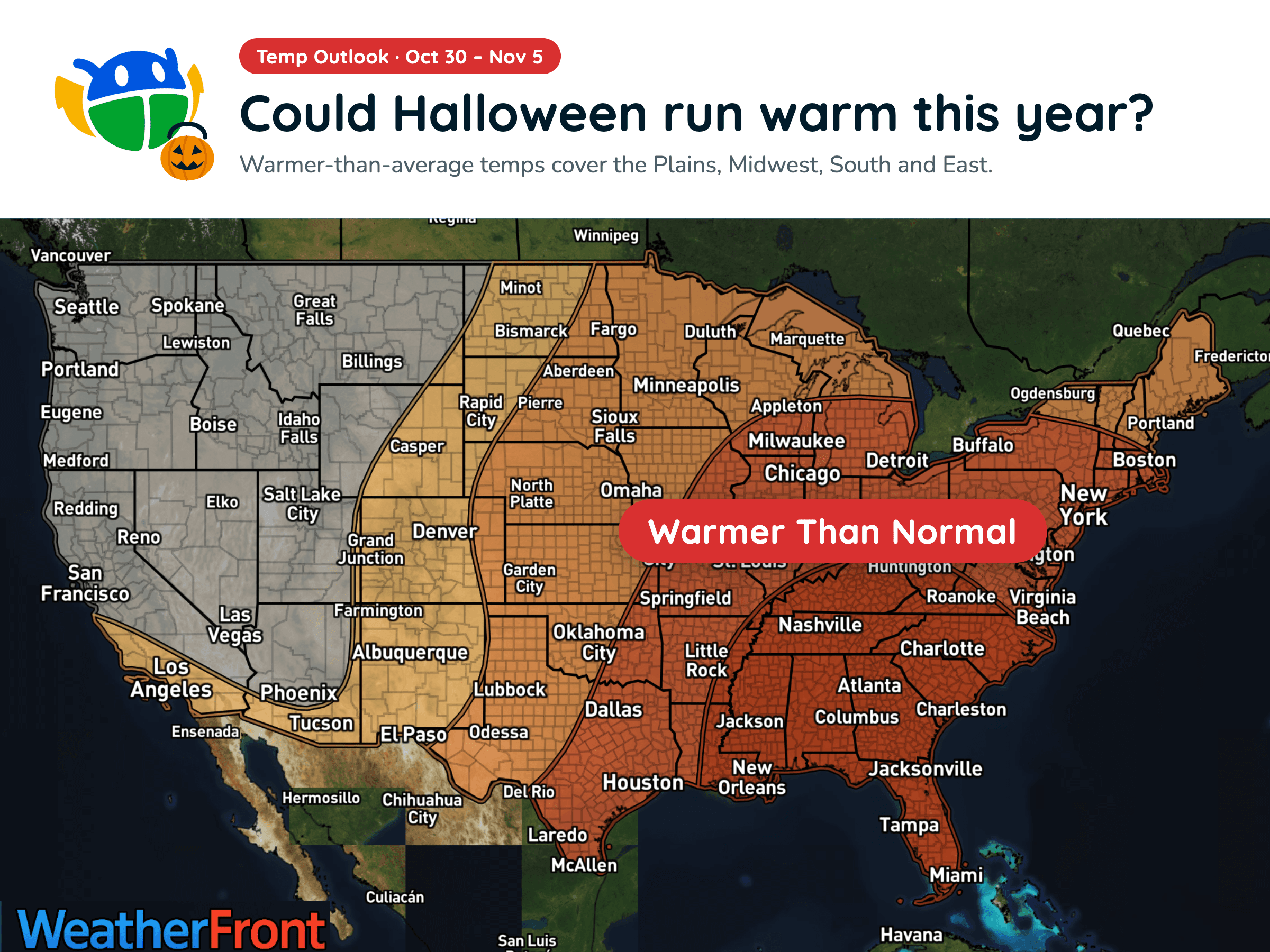
Halloween Weather Outlook: A Warm-Up for Much of the U.S. 🎃
Warmer-than-average temperatures could stick around into early November, but will you need a jacket over your Halloween costume?
Read More
41degrees Fahrenheit

Feels like:38°
Hi:50°Lo:41°
60% Chance of Light Rain
Hi

Cloudy. Rain showers likely in the morning, then a chance of rain showers in the afternoon. Highs in the upper 40s. East winds 10 to 15 mph. Chance of precipitation 70 percent.
Lo

Showers. Lows in the mid 30s. East winds 10 to 20 mph. Chance of precipitation 90 percent.


Closest strike in the last 30 minutes:1420.7 miles
No Lightning Nearby


Warmer-than-average temperatures could stick around into early November, but will you need a jacket over your Halloween costume?




