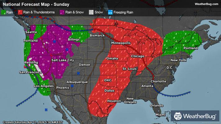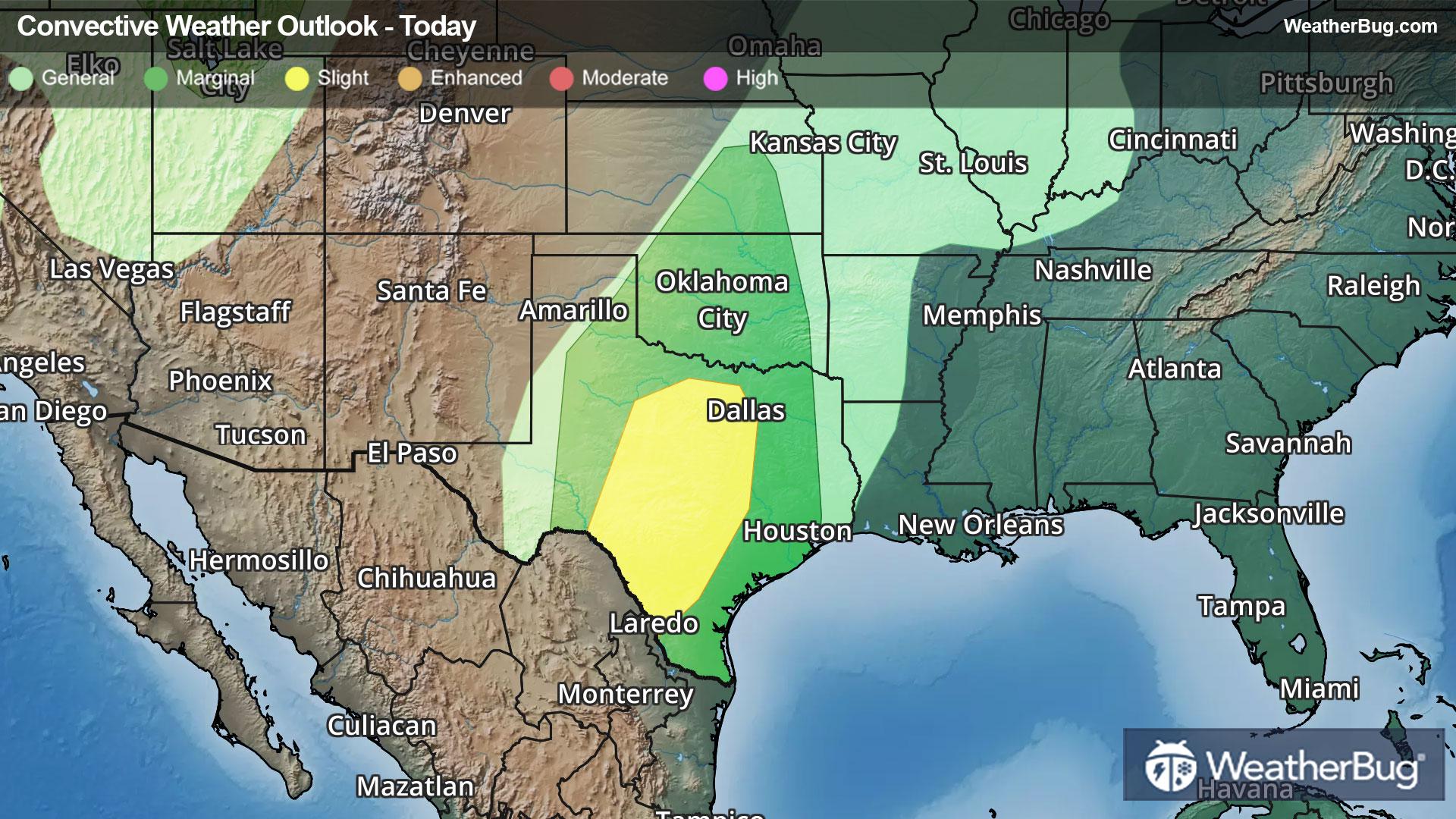
Central U.S. At Risk For Multi-Day Severe Outbreak
Spring kicks into full gear this week as Mother Nature creates multiple chances of severe weather in the Central U.S.
Read More
Weather Station:Streator Township HS
60degrees Fahrenheit
Feels like:60°F
Hi: 78Lo: 60
Partly Cloudy
Hi79°F
Mostly cloudy. A slight chance of thunderstorms with isolated showers early in the afternoon. Scattered showers and a chance of thunderstorms late. Windy. Highs around 80. Southwest winds 20 to 30 mph with gusts up to 45 mph. Chance of precipitation 50 percent.
Lo62°F
Cloudy. Showers in the evening. A slight chance of thunderstorms. Scattered showers after midnight. Breezy with lows in the lower 60s. Southwest winds 15 to 25 mph becoming 15 to 20 mph after midnight. Chance of precipitation 80 percent.

32 | Fair
9.5 Medium-High
Closest strike in the last 30 minutes:193.0 miles
No Lightning Nearby