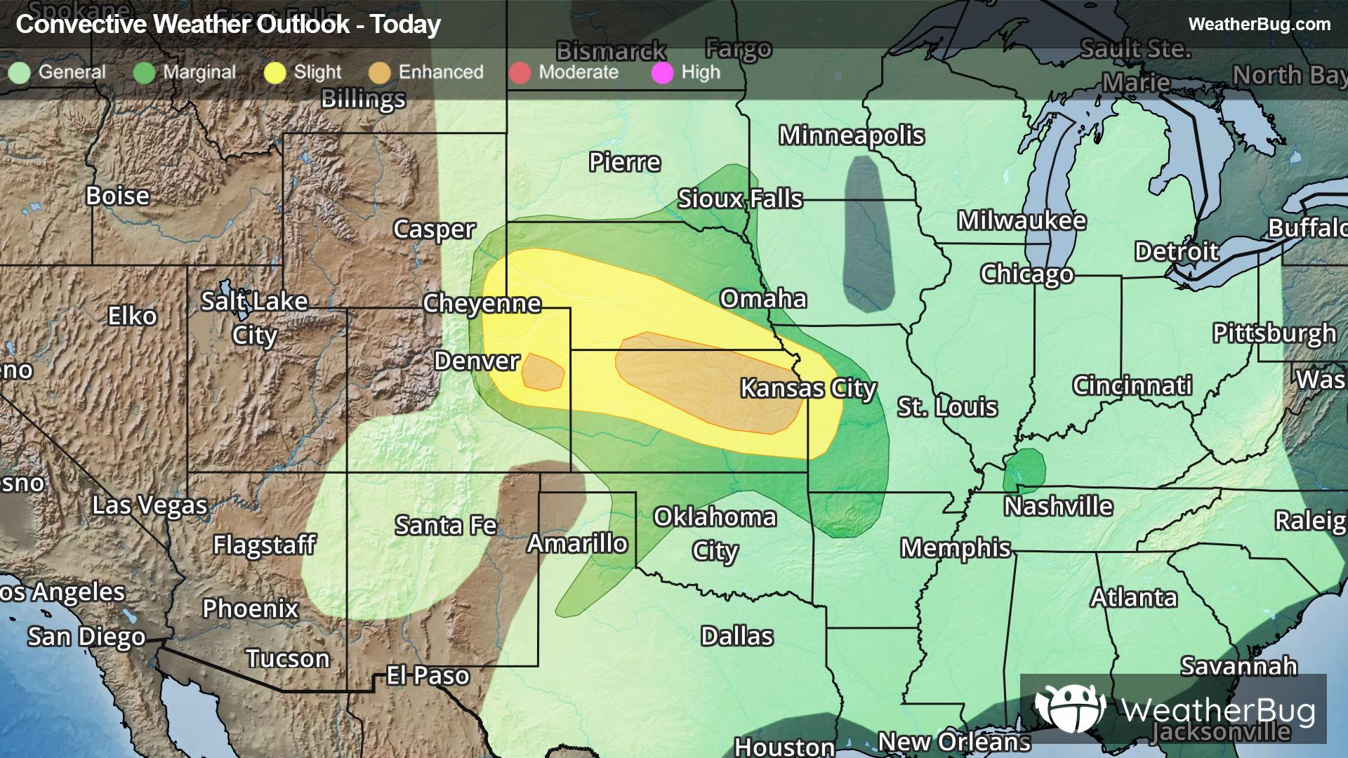
Louisville, CO Weather

As of

Weather Station:WeatherBug

Open weather station selector modal

32degrees Fahrenheit

Feels like:21°F

Hi: 35Lo: 25

70% Chance of Heavy Snow

Live Weather Radar

Louisville, CO weather radar map

Current Weather Details

Windchill
21°
Daily Rain
--"
Dew point
30°
Monthly Rain
0.21"
Humidity
96%
Avg. Wind
NNE 14 mph
Pressure
--"
Wind Gust
-- mph
Sunrise
6:26 AM
Moon
Waning Gibbous
Sunset
5:57 PM
UV Index
2 (Low)

Weather Forecast

  • Today

    Hi

    Snow. Patchy blowing snow late in the afternoon. New snow accumulation of 1 to 3 inches. Highs in the mid 30s. North winds 10 to 20 mph with gusts up to 30 mph.

  • Tonight

    Lo

    Snow likely early in the evening then mostly cloudy with a slight chance of snow during the late evening hours. Partly cloudy after midnight. New snow accumulation up to 1 inch. Lows around 18. North winds 10 to 15 mph with gusts up to 25 mph in the evening becoming light. Chance of snow 60 percent.

Louisville, CO 10-day weather forecast

AIR QUALITY

23 | Fair

Top Triggers:pm25
Air quality data provided by Ambee
View Today's Air Quality details for Louisville, CO

POLLEN COUNT & ALLERGY FORECAST

2.9 Low-Medium

Predominant Pollen:Cedar/Juniper and Elm
View the Pollen forecast details

LIGHTNING MAP

Closest strike in the last 30 minutes:383.3 miles

No Lightning Nearby

Real-time lightning alerts & live Map