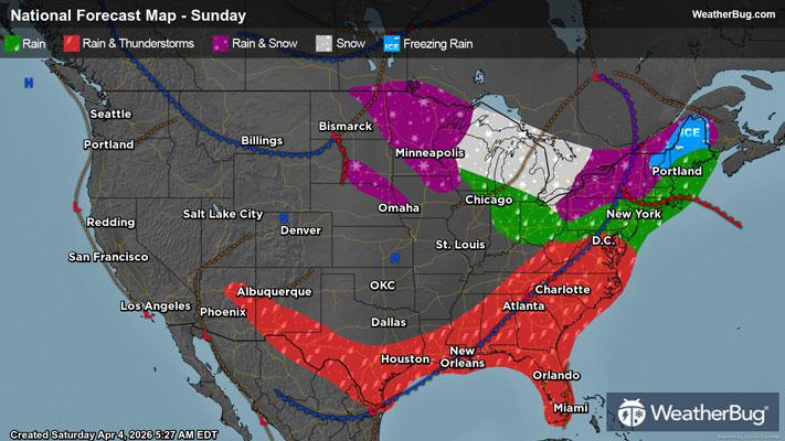
Gusty Thunderstorms Stretch From the Eastern Lakes to the South
Gusty thunderstorms will stretch from the eastern Great Lakes to Texas today.
Read More
Weather Station:Station CYGM4 - Cheybogan MI
33degrees Fahrenheit
Feels like:20°F
Hi: 35Lo: 33
80% Chance of Snow
Hi35°F
Rain showers and slight chance of thunderstorms early then slight chance of rain showers in the afternoon. Areas of fog early then patchy fog in the afternoon. Highs in the lower 40s. Southeast winds 5 to 15 mph with gusts to around 35 mph.
Lo34°F
Mostly cloudy. Patchy fog early. Slight chance of rain showers early then slight chance of rain showers and snow showers after midnight. Lows in the upper 20s. West winds 10 to 20 mph with gusts to around 30 mph. Chance of precipitation 20 percent.

21 | Fair
0.7 Low
Closest strike in the last 30 minutes:284.6 miles
No Lightning Nearby