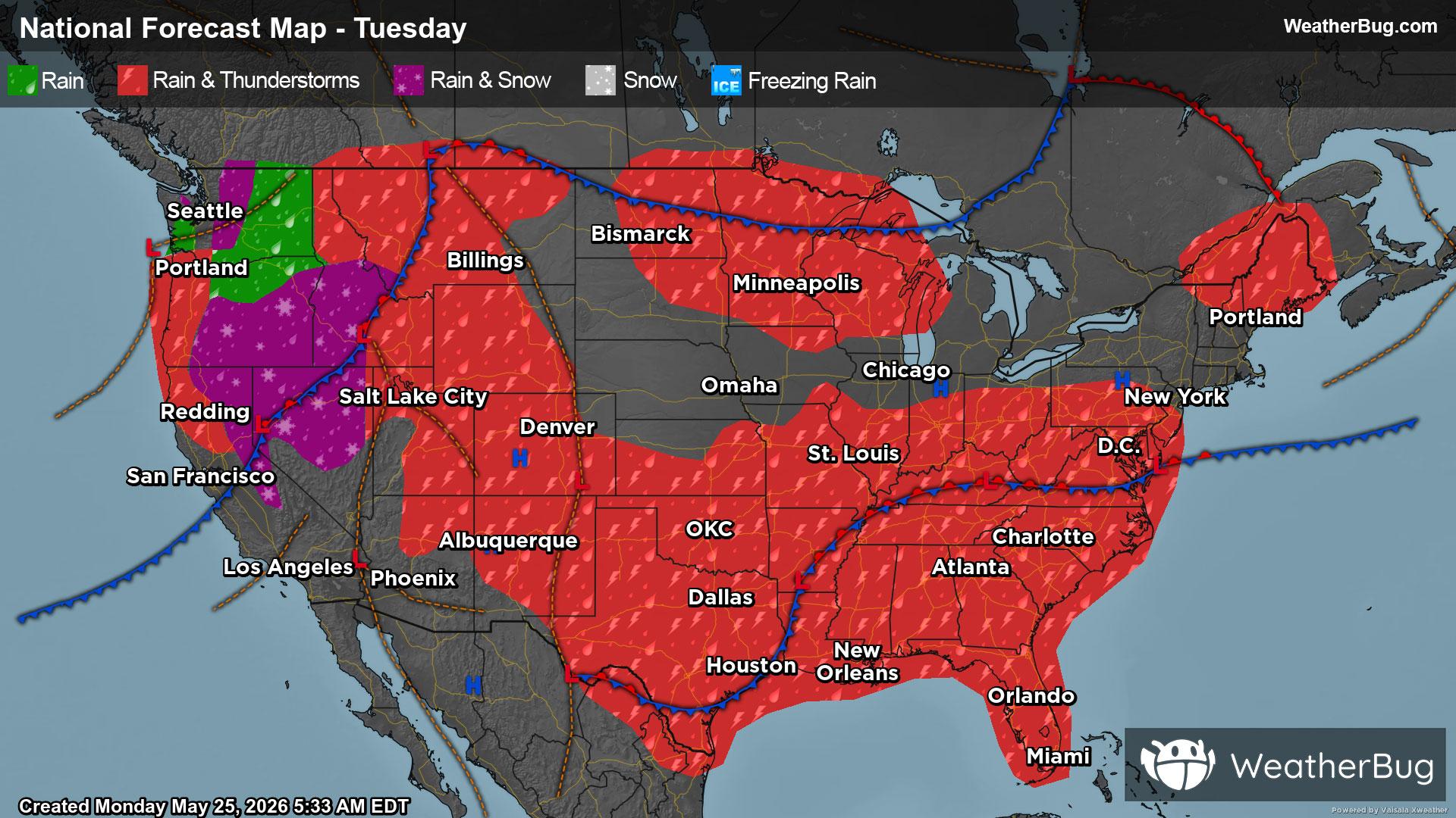
Marion, ND Weather

As of

Weather Station:WeatherBug

Open weather station selector modal

32degrees Fahrenheit

Feels like:21°F

Hi: --Lo: 30

70% Chance of Snow

Live Weather Radar

Marion, ND weather radar map

Current Weather Details

Windchill
--°
Daily Rain
--"
Dew point
--°
Monthly Rain
0.74"
Humidity
--%
Avg. Wind
-- mph
Pressure
--"
Wind Gust
-- mph
Sunrise
7:12 AM
Moon
Full
Sunset
8:01 PM
UV Index
3 (Moderate)

Weather Forecast

  • Tonight

    Lo

    Snow. Patchy blowing and drifting snow after midnight. Snow accumulation of 1 to 3 inches. Lows in the upper 20s. East winds around 15 mph with gusts up to 25 mph.

  • Tomorrow

    Hi

    Snow likely. Patchy blowing and drifting snow. Snow accumulation of 1 to 3 inches. Highs in the lower 30s. Northeast winds 15 to 20 mph with gusts up to 30 mph. Chance of snow 70 percent.

Marion, ND 10-day weather forecast

AIR QUALITY

24 | Fair

Top Triggers:pm25
Air quality data provided by Ambee
View Today's Air Quality details for Marion, ND

POLLEN COUNT & ALLERGY FORECAST

2.3 Low

Predominant Pollen:Cedar/Juniper and Elm.
View the Pollen forecast details

LIGHTNING MAP

Closest strike in the last 30 minutes:541.0 miles

No Lightning Nearby

Real-time lightning alerts & live Map