2026 Fall Foliage Report: Where Colors Are Peaking Now
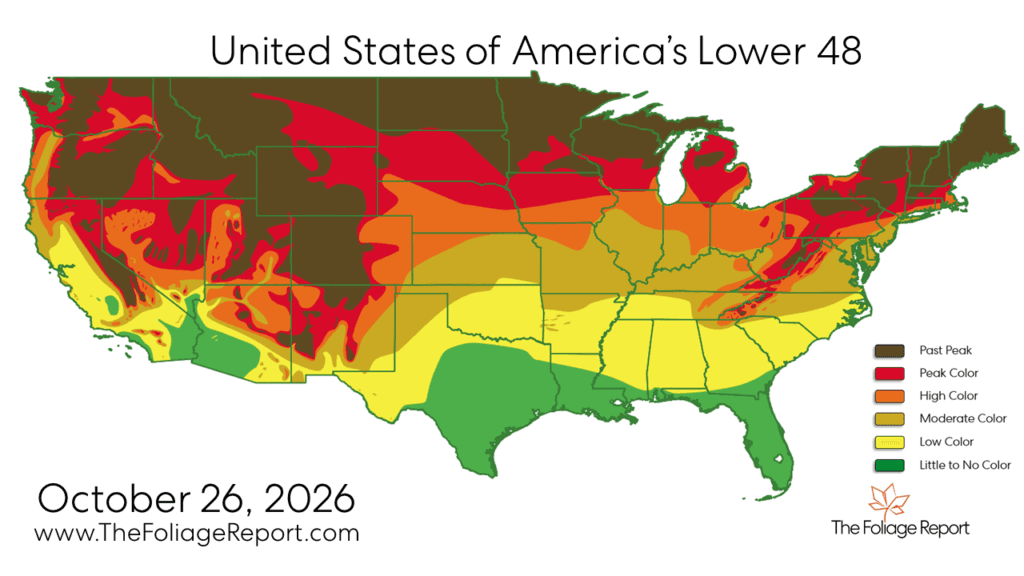
Peak color is shifting south, while the fall foliage season begins to fade across the northern U.S.
Read More
64degrees Fahrenheit

Feels like:64°
Hi:65°Lo:44°
Mostly Cloudy
Hi

Warmer. Partly sunny. A 50 percent chance of thunderstorms late in the afternoon. Highs in the lower 70s. South winds 10 to 15 mph.
Lo

Colder. Rain showers with thunderstorms likely in the evening, then partly cloudy after midnight. Lows in the lower 40s. Southwest winds 5 to 15 mph shifting to the northwest 5 to 10 mph after midnight. Chance of precipitation near 100 percent.


Closest strike in the last 30 minutes:125.7 miles
No Lightning Nearby


Peak color is shifting south, while the fall foliage season begins to fade across the northern U.S.