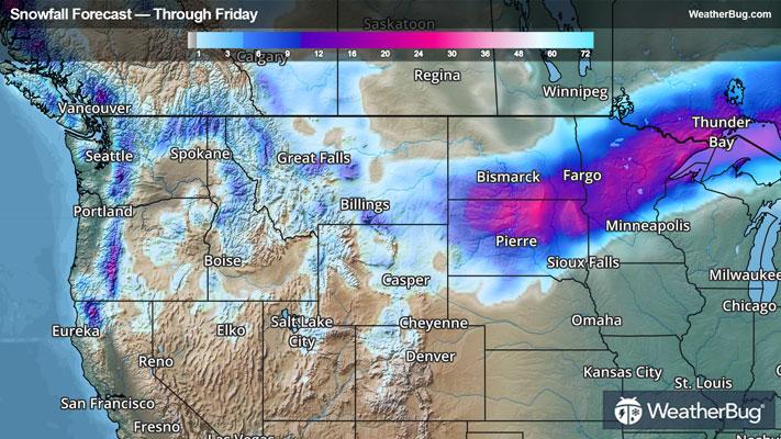
Central U.S. Slammed By Multiple Severe Weather Systems
A pair of low pressure systems will bring severe thunderstorms to the Plains and Midwest through Friday, along with flooding concerns.
Read More
Weather Station:WeatherBug
46degrees Fahrenheit
Feels like:41°F
Hi: --Lo: 46
30% Chance of Light Rain
Lo49°F
Mostly cloudy with scattered thunderstorms. Numerous showers through the late overnight then scattered showers toward daybreak. Cooler with lows in the upper 40s. Temperature steady or slowly rising. East winds 5 to 10 mph becoming southeast with gusts up to 20 mph toward daybreak. Chance of rain 60 percent.
Hi78°F
Partly cloudy. Isolated showers and thunderstorms late in the afternoon. More humid with highs around 80. South winds 10 to 15 mph with gusts up to 35 mph. Chance of rain 20 percent.

23 | Fair
9.6 Medium-High
Closest strike in the last 30 minutes:20.0 miles
Storms Approaching