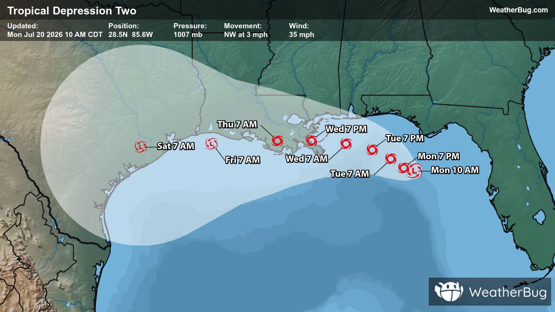
Nortonville, KY Weather

As of

Weather Station:Madisonville Regional Arpt

Open weather station selector modal

67degrees Fahrenheit

Feels like:67°F

Hi: 80Lo: 67

40% Chance Rain Showers

Live Weather Radar

Nortonville, KY weather radar map

Current Weather Details

Windchill
67°
Daily Rain
0"
Dew point
56°
Monthly Rain
1.59"
Humidity
67%
Avg. Wind
S 10 mph
Pressure
29.93" ↑
Wind Gust
10 mph
Sunrise
6:00 AM
Moon
Waxing Gibbous
Sunset
7:35 PM
UV Index
8 (Very High)

Weather Forecast

  • Today

    Hi

    Mostly cloudy with showers likely this morning then partly sunny with a chance of showers and thunderstorms this afternoon. Highs in the mid 80s. South winds 15 to 20 mph with gusts up to 35 mph. Chance of rain 60 percent.

  • Tonight

    Lo

    Thunderstorms likely. Showers. Locally heavy rainfall possible in the evening. Lows in the mid 60s. South winds 15 to 20 mph with gusts up to 30 mph becoming southwest 10 to 15 mph after midnight. Chance of rain 90 percent.

Nortonville, KY 10-day weather forecast

AIR QUALITY

23 | Fair

Top Triggers:pm25
Air quality data provided by Ambee
View Today's Air Quality details for Nortonville, KY

POLLEN COUNT & ALLERGY FORECAST

10 High

Predominant Pollen:Oak, Sycamore and Maple.
View the Pollen forecast details

LIGHTNING MAP

Closest strike in the last 30 minutes:47.7 miles

No Lightning Nearby

Real-time lightning alerts & live Map