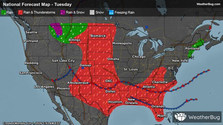
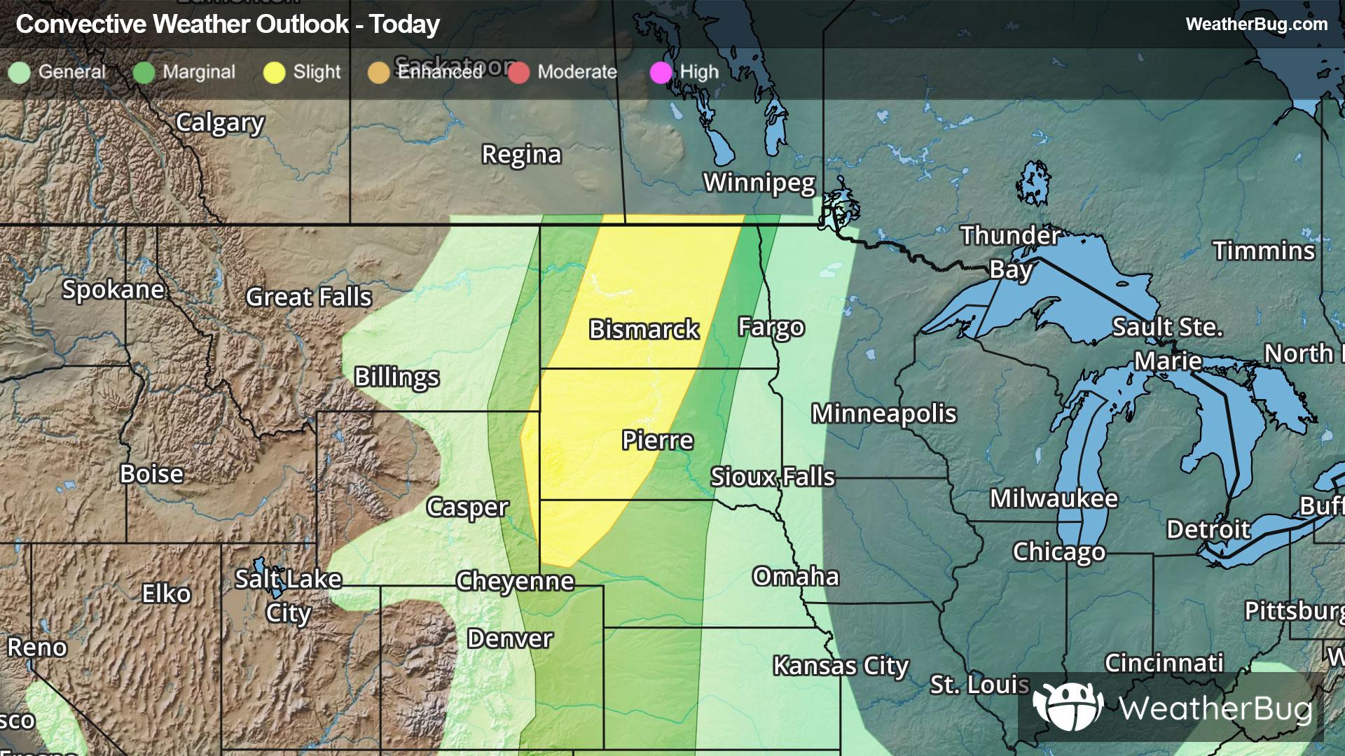
Norwalk, WI Weather

As of

Weather Station:SPARTA/MCCOY AAF

Open weather station selector modal

10degrees Fahrenheit

Feels like:10°F

Hi: 12Lo: -6

30% Chance of Snow

Live Weather Radar

Norwalk, WI weather radar map

Current Weather Details

Windchill
--
Daily Rain
--
Dew point
--
Monthly Rain
--
Humidity
--
Avg. Wind
--
Pressure
--
Wind Gust
--
Sunrise
7:32 AM
Moon
New
Sunset
4:54 PM
UV Index
1 (Low)

Weather Forecast

  • Today

    Hi

    Mostly cloudy with likely snow. Chance of precipitation 100%. High temperature around 12F. Dew point will be around 0F with an average humidity of 73%. Winds will be 7 mph from the SW.

  • Tonight

    Lo

    Mostly cloudy. A chance of snow this evening. Patchy blowing snow after midnight. Additional snow accumulation up to 1 inch possible. Cold with lows around 8 below. Northwest winds 10 to 20 mph with gusts up to 35 mph. Chance of snow 50 percent. Wind chill values as low as 30 below after midnight.

Norwalk, WI 10-day weather forecast

AIR QUALITY

17 | Excellent

Top Triggers:pm25
Air quality data provided by Ambee
View Today's Air Quality details for Norwalk, WI

POLLEN COUNT & ALLERGY FORECAST

0.1 Low

Predominant Pollen:None
View the Pollen forecast details

LIGHTNING MAP

Closest strike in the last 30 minutes:1262.3 miles

No Lightning Nearby

Real-time lightning alerts & live Map