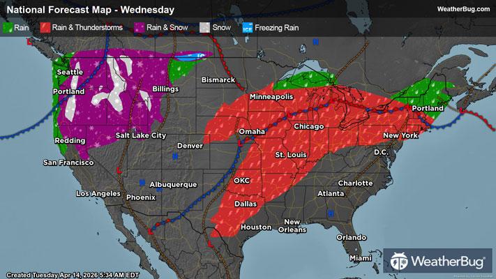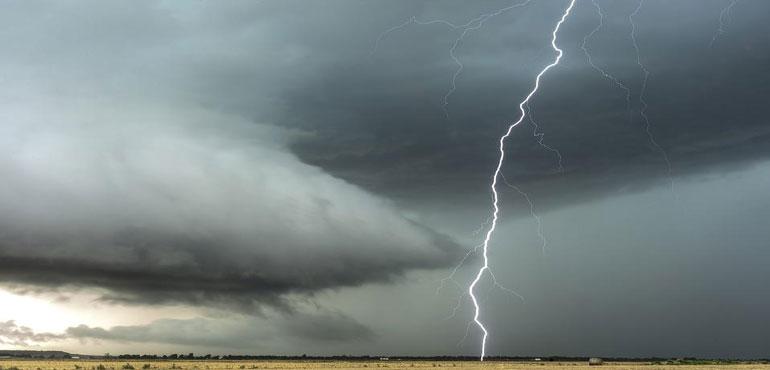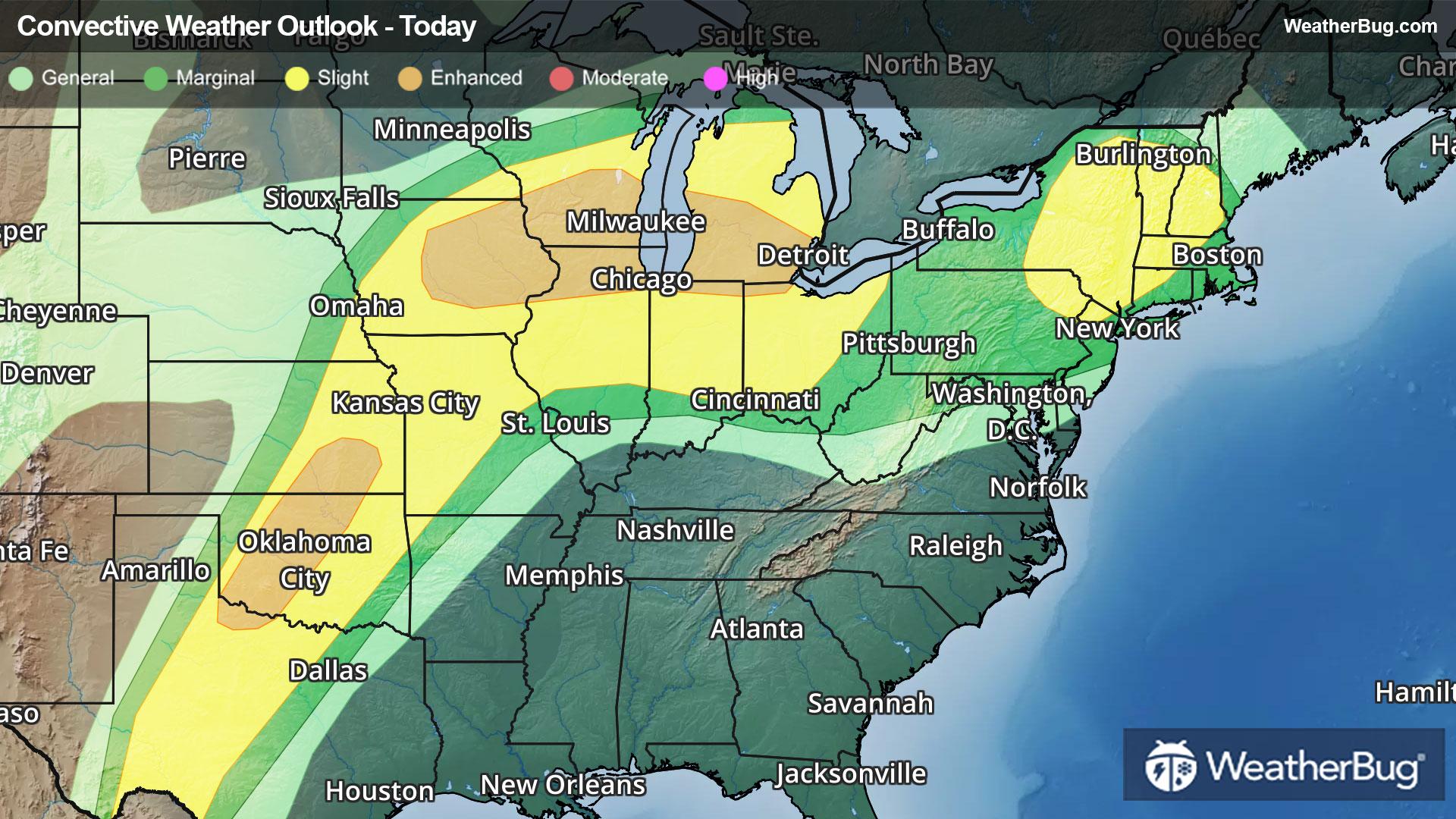
Big Storms Eye Southern Plains to New England Through Tonight
Oodles of dangerous weather will pepper the southern Plains to the Great Lakes, Ohio Valley, and New England.
Read More
Weather Station:Darrington School District
40degrees Fahrenheit
Feels like:40°F
Hi: 40Lo: 31
Chance of Sleet
Hi39°F
Mostly cloudy with a chance of rain and snow in the morning then rain and snow in the afternoon. Snow level near 3500 feet. Rainfall amounts one to three inches possible. Snow accumulation up to 4 inches. Afternoon pass temperatures in the mid 30s. Southwest wind in the passes around 10 mph with gusts to 25 mph.
Lo31°F
Showers snow showers and a slight chance of thunderstorms in the evening then rain and snow after midnight. Snow level near 3500 feet decreasing to 1500 feet after midnight. Snow may be heavy at times until early morning. Snow accumulation of 4 to 9 inches. Lows in the mid 20s. Southwest wind in the passes around 10 mph becoming west after midnight. Gusts to 25 mph.

22 | Fair
5.2 Medium
Closest strike in the last 30 minutes:1423.4 miles
No Lightning Nearby