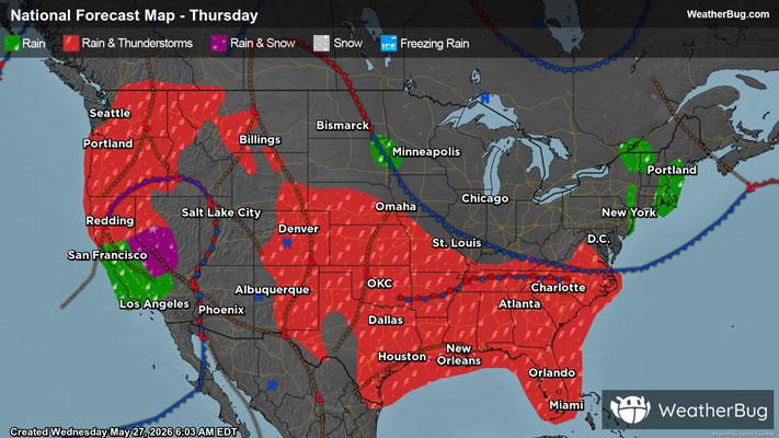
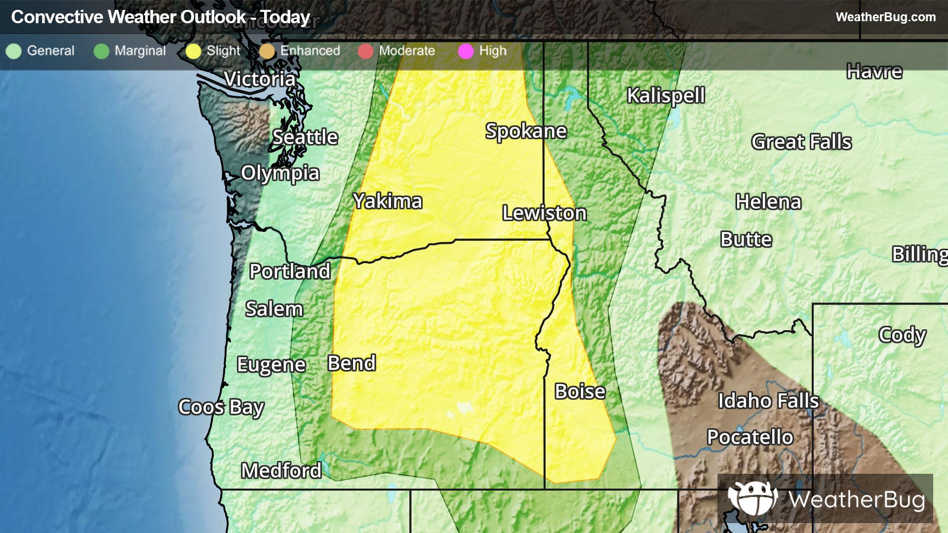
South Dayton, NY Weather

As of

Weather Station:Dunkirk Airport

Open weather station selector modal

20degrees Fahrenheit

Feels like:0

Hi: 20Lo: 4

70% Chance of Heavy Snow

Live Weather Radar

South Dayton, NY weather radar map

Current Weather Details

Windchill
--
Daily Rain
--
Dew point
--
Monthly Rain
--
Humidity
--
Avg. Wind
--
Pressure
--
Wind Gust
--
Sunrise
7:41 AM
Moon
Waxing Crescent
Sunset
5:13 PM
UV Index
1 (Low)

Weather Forecast

  • Today

    Hi

    Snow showers and areas of blowing snow. Visibility one quarter mile or less at times late. Additional accumulation up to 2 inches. Very windy and cold. Temperatures falling to between 10 and 15 inland and to between 15 and 20 along the lake erie shore. West winds 25 to 35 mph with gusts up to 45 mph. Chance of snow near 100 percent.

  • Tonight

    Lo

    Snow showers and areas of blowing snow. Snow may be heavy at times with visibility one quarter mile or less at times. Additional accumulation 3 to 6 inches. Very windy and cold with lows ranging from zero to 5 above in interior valleys to 5 to 10 above along the lake erie shore. West winds 25 to 35 mph with gusts up to 45 mph diminishing to 15 to 30 mph. Chance of snow 90 percent. Wind chill values as low as 15 below.

South Dayton, NY 10-day weather forecast

AIR QUALITY

28 | Fair

Top Triggers:pm25
Air quality data provided by Ambee
View Today's Air Quality details for South Dayton, NY

POLLEN COUNT & ALLERGY FORECAST

0.1 Low

Predominant Pollen:None
View the Pollen forecast details

LIGHTNING MAP

Closest strike in the last 30 minutes:2127.5 miles

No Lightning Nearby

Real-time lightning alerts & live Map