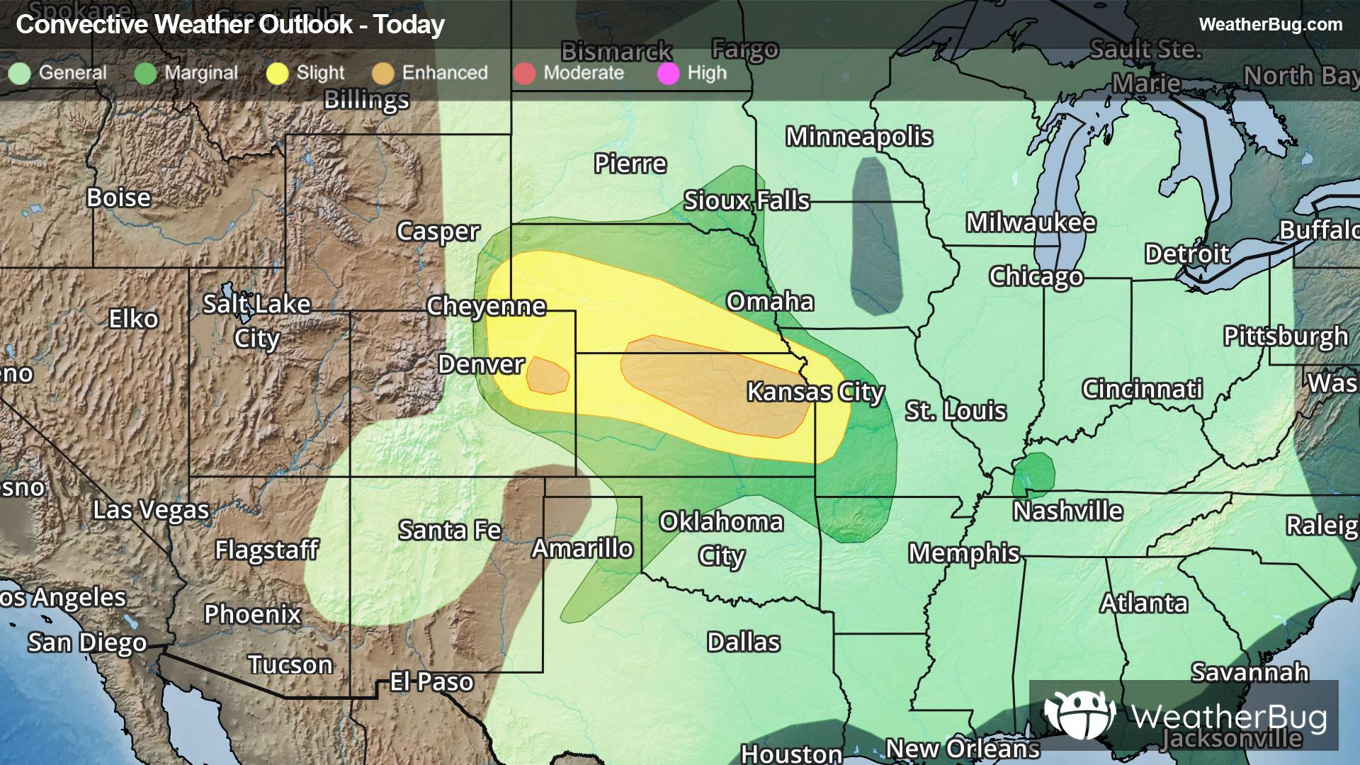
Twin Lakes, MN Weather

As of

Weather Station:ALBERT LEA

Open weather station selector modal

65degrees Fahrenheit

Feels like:65°F

Hi: 65Lo: 48

Partly Cloudy

Live Weather Radar

Twin Lakes, MN weather radar map

Current Weather Details

Windchill
65°
Daily Rain
0"
Dew point
62°
Monthly Rain
1.87"
Humidity
91%
Avg. Wind
N 7 mph
Pressure
29.67" →
Wind Gust
7 mph
Sunrise
6:33 AM
Moon
Waning Crescent
Sunset
7:55 PM
UV Index
6 (High)

Weather Forecast

  • Today

    Hi

    Partly cloudy. High temperature around 65F. Dew point will be around 56F with an average humidity of 88%. Winds will be 5 mph from the N.

  • Tonight

    Lo

    Decreasing clouds. Chance of rain showers early in the evening. Slight chance of thunderstorms in the evening. Slight chance of rain showers after midnight. Patchy fog late in the night. Lows in the upper 40s. North winds 5 to 10 mph. Chance of precipitation 50 percent.

Twin Lakes, MN 10-day weather forecast

AIR QUALITY

29 | Fair

Top Triggers:pm25
Air quality data provided by Ambee
View Today's Air Quality details for Twin Lakes, MN

POLLEN COUNT & ALLERGY FORECAST

11.3 High

Predominant Pollen:Maple, Alder and Elm.
View the Pollen forecast details

LIGHTNING MAP

Closest strike in the last 30 minutes:45.3 miles

No Lightning Nearby

Real-time lightning alerts & live Map