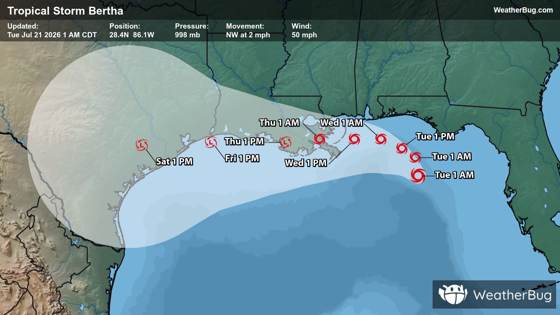
Watauga, SD Weather

As of

Weather Station:WeatherBug

Open weather station selector modal

35degrees Fahrenheit

Feels like:26°F

Hi: 37Lo: 27

Mostly Cloudy

Live Weather Radar

Watauga, SD weather radar map

Current Weather Details

Windchill
--°
Daily Rain
--"
Dew point
--°
Monthly Rain
0.01"
Humidity
--%
Avg. Wind
-- mph
Pressure
--"
Wind Gust
-- mph
Sunrise
7:10 AM
Moon
Waning Gibbous
Sunset
6:43 PM
UV Index
3 (Moderate)

Weather Forecast

  • Today

    Hi

    Partly cloudy with a slight chance of rain-snow mix. Chance of precipitation 30%. High temperature around 37F. Dew point will be around 24F with an average humidity of 64%. Winds will be 9 mph from the NE.

  • Tonight

    Lo

    Mostly cloudy. Snow likely mainly this evening. Snow accumulation up to 1 inch. Lows in the mid 20s. Northeast winds 15 to 20 mph with gusts up to 30 mph becoming southeast 5 to 10 mph with gusts up to 20 mph after midnight. Chance of snow 60 percent.

Watauga, SD 10-day weather forecast

AIR QUALITY

28 | Fair

Top Triggers:pm25
Air quality data provided by Ambee
View Today's Air Quality details for Watauga, SD

POLLEN COUNT & ALLERGY FORECAST

0.2 Low

Predominant Pollen:Cedar/Juniper
View the Pollen forecast details

LIGHTNING MAP

Closest strike in the last 30 minutes:1012.7 miles

No Lightning Nearby

Real-time lightning alerts & live Map