URGENT - WINTER WEATHER MESSAGE
National Weather Service Pittsburgh PA
608 AM EST Thu Jan 1 2026
Tuscarawas-Carroll-Columbiana-Harrison-Jefferson OH-Belmont- Monroe-Mercer-Venango-Forest-Lawrence-Butler-Clarion-Jefferson PA- Beaver-Allegheny-Armstrong-Washington-Greene-Westmoreland-Fayette- Indiana-Higher Elevations of Indiana-Hancock-Brooke-Ohio-Marshall- Wetzel-Marion-Monongalia- Including the cities of New Philadelphia, Cadiz, Indiana, Beaver Falls, Armagh, Tionesta, Morgantown, Greensburg, Monaca, Ellwood City, Ambridge, Follansbee, Clarion, Ford City, Sharon, Murrysville, Punxsutawney, Hermitage, East Liverpool, Franklin, Columbiana, Butler, Steubenville, Weirton, New Castle, Canonsburg, Martins Ferry, Fairmont, Waynesburg, Brookville, Monessen, Washington, Salem, Carrollton, Wheeling, Malvern, Grove City, Woodsfield, Dover, New Martinsville, Aliquippa, Wellsburg, Pittsburgh Metro Area, Moundsville, New Kensington, St. Clairsville, Lower Burrell, Uniontown, Oil City, Kittanning, and Latrobe 608 AM EST Thu Jan 1 2026
...WINTER WEATHER ADVISORY REMAINS IN EFFECT UNTIL 10 AM EST THIS MORNING...
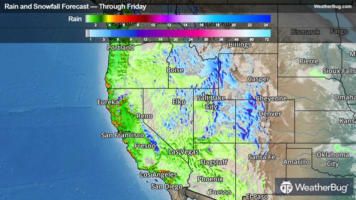
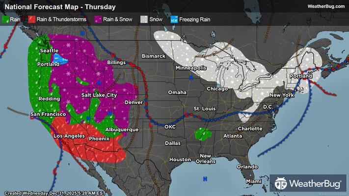
* WHAT...Snow. Additional snow accumulations up to one inch.
* WHERE...Portions of east central Ohio, northwest, southwest, and western Pennsylvania, and northern and the northern panhandle of West Virginia.
* WHEN...Until 10 AM EST this morning.
* IMPACTS...Roads, and especially bridges and overpasses, will likely become slick and hazardous. Plan on slippery road conditions. The hazardous conditions will impact the Thursday morning commute.
PRECAUTIONARY/PREPAREDNESS ACTIONS...
Slow down and use caution while traveling. The latest road conditions can be obtained by calling 5 1 1.
Please report snow or ice accumulations by calling 412-262-1988, posting to the NWS Pittsburgh Facebook page, or using X @NWSPittsburgh.
&&