What to Do When the Hurricane Is Over
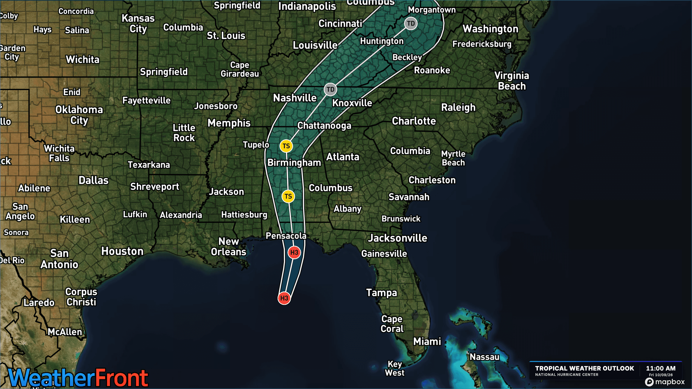
The hurricane may be gone, but the danger isn't. From hidden floodwaters to downed power lines, here's how to stay safe and start recovering after a hurricane.
Read More
# HEADLINE -------------------- STRONG THUNDERSTORMS WILL IMPACT NORTHEASTERN MOORE, NORTHWESTERN SAMPSON, HARNETT, CUMBERLAND, LEE, SOUTHWESTERN WAKE, SOUTHWESTERN JOHNSTON, HOKE AND SOUTHEASTERN CHATHAM COUNTIES THROUGH 1245 PM EDT # SUMMARY -------------------- At 1138 AM EDT, Doppler radar was tracking a cluster of strong thunderstorms along a line extending from near Sanford to near Antioch. Movement was northeast at 40 mph. # DETAILS -------------------- HAZARD Wind gusts up to 50 mph. SOURCE Radar indicated. IMPACT Gusty winds could knock down tree limbs and blow around unsecured objects. LOCATIONS IMPACTED INCLUDE Fayetteville, Sanford, Raeford, Lillington, Fort Bragg, Fuquay-Varina, Dunn, Angier, Benson, and Godwin. THIS INCLUDES THE FOLLOWING HIGHWAYS Interstate 95 between Mile Markers 81 and 41. Interstate 40 between Mile Markers 311 and 332. US 1 between Mile Markers 69 and 73. ISSUED AT Sunday, October 11, 2026 at 11:41 AM EDT ISSUED BY National Weather Service Raleigh NC HEADER Special Weather Statement # PRECAUTIONARY/PREPAREDNESS ACTIONS -------------------- If outdoors, consider seeking shelter inside a building. A Tornado Warning is in effect in Cumberland and Hoke counties until 1215 PM. Doppler radar has indicated rotation with this storm. If the storm intensifies and rotation strengthens, additional tornado warnings may need to be issued. A Tornado Watch remains in effect until 500 PM EDT for central North Carolina. # AREAS AFFECTED -------------------- Moore NC, Chatham NC, Cumberland NC, Harnett NC, Hoke NC, Johnston NC, Lee NC, Sampson NC, Wake NC
# SUMMARY -------------------- The National Weather Service in Raleigh has issued a - Tornado Warning for... Northwestern Cumberland County in central North Carolina... Southeastern Hoke County in central North Carolina... - Until 1215 PM EDT. - At 1136 AM EDT, a severe thunderstorm capable of producing a tornado was located near Raeford, moving northeast at 40 mph. # DETAILS -------------------- HAZARD Tornado. SOURCE Radar indicated rotation. IMPACT Flying debris will be dangerous to those caught without shelter. Mobile homes will be damaged or destroyed. Damage to roofs, windows, and vehicles will occur. Tree damage is likely. THIS DANGEROUS STORM WILL BE NEAR - Fayetteville and Fort Bragg around 1140 AM EDT. Pope AAF around 1145 AM EDT. - Other locations impacted by this tornadic thunderstorm include Spring Lake, Silver City, Rockfish, Hope Mills, and Bonnie Doone. - This includes Interstate 95 between Mile Markers 49 and 44. ISSUED AT Sunday, October 11, 2026 at 11:37 AM EDT ISSUED BY National Weather Service Raleigh NC HEADER BULLETIN - EAS ACTIVATION REQUESTED | Tornado Warning # PRECAUTIONARY/PREPAREDNESS ACTIONS -------------------- TAKE COVER NOW! Move to a basement or an interior room on the lowest floor of a sturdy building. Avoid windows. If you are outdoors, in a mobile home, or in a vehicle, move to the closest substantial shelter and protect yourself from flying debris. To report severe weather contact your nearest law enforcement agency. They will send your report to the National Weather Service office in Raleigh.
# SUMMARY -------------------- THE NATIONAL WEATHER SERVICE HAS ISSUED TORNADO WATCH 680 IN EFFECT UNTIL 5 PM EDT THIS AFTERNOON FOR THE FOLLOWING AREAS IN NORTH CAROLINA THIS WATCH INCLUDES 24 COUNTIES IN CENTRAL NORTH CAROLINA ALAMANCE CHATHAM CUMBERLAND DURHAM EDGECOMBE FRANKLIN GRANVILLE HALIFAX HARNETT HOKE JOHNSTON LEE MOORE NASH ORANGE PERSON RICHMOND SAMPSON SCOTLAND VANCE WAKE WARREN WAYNE WILSON THIS INCLUDES THE CITIES OF ABERDEEN, ANGIER, APEX, BUIES CREEK, BURLINGTON, CAMP MACKALL, CARRBORO, CARTHAGE, CARY, CHAPEL HILL, CLAYTON, CLINTON, CREEDMOOR, DUNN, DURHAM, ELLERBE, ENFIELD, ERWIN, FAYETTEVILLE, FRANKLINTON, GOLDSBORO, GRAHAM, HENDERSON, HILLSBOROUGH, HOPE MILLS, KITTRELL, KNIGHTDALE, LAURINBURG, LILLINGTON, LOUISBURG, MEBANE, NASHVILLE, NORLINA, OXFORD, PINEHURST, PITTSBORO, PRINCEVILLE, RAEFORD, RALEIGH, ROANOKE RAPIDS, ROCKINGHAM, ROCKY MOUNT, ROSEBORO, ROUGEMONT, ROXBORO, SANFORD, SCOTLAND NECK, SELMA, SILER CITY, SMITHFIELD, SOUTHERN PINES, SPRING HOPE, SPRING LAKE, TARBORO, WAGRAM, WAKE FOREST, WARRENTON, AND WILSON. # DETAILS -------------------- ISSUED AT Sunday, October 11, 2026 at 10:01 AM EDT ISSUED BY NATIONAL WEATHER SERVICE RALEIGH NC HEADER WATCH COUNTY NOTIFICATION FOR WATCH 680
Closest strike: 0.04 miles Stay Alert! Remain in a safe area until there has been no lightning within 10 miles of this location for 30 minutes. Please be aware that lightning activity can remain high even when a storm is moving away from your location. Even if rain has stopped, do not leave your safe area until WeatherBug indicates that lightning is more than 10 miles away from this selected location. IF OUTDOORS Avoid water, high ground, and open spaces. Avoid all metal objects including electric wires, fences, and machinery. Find a safe area in a building or in a fully enclosed vehicle with the windows completely shut. Unsafe places include underneath canopies, small picnic or rain shelters, convertibles, or near trees. IF INDOORS Avoid water and stay away from doors and windows. Avoid using a hard line telephone. Take off headphones. Turn off, unplug, and stay away from appliances, computers, power tools, and TV sets. Lightning may strike exterior electric and phone lines, inducing shocks to inside equipment.
There is a Marginal Severe Storm Risk for your location. Continue reading for today's outlook from the National Weather Service's Storm Prediction Center. -------------------- National Severe Storm Outlook THERE IS A SLIGHT RISK OF SEVERE THUNDERSTORMS ACROSS PARTS OF NORTH CAROLINA AND VIRGINIA SUMMARY Thunderstorms capable of producing isolated severe wind gusts and a tornado or two will be possible today across parts of the Mid-Atlantic. Additional storms with isolated severe gusts will be possible in parts of the Desert Southwest and Four Corners region. Mid-Atlantic The remnants of Isaias are now a vertically stacked cyclone centered over Middle TN this morning. Warm sector associated with this cyclone is displaced east of the primary cyclone center, and is delineated well by the 64 deg F isodrosotherm. This isodrosotherm currently extends from the southern Delmarva Peninsula southwestward to a triple point low over the TN/NC border and then southward across central/south-central GA and the far eastern FL Panhandle. Moderate low to mid-level southerly/southwesterly flow currently extends throughout the eastern periphery of the cyclone over the warm sector. Primary core of the cyclone is forecast to progress northeastward across the central Appalachians this afternoon/evening before continuing northeastward across VA to the Mid-Atlantic coast overnight into early tomorrow. The occluded surface and triple point lows associated with this system will shift northeastward as well. This progression will result in northward advection of the warm sector into more of eastern NC and southeast VA while the cold front pushes eastward/northeastward. Abundant cloud cover will limit heating and lapse rates will remain poor, but abundant low-level moisture will still support moderate buoyancy across the warm sector. This buoyancy will support thunderstorm development along and ahead of the cold front as it moves northeastward across the region. Moderate low to mid-level southerly/southwesterly flow will persist across the warm sector, supporting the potential for rotation/organization with any deep and persistent updrafts. As a result, isolated damaging gusts and a few brief tornadoes are possible across the region. The best overlap between buoyancy and shear is expected between 18Z and 00Z from north-central/northeast NC into central/southeast VA. Desert Southwest/Eastern Great Basin Remnants of tropical cyclone Rachel are currently centered in the CA/NV/AZ border vicinity, at the base of a broad upper trough covering much of the western CONUS. These remnants are forecast to progress northeastward today, moving quickly through the Great Basin and ending the period over central/eastern MT. At the same time, another cyclone will shift southward across the Pacific Northwest. Dynamic response to this evolution will support a belt of strong mid-level southwesterly flow from southern CA/AZ through WY into the northern High Plains. Low to mid-level moisture associated with the remnants of Rachel will spread northeastward as well. Persistent large-scale forcing for ascent and the aforementioned moisture will support scattered thunderstorms. Strong low to mid-level southwesterly flow will result in occasionally intense bowing segments capable of strong gusts, particularly in any areas that can experience filtered daytime heating. A low-probability tornado risk will also exist from this morning into the early afternoon across near the surface low over the CA/NV/AZ border intersection vicinity. Here, moist low-level southerly will elongate hodographs (as shown in current ESX VAD), resulting in a kinematic environment supportive of tornadoes. Limited buoyancy should keep any tornado threat isolated and brief.
The hurricane may be gone, but the danger isn't. From hidden floodwaters to downed power lines, here's how to stay safe and start recovering after a hurricane.