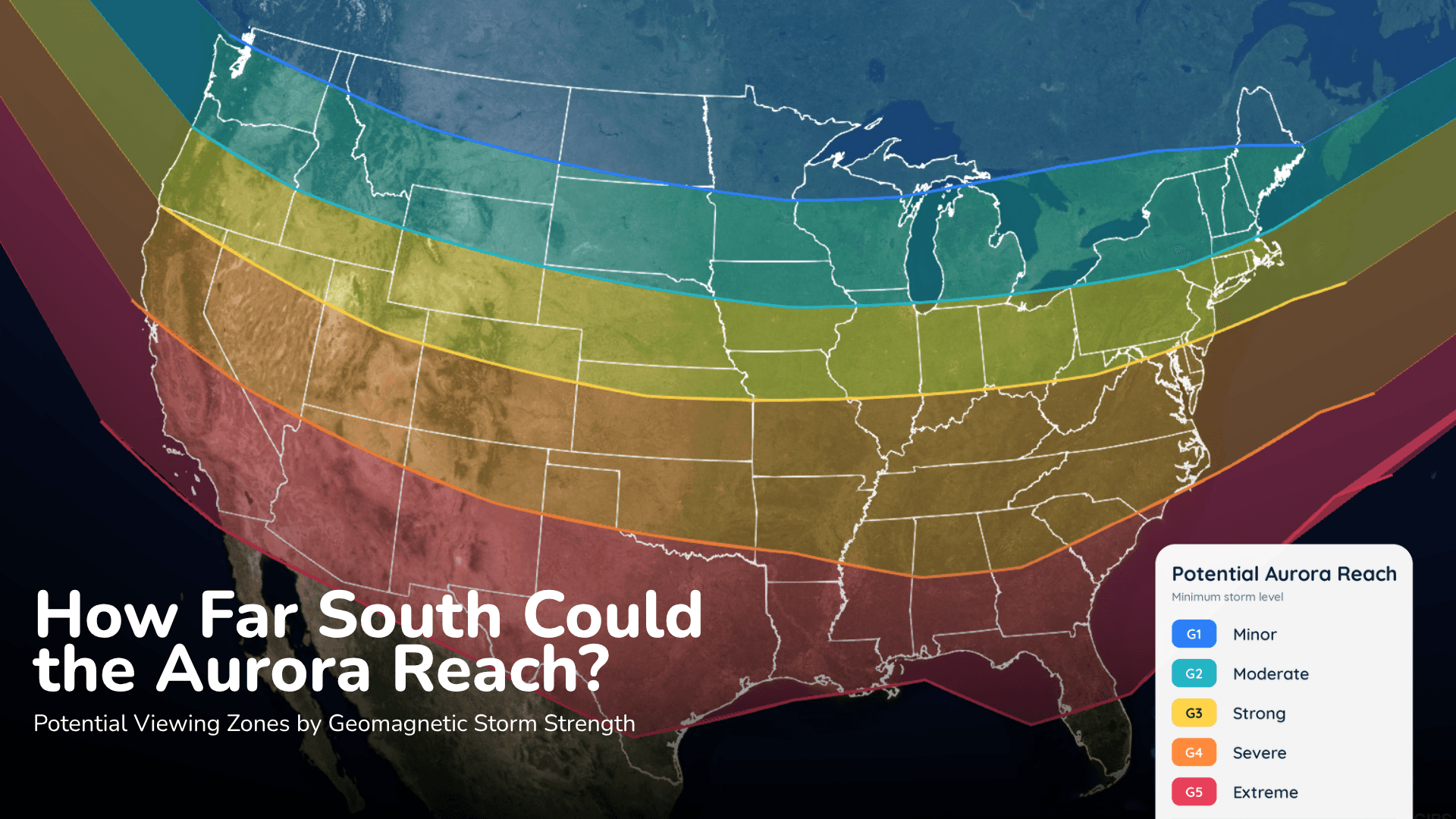
Northern Lights This Weekend: Will Clouds Block the View?
Aurora could reach parts of the northern United States Saturday night, but the cloud forecast may decide who actually sees it.
Read More
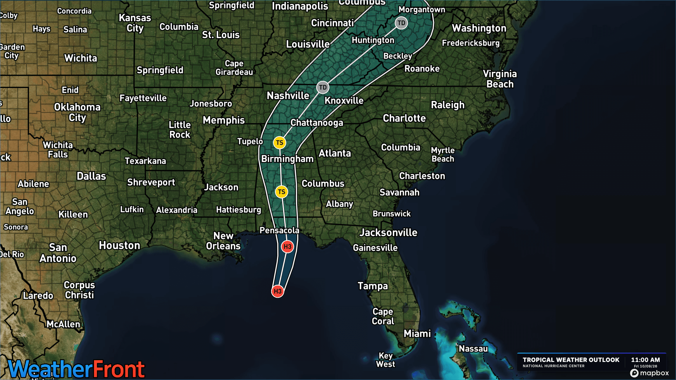
# HEADLINE -------------------- FLOOD WATCH REMAINS IN EFFECT THROUGH SUNDAY MORNING # DETAILS -------------------- WHAT Flooding caused by excessive rainfall continues to be possible. WHERE Portions of central, east central, north central, northeast, northwest, southeast, and west central Georgia, including the following areas, in central Georgia, Baldwin, Bibb, Bleckley, Butts, Crawford, Crisp, Dodge, Dooly, Houston, Jasper, Jones, Laurens, Monroe, Montgomery, Peach, Pulaski, Putnam, Telfair, Twiggs, Wheeler, Wilcox and Wilkinson. In east central Georgia, Emanuel, Glascock, Greene, Hancock, Jefferson, Johnson, Taliaferro, Treutlen, Warren, Washington and Wilkes. In north central Georgia, Barrow, Cherokee, Clayton, Cobb, Dawson, DeKalb, Douglas, Fannin, Fayette, Forsyth, Gilmer, Gwinnett, Hall, Henry, Lumpkin, Morgan, Newton, North Fulton, Pickens, Rockdale, South Fulton, Union and Walton. In northeast Georgia, Banks, Clarke, Jackson, Madison, Oconee, Oglethorpe, Towns and White. In northwest Georgia, Bartow, Carroll, Catoosa, Chattooga, Dade, Floyd, Gordon, Haralson, Murray, Paulding, Polk, Walker and Whitfield. In southeast Georgia, Toombs. In west central Georgia, Chattahoochee, Coweta, Harris, Heard, Lamar, Macon, Marion, Meriwether, Muscogee, Pike, Schley, Spalding, Stewart, Sumter, Talbot, Taylor, Troup, Upson and Webster. WHEN Through Sunday morning. IMPACTS Excessive runoff may result in flooding of rivers, creeks, streams, and other low-lying and flood-prone locations. Flooding may occur in poor drainage and urban areas. ADDITIONAL DETAILS - Post-Tropical Cyclone Isaias will continue to bring rounds of heavy rainfall to the area through Saturday night. Widespread totals of 1 to 4 inches are expected with a localized swath of up to 8 inches where the heaviest bands set up and train. With high rainfall rates and the potential for repeated rounds of heavy rain in bands, flash flooding is expected. The locations most at risk are poor drainage and urban areas, as well as creeks and streams prone to flash flooding. - http://www.weather.gov/safety/flood ISSUED AT Saturday, October 10, 2026 at 5:03 AM EDT ISSUED BY National Weather Service Peachtree City GA HEADER Flood Watch # PRECAUTIONARY/PREPAREDNESS ACTIONS -------------------- You should monitor later forecasts and be alert for possible Flood Warnings. Those living in areas prone to flooding should be prepared to take action should flooding develop. # AREAS AFFECTED -------------------- Baldwin, Bibb, Chattooga, Douglas, Forsyth, Gwinnett, Putnam, Schley, Sumter, Taliaferro, Toombs, Banks, Barrow, Bartow, Bleckley, Butts, Carroll, Catoosa, Chattahoochee, Cherokee, Clarke, Clayton, Cobb, Coweta, Crawford, Crisp, Dade, Dawson, DeKalb, Dodge, Dooly, Emanuel, Fannin, Fayette, Floyd, Gilmer, Glascock, Gordon, Greene, Hall, Hancock, Haralson, Harris, Heard, Henry, Houston, Jackson, Jasper, Jefferson, Johnson, Jones, Lamar, Laurens, Lumpkin, Macon, Madison, Marion, Meriwether, Monroe, Montgomery, Morgan, Murray, Muscogee, Newton, North Fulton, Oconee, Oglethorpe, Paulding, Peach, Pickens, Pike, Polk, Pulaski, Rockdale, South Fulton, Spalding, Stewart, Talbot, Taylor, Telfair, Towns, Treutlen, Troup, Twiggs, Union, Upson, Walker, Walton, Warren, Washington, Webster, Wheeler, White, Whitfield, Wilcox, Wilkes, Wilkinson Including the cities of Ellijay, Pine Mountain, Marietta, Woodstock, Stockbridge, Griffin, Covington, Atlanta, Warner Robins, Cumming, Jeffersonville, Cleveland, Monticello, Cochran, Hiawassee, Douglasville, Blue Ridge, Abbeville, Gray, Vienna, Riverdale, Lawrenceville, Bremen, Fort Valley, Vidalia, Sparta, Athens, Madison, Jasper, West Point, Warrenton, Talbotton, East Point, Rome, Columbus, Lumpkin, Carrollton, Zebulon, Swainsboro, Milledgeville, Dallas, Crawfordville, Greensboro, Dublin, Monroe, Commerce, Butler, Gainesville, Wrightsville, Comer, Mount Vernon, Peachtree City, Winder, Dawsonville, Eatonton, Franklin, Decatur, Blairsville, Gibson, Cordele, Ellaville, Soperton, Jackson, Newnan, Americus, Washington, Watkinsville, Toomsboro, Mcrae, Hawkinsville, Conyers, Calhoun, Buena Vista, Eastman, Macon, Trenton, Cartersville, Roberts, Dalton, Sandersville, LaFayette, Louisville, Thomaston, Preston, Barnesville, Summerville, Fort Oglethorpe, Dahlonega, Cedartown, Forsyth, Montezuma, Crawford, Fort Benning, Homer, Alamo, Manchester, and Chatsworth
# HEADLINE -------------------- WIND ADVISORY REMAINS IN EFFECT UNTIL 11 PM EDT THIS EVENING # DETAILS -------------------- WHAT East winds 10 to 20 mph with gusts up to 40 mph expected. WHERE Portions of central, east central, north central, northeast, and west central Georgia. WHEN Until 11 PM EDT this evening. IMPACTS Gusty winds will blow around unsecured objects. Tree limbs could be blown down and a few power outages may result. ISSUED AT Saturday, October 10, 2026 at 5:00 AM EDT ISSUED BY National Weather Service Peachtree City GA HEADER URGENT - WEATHER MESSAGE # PRECAUTIONARY/PREPAREDNESS ACTIONS -------------------- Winds this strong can make driving difficult, especially for high profile vehicles. Use extra caution. Secure outdoor objects. # AREAS AFFECTED -------------------- Bleckley, Hancock, Jefferson, Baldwin, Bibb, Butts, Crawford, Crisp, Dodge, Dooly, Glascock, Greene, Houston, Jasper, Johnson, Jones, Lamar, Laurens, Monroe, Morgan, Oglethorpe, Peach, Pulaski, Putnam, Taliaferro, Twiggs, Warren, Washington, Wilcox, Wilkes, Wilkinson Including the cities of Roberts, Fort Valley, Sandersville, Sparta, Wrightsville, Madison, Louisville, Eatonton, Warrenton, Gibson, Cordele, Warner Robins, Barnesville, Jeffersonville, Jackson, Forsyth, Monticello, Cochran, Milledgeville, Washington, Crawford, Toomsboro, Hawkinsville, Abbeville, Gray, Vienna, Crawfordville, Greensboro, Eastman, Dublin, and Macon
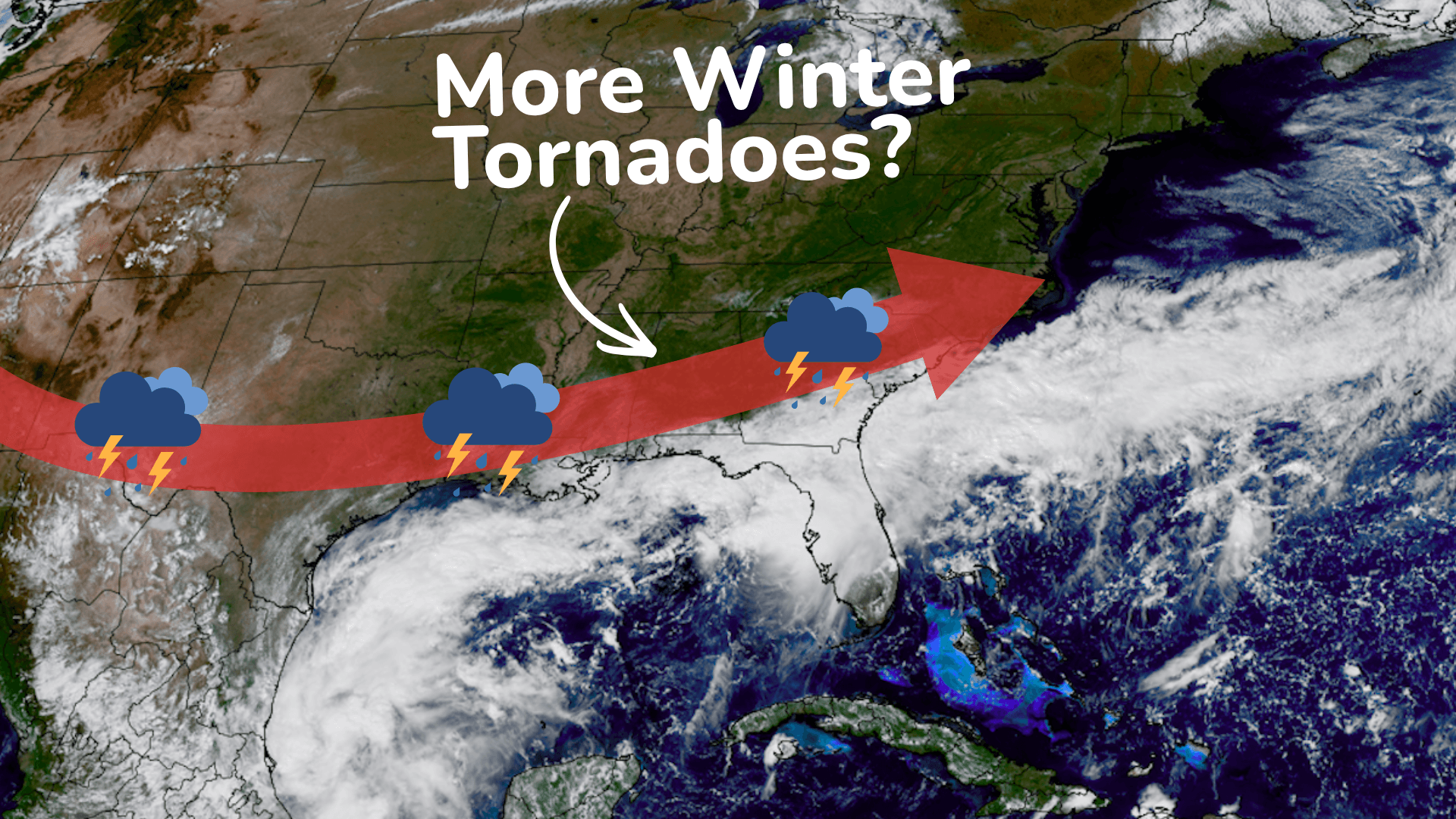
There is a Slight Severe Storm Risk for your location. Continue reading for today's outlook from the National Weather Service's Storm Prediction Center. -------------------- National Severe Storm Outlook THERE IS A SLIGHT RISK OF SEVERE THUNDERSTORMS ACROSS PARTS OF THE EASTERN FLORIDA PANHANDLE...GEORGIA AND SOUTH CAROLINA SUMMARY Thunderstorms associated with a tornado threat will be possible today from the eastern Florida Panhandle northeastward into the Carolinas. A few severe wind gusts may also occur in parts of the Desert Southwest. Eastern Florida Panhandle/Georgia/Carolinas The remnants of Isaias are forecast to move northward into the Tennessee Valley today. The eastern extent of the system will move north-northeastward across Georgia and South Carolina today, where isolated to scattered thunderstorms will develop as surface temperatures warm. From eastern Georgia into South Carolina, surface dewpoints in the mid to upper 70s F will contribute to moderate instability, with MLCAPE likely peaking in the 1500 to 2000 J/kg range. RAP forecast soundings along and near the axis of instability this afternoon have veering winds with height below 850 mb and 30 to 40 knot of flow in the low to mid-levels. 0-3 km storm-relative helicity is forecast to peak near 225 m2/s2. This will support a tornado threat with supercells that remain semi-discrete. The tornado threat is expected to persist into the evening as the eastern periphery of Isaias moves into the Carolinas. Western and Southern Arizona/Southeast California A mid-level shortwave trough will move northeastward toward Baja California today, with the system interacting with Tropical Storm Rachel. Ahead of the system, low-level moisture advection will increase surface dewpoints into the 60s F over much of western and southern Arizona by this evening. In response, MLCAPE is forecast to increase to near 1000 J/kg over parts of southwest Arizona. This combined with large-scale ascent ahead of the system and lift associated with a low-level jet will provide support for scattered thunderstorm development. In addition, the exit region of a mid-level jet is forecast to overspread southwest Arizona during the evening. This feature will create moderate to strong deep-layer shear, which will be sufficient for supercells. If a supercell can develop, then isolated severe wind gusts would be possible.
Aurora could reach parts of the northern United States Saturday night, but the cloud forecast may decide who actually sees it.