


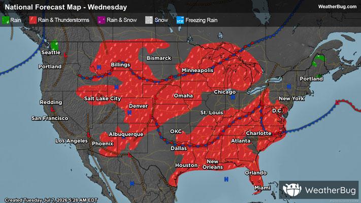
Thunderstorms Rumble Over the Plains
As has been the case the past several days, strong to severe thunderstorms will form across parts of the northern and central Plains this afternoon and tonight.
After a slowly-weakening thunderstorm complex passes through the northern Plains this morning, another disturbance aloft will pass over Nebraska this afternoon and evening. This feature, in combination with strong daytime heating, will cause showers and thunderstorms to erupt. Some of the thunderstorms will have the potential to be strong to severe in nature. Within these thunderstorms, the main concerns will be heavy downpours, damaging wind gusts up to 60 to 70 mph, and large hail. There could even be a couple of brief, isolated tornadoes.
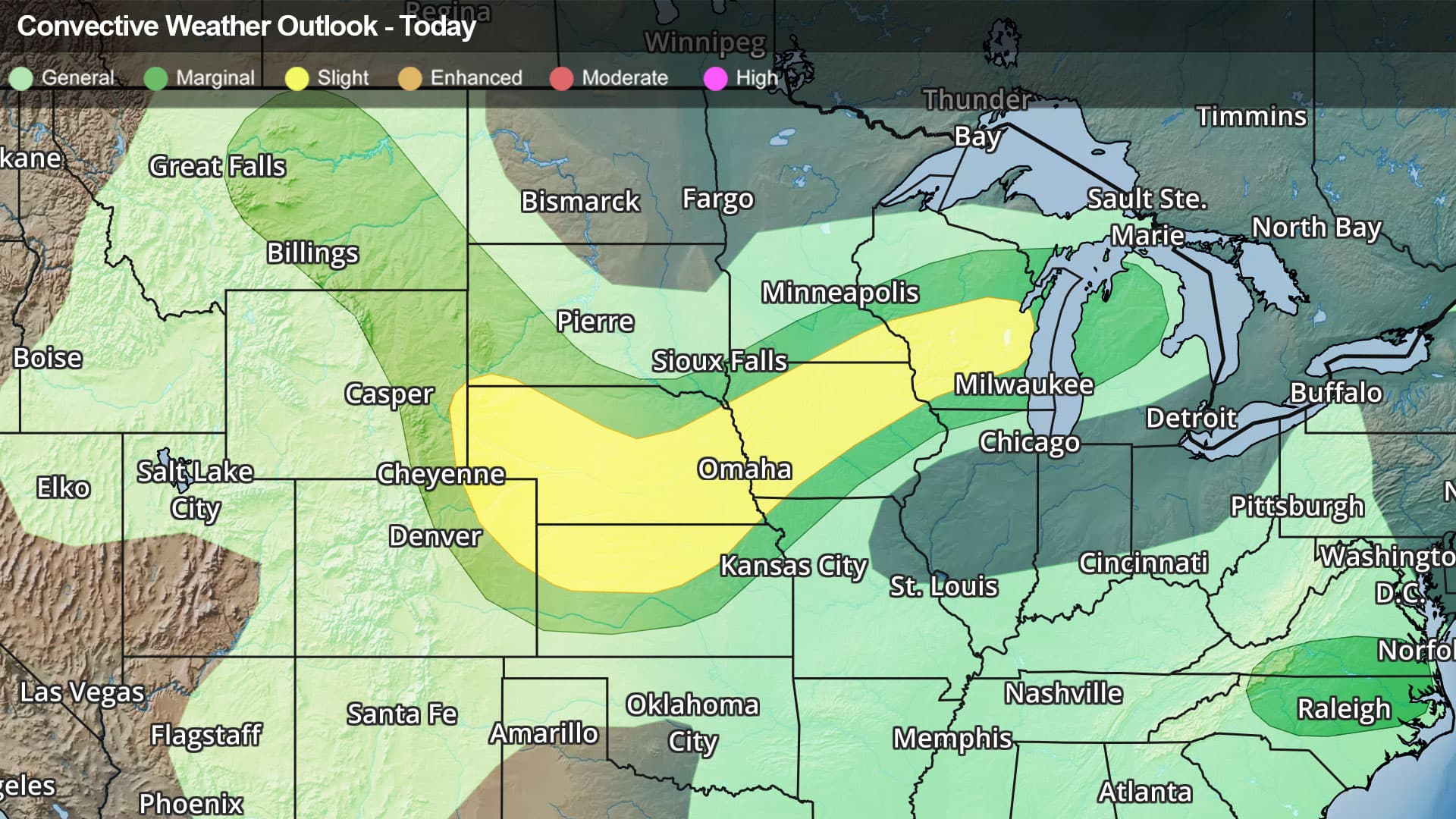
The government's Storm Prediction Center has issued a Slight Risk (level 2 of 5) for severe weather in parts of the north-central U.S. This covers extreme southeastern Wyoming, northeastern Colorado, northern Kansas, most of Nebraska, almost all of Iowa but its southeastern corner and most of southern and central Wisconsin. Cities under in the risk area include Lincoln, Neb., Green Bay, Wis., Omaha, Neb., and Des Moines, Iowa.
A Severe Thunderstorm Watch has been issued for a large area in central Minnesota.
As if the worry of strong to severe thunderstorms wasn’t enough, torrential downpours and/or repetitive rounds of heavy rainfall will be possible in the north-central U.S. 1 to 3 inches of rain could quickly fall, with locally higher amounts possible. These rainfall amounts in such a short time would likely lead to areas of flooding. If you do approach a flooded roadway, it is always best to “Turn Around, Don’t Drown!”
Flood Watches have been posted in a small portion of northeastern South Dakota, a large section of north-central Minnesota, and extreme northwest Wisconsin.
Make sure to know the difference between a watch and a warning should they be issued. A "watch" means that conditions are favorable for severe weather to occur, and to be on alert for any rapidly changing conditions. A "warning" means that severe weather is imminent, and you should act fast to remain safe.
The best way to remain safe is to stay prepared and informed about your local weather. Have a severe weather kit packed with a battery-operated radio, water, and non-perishable food items. Also, check the WeatherBug app frequently for any updates on today's severe weather. Remember, "When Thunder Roars, Go Indo