10-Day Weather Forecast - Auburn Junction, IN
- 73|64°F50% Chance of StormsHourly details
Today
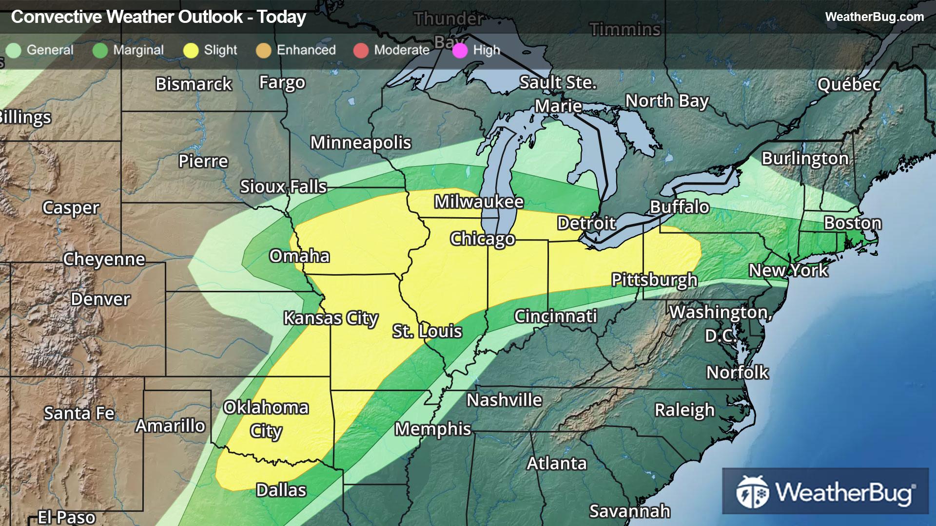
73°FMostly cloudy with a chance of showers and thunderstorms. Some thunderstorms may produce heavy rainfall. Near steady temperature in the mid 70s. Southwest winds 10 to 15 mph with gusts up to 25 mph. Chance of rain 50 percent.
Tonight
64°FA chance of thunderstorms. Showers. Some thunderstorms may produce heavy rainfall. Lows in the lower 60s. Southwest winds 10 to 15 mph. Chance of rain 90 percent.
- 72|52°F80% Chance of StormsHourly details
Day
72°FShowers with a chance of thunderstorms in the morning then showers likely with a chance of thunderstorms in the afternoon. Some thunderstorms may produce heavy rainfall in the morning. Highs in the lower 70s. Southwest winds 10 to 15 mph with gusts up to 25 mph. Chance of rain 80 percent.
Night
52°FMostly clear. A chance of showers and thunderstorms in the evening. Lows in the lower 50s. Northwest winds 5 to 10 mph. Gusts up to 20 mph in the evening. Chance of rain 50 percent.
- 74|63°FPartly CloudyHourly details
Day
74°FPartly cloudy. Highs in the mid 70s. East winds around 5 mph becoming south in the afternoon.
Night
63°FPartly cloudy with a slight chance of showers and thunderstorms in the evening then mostly cloudy with showers likely with a chance of thunderstorms after midnight. Lows in the upper 50s. Chance of rain 70 percent.
Weekend Weather
- 66|38°F80% Chance of StormsHourly details
Day
66°FA chance of thunderstorms. Showers. Highs in the upper 60s. Temperature falling into the upper 50s in the afternoon. Chance of rain 80 percent.
Night
38°FPartly cloudy with a chance of showers and thunderstorms in the evening then mostly clear with a slight chance of showers after midnight. Much cooler with lows in the mid 30s. Chance of rain 40 percent.
- 49|36°FMostly SunnyHourly details
Day
49°FMostly sunny. Cooler with highs in the upper 40s.
Night
36°FMostly clear. A slight chance of snow showers after midnight. Lows in the lower 30s. Chance of snow 20 percent.
- 54|40°FMostly SunnyHourly details
Day
54°FMostly sunny. A slight chance of snow showers in the morning. Highs in the mid 50s. Chance of snow 20 percent.
Night
40°FMostly clear. Lows in the lower 40s.
- 69|51°FPartly Cloudy
Day
69°FPartly cloudy. Not as cool with highs around 70.
Night
51°FPartly cloudy. Low temperature around 51F. Dew point will be around 46F with an average humidity of 65%. Winds will be 7 mph from the W.
- 65|50°F30% Chance of Rain
Day
65°FCloudy with a slight chance of rain. Chance of precipitation 25%. High temperature around 65F. Dew point will be around 50F with an average humidity of 74%. Winds will be 4 mph from the SW.
Night
50°FMostly clear with a slight chance of rain. Chance of precipitation 25%. Low temperature around 50F. Dew point will be around 48F with an average humidity of 76%. Winds will be 4 mph from the SE.
- 65|50°F50% Chance of Rain
Day
65°FMostly cloudy with a chance of rain. Chance of precipitation 45%. High temperature around 65F. Dew point will be around 51F with an average humidity of 76%. Winds will be 4 mph from the SE.
Night
50°FPartly cloudy with a chance of rain. Chance of precipitation 40%. Low temperature around 50F. Dew point will be around 47F with an average humidity of 74%. Winds will be 5 mph from the E.
- 61|49°F50% Chance of Rain
Day
61°FCloudy with a chance of rain. Chance of precipitation 50%. High temperature around 61F. Dew point will be around 49F with an average humidity of 76%. Winds will be 5 mph from the SE.
Night
49°FCloudy with a 50% chance for rain and thunderstorms. Low temperature around 49F. Dew point will be around 47F with an average humidity of 78%. Winds will be 4 mph from the E.