10-Day Weather Forecast - Fullerton, PA
- |51°F40% Chance of RainHourly details
Tonight
51°FMostly cloudy with a chance of rain. Chance of precipitation 35%. Low temperature around 51F. Dew point will be around 49F with an average humidity of 96%. Winds will be 11 mph from the S.
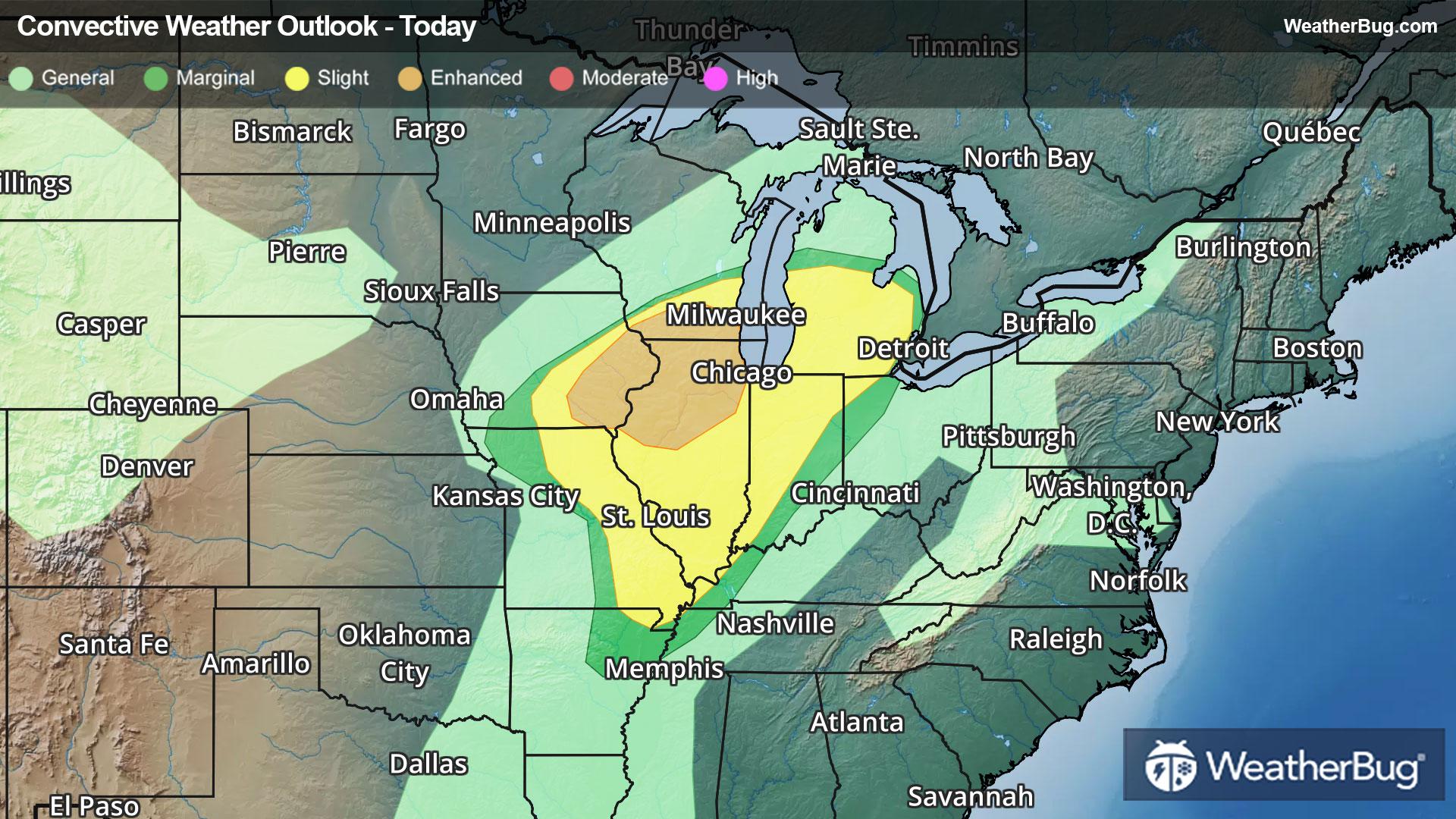
- 69|52°F70% Chance of StormsHourly details
Day
69°FShowers likely. A chance of thunderstorms this afternoon. Not as cool with highs in the upper 60s. Southwest winds 10 to 15 mph with gusts up to 30 mph. Chance of rain 70 percent.
Night
52°FMostly cloudy. Showers likely with a chance of thunderstorms in the evening then a slight chance of showers after midnight. Mild. Lows in the lower 50s. West winds 5 to 10 mph with gusts up to 20 mph becoming north after midnight. Chance of rain 70 percent.
Weekend Weather
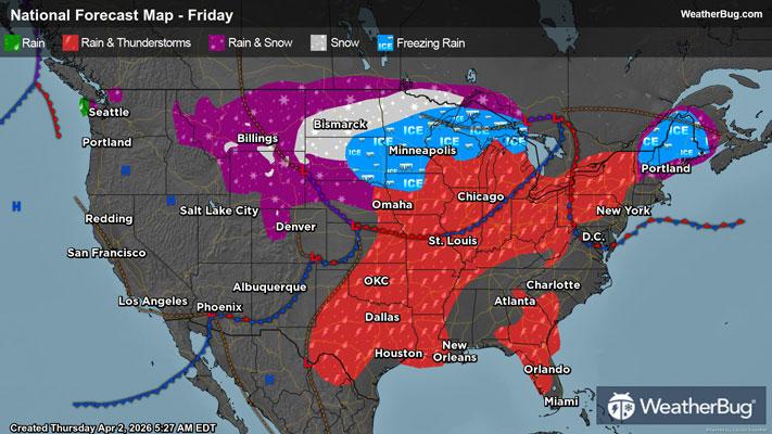
- 75|50°F70% Chance of StormsHourly details
Day
75°FShowers likely. A chance of thunderstorms in the afternoon. Some thunderstorms may produce gusty winds and small hail in the afternoon. Warm with highs in the mid 70s. South winds 5 to 10 mph. Gusts up to 25 mph in the afternoon. Chance of rain 70 percent.
Night
50°FShowers likely in the evening then showers after midnight. Lows in the mid 40s. Southwest winds 5 to 10 mph with gusts up to 25 mph. Chance of rain near 100 percent.
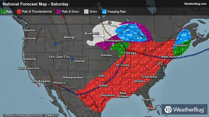
- 50|30°FRainHourly details
Day
50°FShowers mainly in the morning. Much cooler with highs in the upper 40s. West winds 10 to 15 mph with gusts up to 30 mph. Chance of rain near 100 percent.
Night
30°FMostly cloudy. Much cooler with lows in the upper 20s.
- 44|30°F30% Chance Frozen MixHourly details
Day
44°FPartly sunny. A chance of snow and rain showers in the afternoon. Highs in the lower 40s. Chance of precipitation 30 percent.
Night
30°FMostly cloudy with a 50 percent chance of snow showers. Lows in the mid 20s.
- 37|22°F50% Chance Snow ShowersHourly details
Day
37°FMostly cloudy in the morning then becoming mostly sunny. A 50 percent chance of snow showers. Highs in the upper 30s.
Night
22°FMostly clear. Lows around 20.
- 49|33°FSunnyHourly details
Day
49°FSunny. Not as cool with highs in the lower 50s.
Night
33°FPartly cloudy in the evening then becoming mostly cloudy. Not as cool with lows in the mid 30s.
- 56|40°FMostly Sunny
Day
56°FMostly sunny. Not as cool with highs in the mid 60s.
Night
40°FCloudy with a chance of rain. Chance of precipitation 35%. Low temperature around 40F. Dew point will be around 38F with an average humidity of 77%. Winds will be 6 mph from the S.
- 58|44°F30% Chance of Rain
Day
58°FPartly cloudy with a slight chance of rain. Chance of precipitation 25%. High temperature around 58F. Dew point will be around 40F with an average humidity of 69%. Winds will be 4 mph from the S.
Night
44°FPartly cloudy with a slight chance of rain. Chance of precipitation 25%. Low temperature around 44F. Dew point will be around 41F with an average humidity of 78%. Winds will be 3 mph from the S.
Weekend Weather
- 61|47°F40% Chance of Rain
Day
61°FCloudy with a chance of rain. Chance of precipitation 35%. High temperature around 61F. Dew point will be around 44F with an average humidity of 72%. Winds will be 6 mph from the S.
Night
47°FCloudy with a chance of rain. Chance of precipitation 40%. Low temperature around 47F. Dew point will be around 46F with an average humidity of 82%. Winds will be 4 mph from the S.