10-Day Weather Forecast - Hobson, MT
Weekend Weather
- 53|47°F
 ThunderstormsHourly details
Today
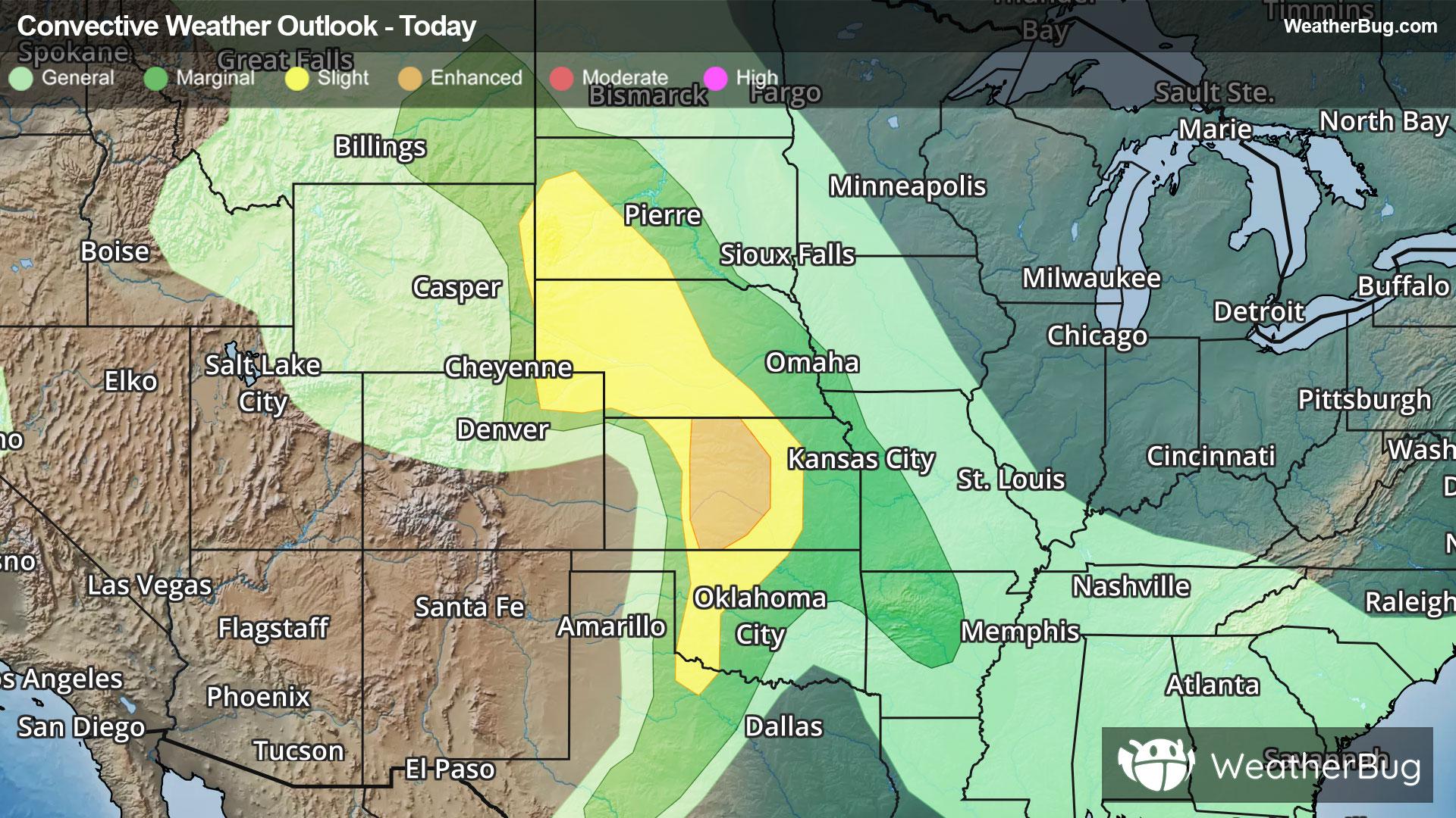
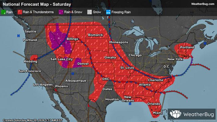
53°FCooler. Rain and slight chance of thunderstorms early in the afternoon then rain and chance of thunderstorms late in the afternoon. Some thunderstorms may produce heavy rainfall early in the afternoon. Some thunderstorms may produce heavy rainfall late in the afternoon. Near steady temperature in the lower 50s. North winds 10 to 15 mph with gusts to around 30 mph. Chance of precipitation near 100 percent.
Tonight
47°F
Colder. Rain and chance of thunderstorms in the evening then rain after midnight. Some thunderstorms may produce heavy rainfall in the evening. Lows 37 to 43. Northwest winds 10 to 20 mph with gusts to around 50 mph. Chance of precipitation near 100 percent.
- 47|40°F
 RainHourly details
Day
47°FBreezy rain. Near steady temperature in the lower 40s. West winds 10 to 25 mph with gusts to around 50 mph. Chance of rain near 100 percent.
Night
40°F
Rain showers likely in the evening then chance of rain showers after midnight. Light snow accumulations. Lows 34 to 40. West winds 5 to 15 mph with gusts to around 45 mph. Chance of showers 70 percent.
- 52|41°F
 50% Chance Frozen MixHourly details
Day
52°FNot as cool. Partly sunny. Chance of rain showers and snow showers in the morning then chance of rain showers and slight chance of thunderstorms in the afternoon. Highs 48 to 56. West winds 5 to 15 mph with gusts to around 30 mph. Chance of precipitation 50 percent.
Night
41°FMostly cloudy. Chance of rain showers and slight chance of thunderstorms in the evening then slight chance of rain showers after midnight. Lows 35 to 41. Chance of precipitation 50 percent.
- 55|42°F50% Chance of StormsHourly details
Day
55°FPartly sunny. Slight chance of rain showers in the morning then chance of thunderstorms in the afternoon. Highs 54 to 60. Chance of precipitation 50 percent.
Night
42°FMostly cloudy. Chance of rain showers and slight chance of thunderstorms in the evening. Lows 36 to 42. Chance of precipitation 40 percent.
- 59|47°F50% Chance of StormsHourly details
Day
59°FMostly sunny. Chance of rain showers and slight chance of thunderstorms in the afternoon. Highs 59 to 65. Chance of precipitation 50 percent.
Night
47°FMostly cloudy. Chance of rain showers and slight chance of thunderstorms in the evening then chance of rain after midnight. Lows 40 to 46. Chance of precipitation 40 percent.
- 56|44°F70% Chance of StormsHourly details
Day
56°FMostly cloudy. Chance of rain in the morning then rain showers likely and chance of thunderstorms in the afternoon. Highs 59 to 65. Chance of precipitation 70 percent.
Night
44°FMostly cloudy with chance of rain showers and slight chance of thunderstorms in the evening then partly cloudy after midnight. Lows 40 to 46. Chance of precipitation 30 percent.
- 67|51°F
 Mostly Sunny
Day
67°FMostly sunny. A 20 percent chance of thunderstorms in the afternoon. Highs 66 to 72.
Night
51°F
Mostly clear. Low temperature around 51F. Dew point will be around 40F with an average humidity of 56%. Winds will be 6 mph from the SE.
Weekend Weather
- 73|51°F30% Chance of Rain
Day
73°FPartly cloudy with a 30% chance for rain and thunderstorms. High temperature around 73F. Dew point will be around 39F with an average humidity of 38%. Winds will be 2 mph from the SW.
Night
51°F
Partly cloudy with a 35% chance for rain and thunderstorms. Low temperature around 51F. Dew point will be around 40F with an average humidity of 51%. Winds will be 3 mph from the W.
- 67|49°F40% Chance of Rain
Day
67°FSunny with a chance of rain. Chance of precipitation 40%. High temperature around 67F. Dew point will be around 40F with an average humidity of 46%. Winds will be 2 mph from the E.
Night
49°FClear with a chance of rain. Chance of precipitation 45%. Low temperature around 49F. Dew point will be around 42F with an average humidity of 62%. Winds will be 2 mph from the NW.
- 66|50°F40% Chance of Rain
Day
66°FMostly sunny with a 35% chance for rain and thunderstorms. High temperature around 66F. Dew point will be around 40F with an average humidity of 48%. Winds will be 2 mph from the E.
Night
50°FPartly cloudy with a 40% chance for rain and thunderstorms. Low temperature around 50F. Dew point will be around 40F with an average humidity of 57%. Winds will be 3 mph from the W.