10-Day Weather Forecast - Oasis, NV
- |37°FPartly CloudyHourly details
Tonight
37°FPartly cloudy. Low temperature around 37F. Dew point will be around 28F with an average humidity of 51%. Winds will be 4 mph from the NW.
- 67|40°F50% Chance of StormsHourly details
Day
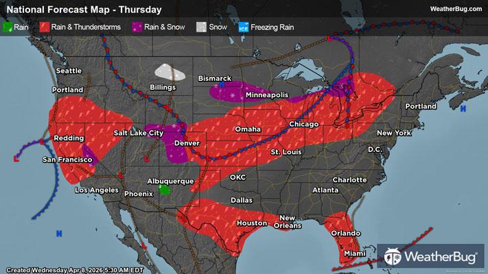
67°FMostly sunny. Scattered rain showers and isolated thunderstorms in the afternoon. Highs 61 to 69. East winds up to 10 mph. Chance of precipitation 50 percent.
Night
40°FMostly cloudy. Scattered rain showers and isolated thunderstorms in the evening then scattered rain showers after midnight. Lows in the lower 40s. Northeast winds up to 10 mph. Chance of precipitation 50 percent.
- 69|39°FScattered ShowersHourly details
Day
69°FScattered rain showers in the morning then rain showers in the afternoon. Highs 60 to 68. South winds up to 10 mph increasing to 10 to 20 mph with gusts to around 35 mph in the afternoon. Chance of showers near 100 percent.
Night
39°FRain showers in the evening then scattered rain showers after midnight. Lows in the upper 30s. Southwest winds 5 to 15 mph. Gusts up to 30 mph in the evening. Chance of showers near 100 percent.
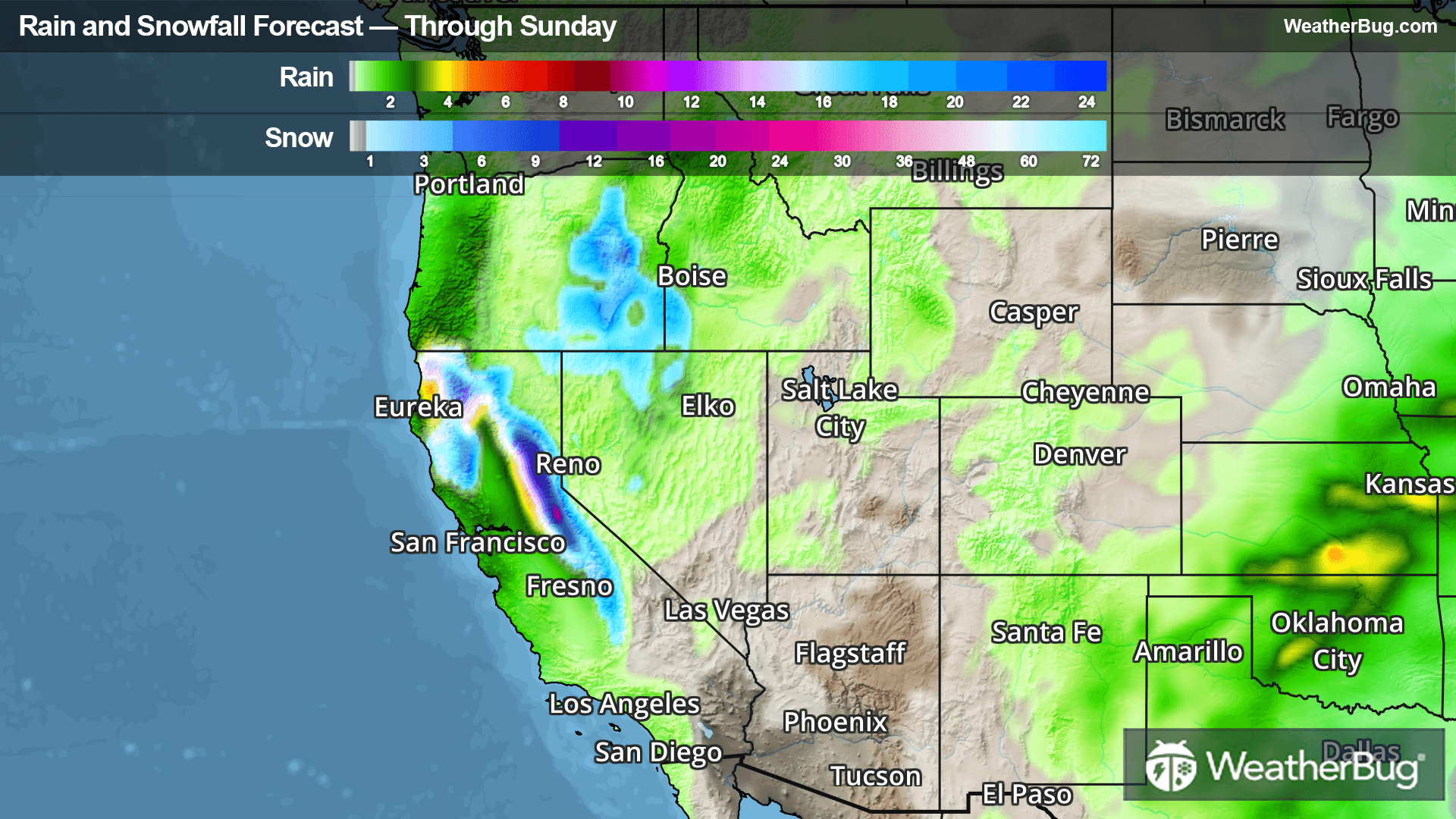
Weekend Weather
- 60|36°FLight SnowHourly details
Day
60°FBreezy. Numerous rain showers in the morning then rain showers in the afternoon. Light snow accumulations. Highs 52 to 60. Southwest winds 5 to 15 mph increasing to 10 to 25 mph in the afternoon. Chance of showers 90 percent.
Night
36°FRain showers. Moderate snow accumulations. Lows in the lower 30s. Chance of showers near 100 percent.
- 57|31°FFrozen MixHourly details
Day
57°FBreezy. Snow showers and rain showers. Heavy snow accumulations. Highs 40 to 48. Chance of precipitation near 100 percent.
Night
31°FNumerous snow showers and rain showers in the evening then scattered snow showers and rain showers after midnight. Heavy snow accumulations. Lows in the upper 20s. Chance of precipitation 70 percent.
- 46|26°FFrozen MixHourly details
Day
46°FNumerous snow showers in the morning then snow showers and rain showers in the afternoon. Moderate snow accumulations. Highs 39 to 47. Chance of precipitation 90 percent.
Night
26°FMostly cloudy with scattered snow showers and rain showers in the evening then partly cloudy after midnight. Lows in the upper 20s. Chance of precipitation 50 percent.
- 51|28°F40% Chance Snow ShowersHourly details
Day
51°FNot as cool. Partly sunny. Scattered snow showers in the afternoon. Highs 46 to 54. Chance of snow 40 percent.
Night
28°FPartly cloudy. Lows in the lower 30s.
- 57|33°FMostly Sunny
Day
57°FNot as cool. Mostly sunny. Highs 53 to 61.
Night
33°FPartly cloudy. Low temperature around 33F. Dew point will be around 28F with an average humidity of 60%. Winds will be 7 mph from the NW.
- 54|29°FCloudy
Day
54°FCloudy. High temperature around 54F. Dew point will be around 28F with an average humidity of 47%. Winds will be 5 mph from the NW.
Night
29°FMostly cloudy. Low temperature around 29F. Dew point will be around 25F with an average humidity of 65%. Winds will be 4 mph from the N.
- 55|31°FMostly Cloudy
Day
55°FMostly cloudy. High temperature around 54F. Dew point will be around 27F with an average humidity of 43%. Winds will be 2 mph from the W.
Night
31°FCloudy. Low temperature around 31F. Dew point will be around 28F with an average humidity of 66%. Winds will be 3 mph from the W.
Weekend Weather
- 56|30°F30% Chance of Rain
Day
56°FCloudy with a slight chance of rain. Chance of precipitation 30%. High temperature around 56F. Dew point will be around 30F with an average humidity of 45%. Winds will be 4 mph from the SW.
Night
30°FCloudy with a chance of rain-snow mix. Chance of precipitation 40%. Low temperature around 30F. Dew point will be around 28F with an average humidity of 69%. Winds will be 4 mph from the W.