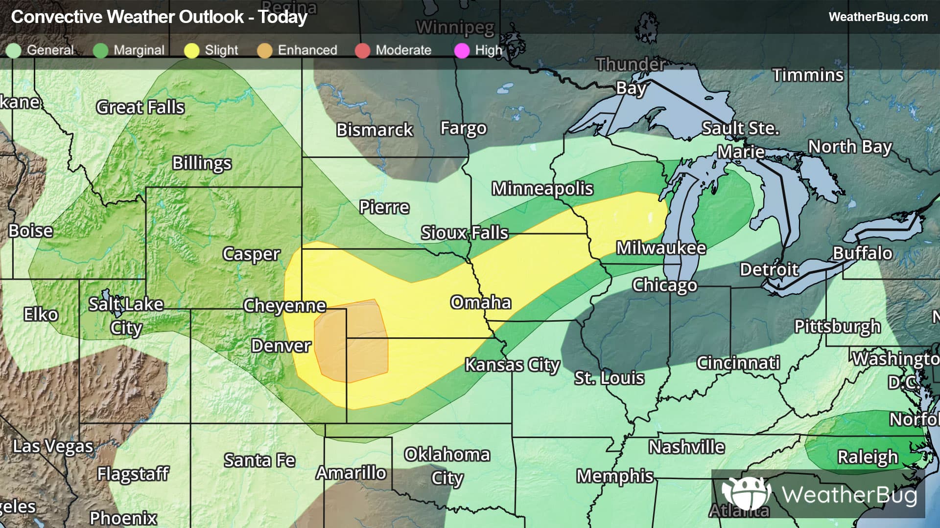
There is a Marginal Severe Storm Risk for your location. Continue reading for today's outlook from the National Weather Service's Storm Prediction Center.
--------------------
National Severe Storm Outlook
THERE IS AN ENHANCED RISK OF SEVERE THUNDERSTORMS OVER PARTS OF NORTHEAST COLORADO...SOUTHWEST NEBRASKA...AND NORTHWEST KANSAS
SUMMARY
Thunderstorms with severe wind gusts and hail will be possible this afternoon and evening across parts of the central Plains, and from the Missouri Valley into the upper Mississippi Valley. Isolated severe gusts may also occur from the northern Great Basin into the northern High Plains, from North Carolina into southern Virginia, and over southeast Arizona.
20Z Update
The forecast remains on track, and only minor changes were made with this update.
The SLGT risk in the central High Plains was expanded northward into northeast WY, southwest SD, and far southeast MT -- driven by 15-percent wind probabilities. High-based thunderstorms are already forming/strengthening along the high terrain in northern WY and southern MT. Given steep lapse rates/moderate buoyancy and an elongated/straight hodograph (around 40 kt of effective shear) downstream, a few organized clusters will pose a risk for scattered severe wind gusts and isolated large hail. See MCD #1543 for more information.
Farther east, the SLGT risk in the Midwest was expanded northward into southeastern MN and central WI, based on the latest placement of the surface boundary. Thunderstorm clusters will pose a risk for damaging wind gusts through the afternoon. As these storms track southward into a moist/unstable air mass across northern IA this evening/tonight, upscale growth could promote a locally greater concentration of damaging wind gusts.