Severe Storms Fire Up Across Parts of the Midwest
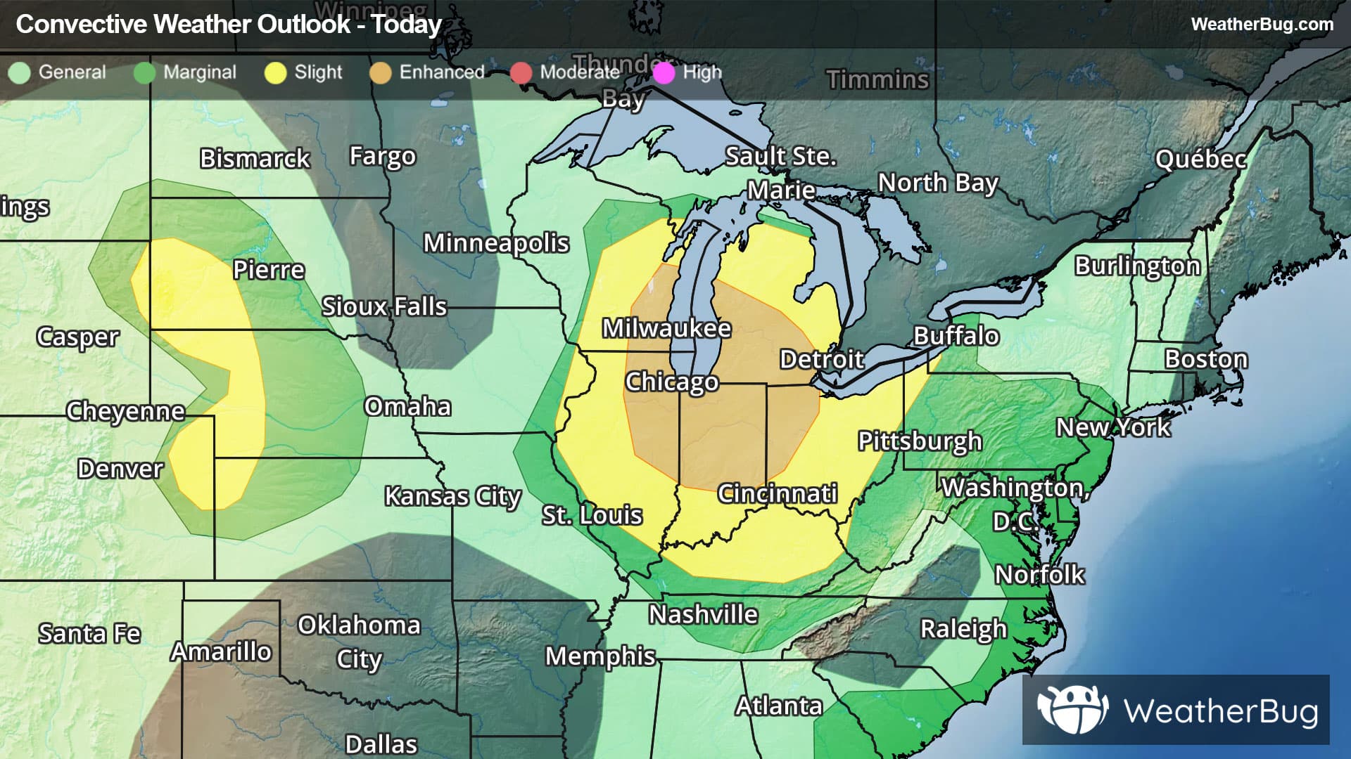
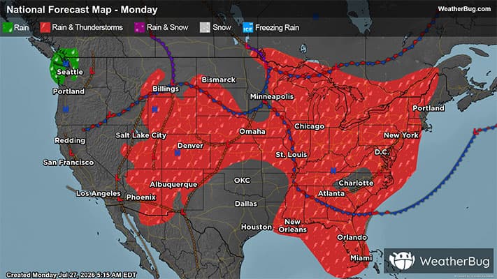
Strong to severe thunderstorms are expected to develop across the Great Lakes and Ohio Valley today.
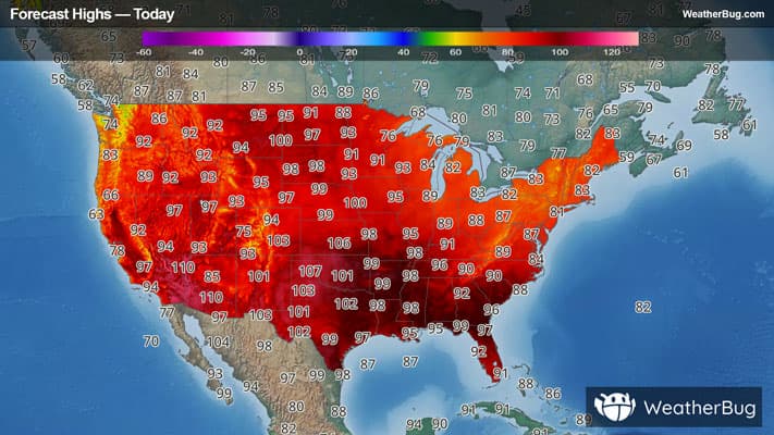
# HEADLINE -------------------- EXTREME HEAT WARNING REMAINS IN EFFECT UNTIL 9 PM CDT THIS EVENING # DETAILS -------------------- WHAT Dangerously hot conditions with heat index values up to 110. WHERE Portions of south central, southwest, and west central Illinois and central and northeast Missouri. WHEN Until 9 PM CDT this evening. IMPACTS Heat related illnesses increase significantly during extreme heat and high humidity events. ISSUED AT Monday, July 27, 2026 at 12:14 PM CDT ISSUED BY National Weather Service St Louis MO HEADER URGENT - WEATHER MESSAGE # PRECAUTIONARY/PREPAREDNESS ACTIONS -------------------- Drink plenty of fluids, stay in an air-conditioned room, stay out of the sun, and check up on relatives and neighbors. Young children and pets should never be left unattended in vehicles under any circumstances. Take extra precautions if you work or spend time outside. When possible reschedule strenuous activities to early morning or evening. Know the signs and symptoms of heat exhaustion and heat stroke. Wear lightweight and loose fitting clothing when possible. To reduce risk during outdoor work, the Occupational Safety and Health Administration recommends scheduling frequent rest breaks in shaded or air conditioned environments. Anyone overcome by heat should be moved to a cool and shaded location. Heat stroke is an emergency! Call 9 1 1. # AREAS AFFECTED -------------------- Monroe MO, Pike IL, Adams IL, Audrain MO, Brown IL, Calhoun IL, Fayette IL, Greene IL, Jersey IL, Knox MO, Lewis MO, Macoupin IL, Marion MO, Montgomery IL, Pike MO, Ralls MO, Shelby MO Including the cities of Litchfield, Vandalia, Bowling Green, Quincy, Hannibal, Mexico, Pittsfield, and Mount Sterling
There is a Slight Severe Storm Risk for your location. Continue reading for today's outlook from the National Weather Service's Storm Prediction Center. -------------------- National Severe Storm Outlook THERE IS AN ENHANCED RISK OF SEVERE THUNDERSTORMS ACROSS PARTS OF THE MIDWEST THERE IS A SLIGHT RISK OF SEVERE THUNDERSTORMS OVER THE CENTRAL HIGH PLAINS CORRECTED FOR THUNDERSTORM LINES SUMMARY Severe storms capable of strong to severe wind gusts and large hail are expected across the Great Lakes and Midwest through tonight. More sporadic occurrences of damaging wind are possible in the Mid-Atlantic, Tennessee Valley, central High Plains, and southeast Arizona. Midwest/Ohio Valley A large upper ridge remains present today over the central Plains/Rockies, with moderately strong northwest flow aloft from the Midwest into the OH Valley. A very moist and unstable low-level air mass resides from WI/IL into MI/IN/OH, where mostly clear skies will result in hot afternoon temperatures and MLCAPE values over 3000 J/kg. Multiple clusters of intense thunderstorms are ongoing over parts of WI tracking southeastward. These storms will move through this reservoir of high CAPE, leading to the potential for an active severe weather event today. However, details of how these clusters evolve are uncertain. Vertical shear across this region will support supercell structures, capable of damaging winds, hail, and isolated tornadoes this afternoon. However, the greater concern is if storms can congeal into a southeastward bowing system and that sweeps across Lower MI, eastern IL, IN, and western OH. Several morning CAM solutions indicate that risk, with storms spreading into KY overnight before weakening. Unfortunately, this synoptic pattern does not lend itself to a high-confidence convective forecast. High Plains Widespread clouds are affecting parts of western NE this morning. However, strong heating will occur north and south of these clouds, leading to afternoon thunderstorms. The most active area will likely be over the Black Hills region where damaging winds and hail are possible. Farther south, widely scattered high-based thunderstorms will affect eastern CO/western KS with a risk of damaging wind gusts.