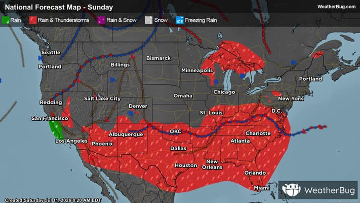
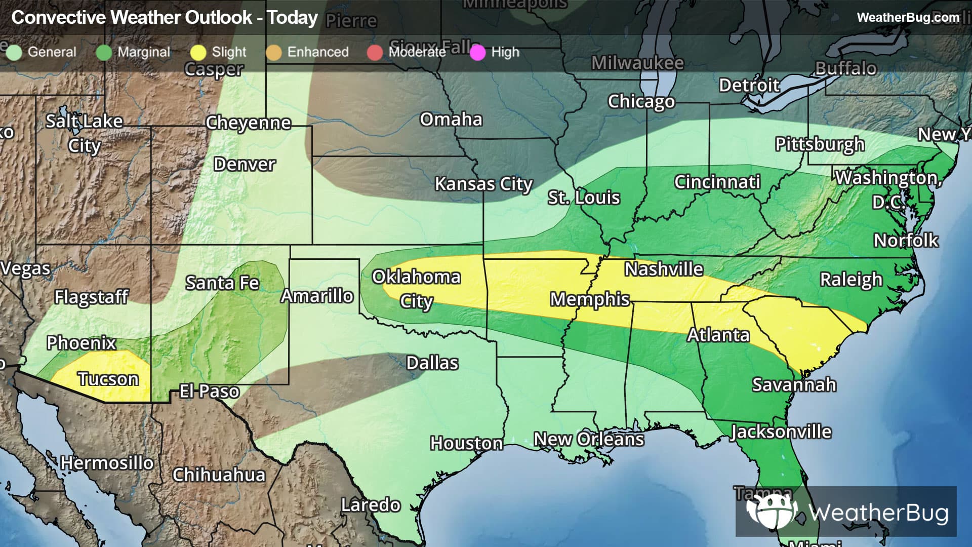
Weather Alerts For Georgetown, CO
High Wind Warning
-URGENT - WEATHER MESSAGE National Weather Service Denver CO 1025 AM MST Wed Dec 17 2025 South and East Jackson/Larimer/North and Northeast Grand/Northwest Boulder Counties Above 9000 Feet-South and Southeast Grand/West Central and Southwest Boulder/Gilpin/Clear Creek/Summit/North and West Park Counties Above 9000 Feet-Larimer and Boulder Counties Between 6000 and 9000 Feet-Jefferson and West Douglas Counties Above 6000 Feet/Gilpin/Clear Creek/Northeast Park Counties Below 9000 Feet- Including the cities of Cameron Pass, Eisenhower Tunnel, Georgetown, Estes Park, Glendevey, Breckenridge, Williams Fork Mountains, Westcreek, Berthoud Pass, Laramie and Medicine Bow Mountains, Red Feather Lakes, Winter Park, Rocky Mountain National Park, Central City, Indian Peaks, Bailey, East Slopes Mosquito Range, Nederland, Mount Blue Sky, Willow Creek Pass, Idaho Springs, Evergreen, Rabbit Ears Range, Kenosha Mountains, and East Slopes Southern Gore Range 1025 AM MST Wed Dec 17 2025 ...HIGH WIND WARNING REMAINS IN EFFECT UNTIL 5 AM MST THURSDAY... * WHAT...West winds 30 to 50 mph with gusts up to 90 mph expected, with the strongest winds focused over wind-prone locations in the foothills. * WHERE...Rocky Mountain National Park and the Medicine Bow Range, the Mountains of Summit County, the Mosquito Range, the Indian Peaks, and the foothills. * WHEN...From 11 AM Wednesday to 5 AM MST Thursday. Strongest winds expected Wednesday evening through Wednesday night. * IMPACTS...Damaging winds may blow down trees and power lines, with power outages possible. Travel will be difficult, especially for high profile vehicles. Strong winds may lead to rapid fire growth of any new fire in the lower foothills. PRECAUTIONARY/PREPAREDNESS ACTIONS... People are urged to secure loose objects that could be blown around or damaged by the wind. &&