Several Severe Thunderstorms Target Central U.S.
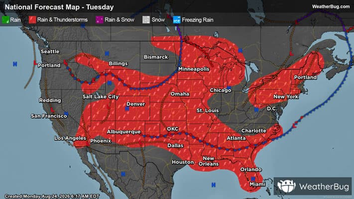
An abundance of severe weather threats will hit the central U.S. today.
Read More
# HEADLINE -------------------- OZONE ACTION DAY ALERT FROM 400 PM MONDAY UNTIL 1200 AM TUESDAY # SUMMARY -------------------- The Colorado Department of Public Health and Environment has issued the following... WHAT...Ozone Action Day Alert. # DETAILS -------------------- WHERE Douglas, Jefferson, Denver, western Arapahoe, western Adams, Broomfield, Boulder, Larimer, and Weld Counties WHEN 400 PM Monday August 24 to 1200 AM Tuesday August 25 IMPACTS Ozone Action Day Alert is now in effect for the Front Range Urban Corridor. Ozone is expected to reach the Unhealthy for Sensitive Groups category on Monday, but will stay in the Good to Moderate range on Tuesday. For Colorado air quality conditions, forecasts, and advisories, visit: https://www.colorado.gov/airquality/colorado\_summary.aspx If possible, please help us reduce ozone pollution by limiting driving gas and diesel-powered vehicles until midnight, Monday night, August 24, 2026. Colorado is also addressing ozone pollution through state policies. For more information about health impacts and how ozone pollution forms in Colorado, visit: https://cdphe.colorado.gov/ozone- pollution-and-your-health HEALTH INFORMATION Increasing likelihood of respiratory symptoms and breathing discomfort in active children and adults and people with lung disease, such as asthma. Active children and adults, and people with lung disease, such as asthma, should reduce prolonged or heavy outdoor exertion. ISSUED AT Monday, August 24, 2026 at 4:10 PM MDT ISSUED BY Relayed by National Weather Service Boulder CO HEADER Air Quality Alert Message | Colorado Department of Public Health and Environment # AREAS AFFECTED -------------------- Adams, Arapahoe, Boulder, Broomfield, Denver, Douglas, Jefferson, Larimer, Weld
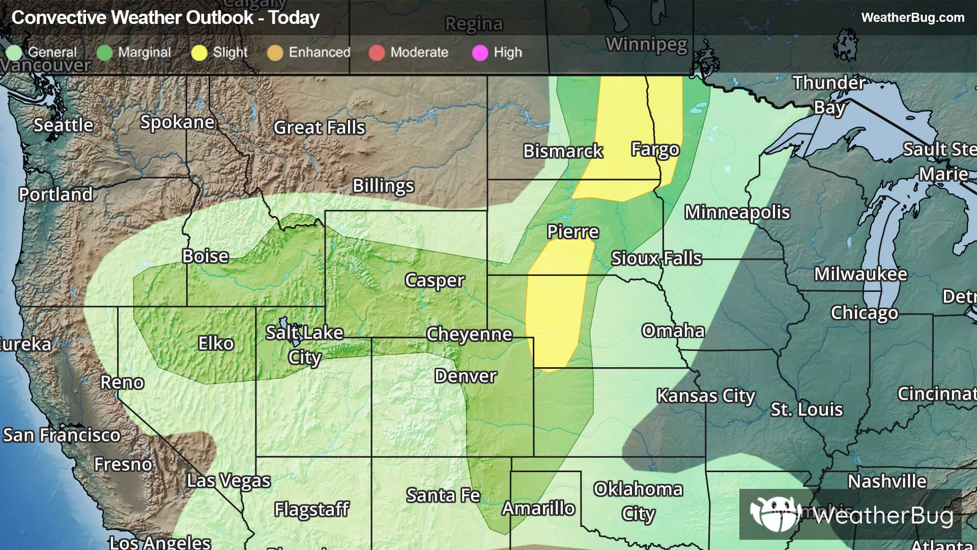
There is a Marginal Severe Storm Risk for your location. Continue reading for today's outlook from the National Weather Service's Storm Prediction Center. -------------------- National Severe Storm Outlook THERE IS A SLIGHT RISK OF SEVERE THUNDERSTORMS ACROSS THE NORTHERN PLAINS AND CENTRAL HIGH PLAINS SUMMARY Severe thunderstorms will remain possible this evening across eastern North Dakota/northwest Minnesota, as well as central South Dakota and western Nebraska, with large hail and damaging winds the primary hazards. Northern Plains/Upper Midwest and central High Plains Scattered severe thunderstorms including a few supercells will continue across central South Dakota into northern Nebraska, and possibly west-central Nebraska within a zone of 60s F surface dewpoints and moderate instability ahead of a front and near a southward-extending pre-frontal trough. Large hail and damaging winds will remain possible this evening as storms persist southeastward. Somewhat richer low-level moisture exists ahead of the front across north-central/northeast South Dakota into eastern North Dakota where scattered severe storms continue this evening. 00z observed soundings from Aberdeen and Bismarck sampled effective shear around 40 kt with 2000-2500 J/kg MLCAPE and steep mid-level lapse rates. Supercells will remain possible in the short-term, but a modest degree of upscale growth may occur as storms further cluster and progress southeastward with continued hail/wind potential at least through the evening. Northern Great Basin/north-central Rockies A few stronger storms capable of gusty/potentially severe-caliber wind gusts will remain a possibility over the next hour or two this evening, with storm updraft/downdraft intensity expected to diminish thereafter.
Pollen Index: 10.4 Pollen Level: high Predominant Pollen: Ragweed, Chenopods and Sagebrush/Sage. Pollen concentrations for Tuesday will be falling but will remain in the very high range. This lower level is caused by rising humidity, weakening winds and expected precipitation in the morning and evening which tends to wash pollen out of the air.