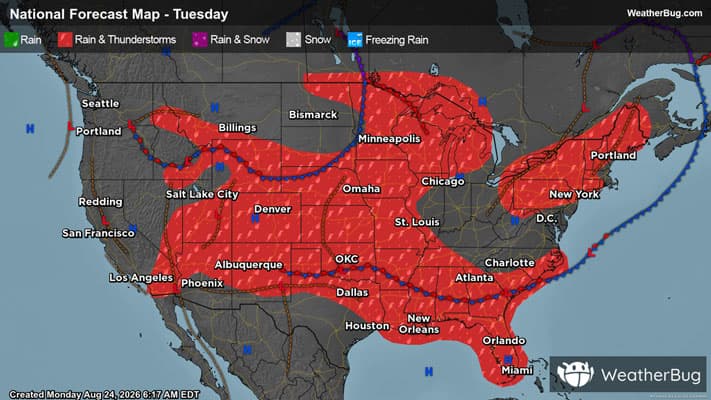
Several Severe Thunderstorms Target Central and Southeastern U.S.
An abundance of severe weather threats will hit the central and southeastern U.S. today.
Read More
# SUMMARY -------------------- SEVERE THUNDERSTORM WATCH 622 REMAINS VALID UNTIL 7 PM CDT THIS EVENING FOR THE FOLLOWING AREAS IN FLORIDA THIS WATCH INCLUDES 3 COUNTIES IN NORTHWEST FLORIDA ESCAMBIA OKALOOSA SANTA ROSA THIS INCLUDES THE CITIES OF BELLVIEW, BRENT, CRESTVIEW, DESTIN, EGLIN AFB, ENSLEY, FERRY PASS, FORT WALTON BEACH, GULF BREEZE, MILTON, MYRTLE GROVE, NICEVILLE, PACE, PENSACOLA, SEMINOLE, AND WRIGHT. # DETAILS -------------------- ISSUED AT Monday, August 24, 2026 at 4:52 PM CDT ISSUED BY NATIONAL WEATHER SERVICE MOBILE AL HEADER WATCH COUNTY NOTIFICATION FOR WATCH 622
A Weather Alert has been issued for a nearby area. While your current location is outside of the impacted area, please stay alert and monitor weather conditions. # HEADLINE -------------------- STRONG THUNDERSTORMS WILL IMPACT NORTHWESTERN OKALOOSA AND NORTHEASTERN SANTA ROSA COUNTIES THROUGH 530 PM CDT # SUMMARY -------------------- At 447 PM CDT, Doppler radar was tracking strong thunderstorms along a line extending from 10 miles northeast of Point Baker to near Roeville to near Pea Ridge. Movement was east at 20 mph. # DETAILS -------------------- HAZARD Wind gusts up to 50 mph. SOURCE Radar indicated. IMPACT Gusty winds could knock down tree limbs and blow around unsecured objects. LOCATIONS IMPACTED INCLUDE Milton, Bagdad, Baker, Point Baker, Pea Ridge, and Roeville. ISSUED AT Monday, August 24, 2026 at 4:47 PM CDT ISSUED BY National Weather Service Mobile AL HEADER Special Weather Statement # PRECAUTIONARY/PREPAREDNESS ACTIONS -------------------- Frequent cloud to ground lightning is occurring with these storms. Lightning can strike 10 miles away from a thunderstorm. Seek a safe shelter inside a building or vehicle. A Severe Thunderstorm Watch remains in effect until 700 PM CDT for northwestern Florida. # AREAS AFFECTED -------------------- Okaloosa Inland FL, Santa Rosa Coastal FL, Santa Rosa Inland FL
Closest strike: 5.09 miles Stay Alert! Remain in a safe area until there has been no lightning within 10 miles of this location for 30 minutes. Please be aware that lightning activity can remain high even when a storm is moving away from your location. Even if rain has stopped, do not leave your safe area until WeatherBug indicates that lightning is more than 10 miles away from this selected location. IF OUTDOORS Avoid water, high ground, and open spaces. Avoid all metal objects including electric wires, fences, and machinery. Find a safe area in a building or in a fully enclosed vehicle with the windows completely shut. Unsafe places include underneath canopies, small picnic or rain shelters, convertibles, or near trees. IF INDOORS Avoid water and stay away from doors and windows. Avoid using a hard line telephone. Take off headphones. Turn off, unplug, and stay away from appliances, computers, power tools, and TV sets. Lightning may strike exterior electric and phone lines, inducing shocks to inside equipment.
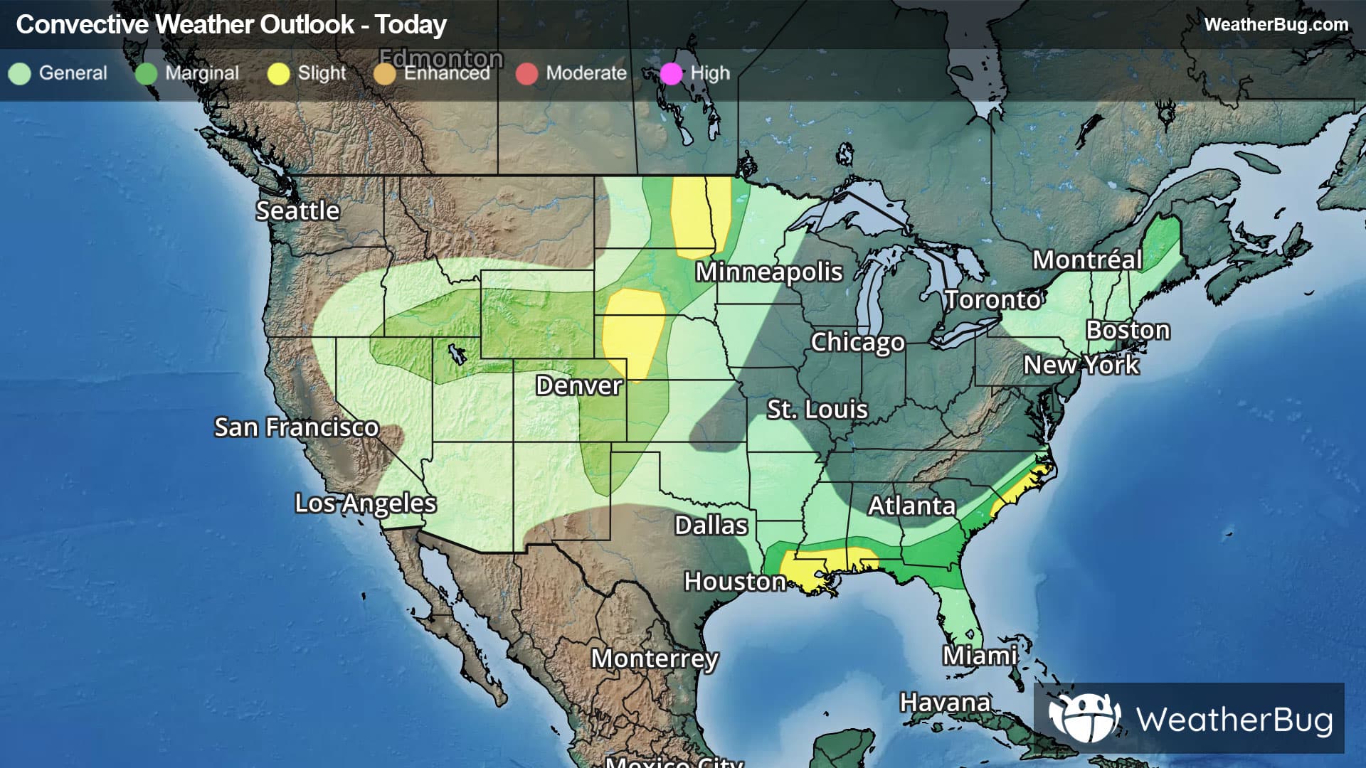
There is a Slight Severe Storm Risk for your location. Continue reading for today's outlook from the National Weather Service's Storm Prediction Center. -------------------- National Severe Storm Outlook THERE IS A SLIGHT RISK OF SEVERE THUNDERSTORMS ACROSS PARTS OF THE NORTHERN PLAINS/UPPER MIDWEST...EASTERN IDAHO...CENTRAL HIGH PLAINS...LOWER MISSISSIPPI RIVER VALLEY/CENTRAL GULF COAST...AND COASTAL CAROLINAS SUMMARY Severe thunderstorms capable of producing large hail and severe wind gusts will be possible this afternoon and evening across parts of the Upper Midwest as well as the central High Plains. Other severe thunderstorms with mainly a damaging wind threat are possible across the central Gulf Coast, eastern Idaho, and coastal Carolinas. Northern Great Basin A targeted upgrade to a Level 2/Slight risk was introduced for portions of eastern Idaho where the latest HRRR/RRFS runs and TLE probabilities suggest a corridor of locally greater damaging/severe wind gust coverage may materialize in association with developing convection across southern Idaho given a favorable thermodynamic environment. Similarly, the 5% wind probability and CIG1 areas have also been expanded across adjacent areas of the northern Great Basin given the potential for high-based, loosely-organized convective clusters to produce isolated damaging/severe wind gusts. See MCD 2115 for additional short-term details. Elsewhere, the forecast remains generally on track with only minor adjustments made to the existing outlook. See the discussion below and MCDs 2116 and 2117 for additional short-term details.