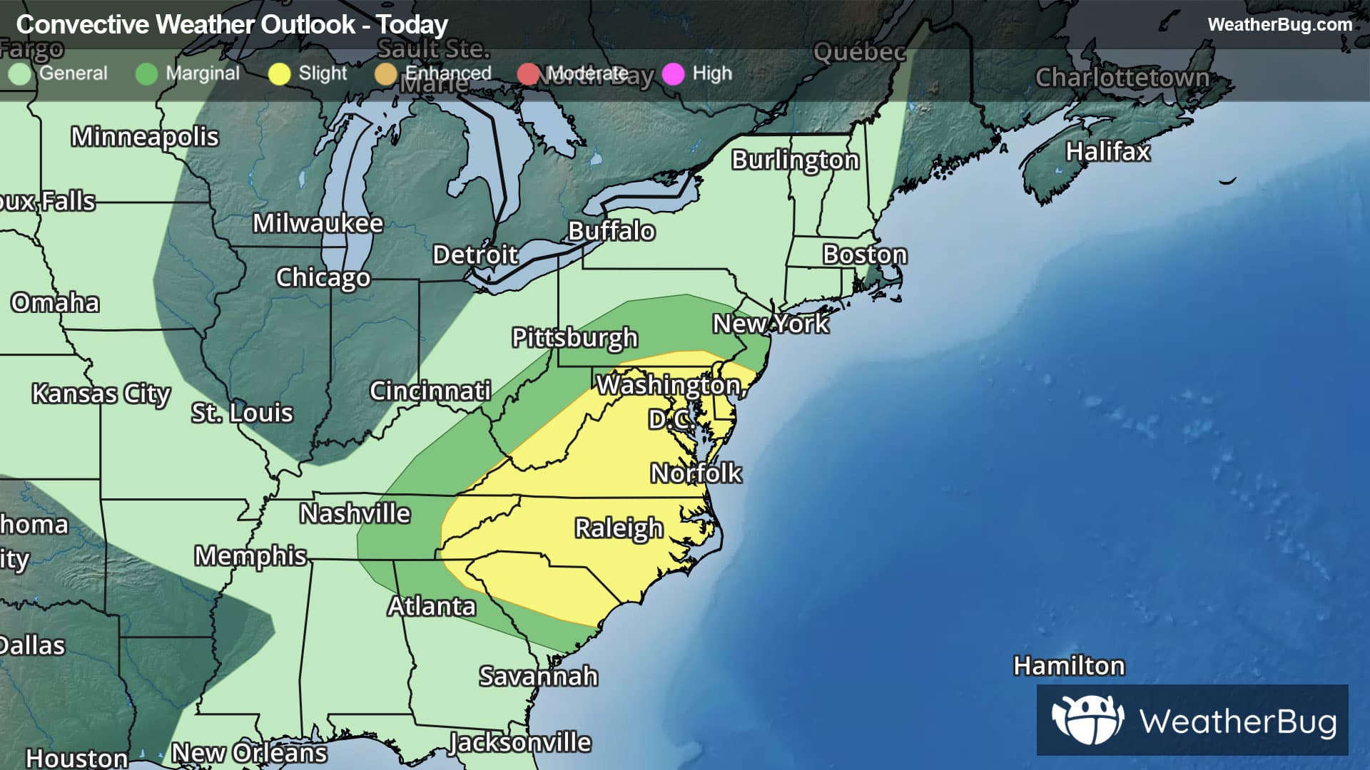
There is a Marginal Severe Storm Risk for your location. Continue reading for today's outlook from the National Weather Service's Storm Prediction Center.
--------------------
National Severe Storm Outlook
THERE IS AN ENHANCED RISK OF SEVERE THUNDERSTORMS ACROSS PARTS OF THE OHIO VALLEY
SUMMARY
Thunderstorms with severe wind gusts and hail are expected this evening across parts of the Ohio Valley. Additional storms with severe wind gusts are also expected from Lower Michigan southward into Ohio. A few strong gusts will also be possible in parts of the central Plains and in south-central Arizona.
Ohio Valley/Great Lakes
On water vapor imagery, a mid-level shortwave trough is moving southward through the Ohio Valley. Ahead of this feature, a moist and unstable airmass is in place with surface dewpoints in the 70s and low 80s F. The RAP has a pocket of strong instability located from western Kentucky into southern Indiana, where MLCAPE is estimated in the 3500 to 4500 J/kg range. Scattered strong to severe storms are ongoing along the northern edge of the stronger instability, and the storms are being supported by large-scale ascent associated with the shortwave trough. In addition, the WSR-88D VWP at Louisville has 0-6 km shear of 30 to 35 knots suggesting a potential for organized severe storms will continue this evening. Severe wind gusts will be possible with supercells and short bowing line segments. The greatest coverage of severe is expected to be over southern Indiana and far northern Kentucky...see MCD 1774.
Further north into Lower Michigan, scattered strong thunderstorms are ongoing ahead a subtle shortwave trough evident on water vapor imagery. Short-term model forecasts suggest these storms will expand in coverage and move southward across Lower Michigan into Ohio during the late evening and early overnight period. Along this corridor, the RAP has MLCAPE in the 1000 to 1500 J/kg range with 40 to 50 knot of deep-layer shear. This should support a wind-damage threat with organized short line segments.
Central Plains
At mid-levels, a subtle shortwave trough is currently moving over the top of a ridge in the central High Plains. Ahead of the shortwave trough, scattered strong thunderstorms are ongoing along the western edge of a pocket of strong instability. The RAP currently shows MLCAPE over central Nebraska in the 4000 to 5500 range. Even though forecast soundings near the instability maximum have low to mid-level wind speeds generally less than 20 knots, the instability combined with very steep low-level lapse rates may be enough for isolated severe wind gusts for a few more hours this evening.
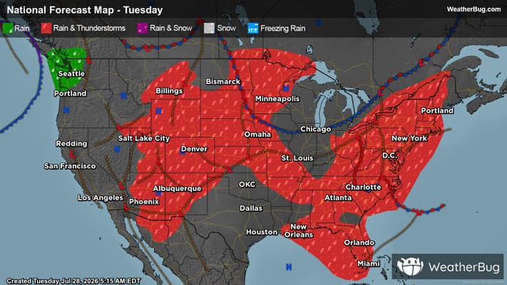
Arizona
The latest surface analysis shows a sufficiently moist airmass in place over the southern half of Arizona, where dewpoints are mostly in the mid to upper 50s F. Within the moist air, the RAP has a pocket of moderate instability with MLCAPE in the 1500 to 2500 J/kg range. Thunderstorm have developed along the northern edge of the stronger instability. These storms will move westward across south-central Arizona this evening, and may pose a threat for severe wind gusts due to very steep low to mid-level lapse rates...MCD 1772.