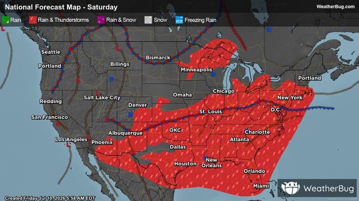
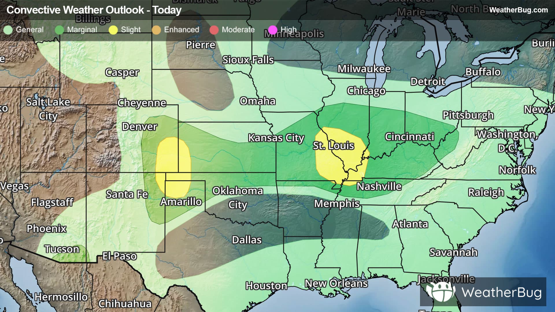
Weather Alerts For Oberlin, KS
High Wind Watch
-URGENT - WEATHER MESSAGE National Weather Service Goodland KS 622 AM MST Wed Dec 17 2025 Yuma-Kit Carson-Cheyenne-Cheyenne-Rawlins-Decatur-Norton-Sherman- Thomas-Sheridan-Graham-Wallace-Logan-Gove-Greeley-Wichita-Dundy- Hitchcock-Red Willow- Including the cities of Bird City, Hoxie, Grinnell, Wray, Oakley, Oberlin, Tribune, Sharon Springs, Goodland, Leoti, Colby, Trenton, Quinter, Palisade, Grainfield, Norton, Cheyenne Wells, St. Francis, Stratton Ne, Arapahoe, McCook, Benkelman, Yuma, Atwood, Burlington, Culbertson, and Hill City 622 AM MST Wed Dec 17 2025 /722 AM CST Wed Dec 17 2025/ ...HIGH WIND WATCH REMAINS IN EFFECT FROM LATE TONIGHT THROUGH THURSDAY AFTERNOON... * WHAT...Northwest winds 35 to 50 mph with gusts up to 70 mph possible. * WHERE...Entire Tri-State area. * WHEN...From late tonight through Thursday afternoon. * IMPACTS...Dangerous travel conditions, especially for high profile vehicles. High winds may also damage property. * ADDITIONAL DETAILS...Strong northwest winds will accompany a cold frontal passage this evening. Winds will weaken for a period overnight, then strengthen after sunrise. The strongest winds are expected mid morning through mid afternoon on Thursday. Winds will decrease during the late afternoon and abruptly weaken around sunset Thursday evening. PRECAUTIONARY/PREPAREDNESS ACTIONS... Monitor the latest forecasts and warnings for updates. &&