# HEADLINE
--------------------
FLOOD WATCH NOW IN EFFECT FROM 8 AM EDT THIS MORNING THROUGH WEDNESDAY EVENING
# DETAILS
--------------------
WHAT
Flash flooding caused by excessive rainfall continues to be possible.
WHERE
Portions of northeast New Jersey, including the following areas, Eastern Bergen, Eastern Essex, Eastern Passaic, Eastern Union, Hudson, Western Essex and Western Union and southeast New York, including the following areas, Bronx, Kings (Brooklyn), New York (Manhattan), Northern Queens, Richmond (Staten Island), Southern Queens and Southern Westchester.
WHEN
From 8 AM EDT this morning through Wednesday evening.
IMPACTS
Excessive runoff may result in flooding of rivers, creeks, streams, and other low-lying and flood-prone locations.
ADDITIONAL DETAILS
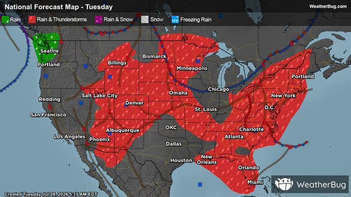
- A slow moving low pressure system will bring multiple rounds of heavy showers and thunderstorms to the area today through Wednesday. Average rainfall amounts are expected to be between 2 and 3 inches with localized higher amounts. Peak hourly rainfall rates could be as high as 1.5 to 2.5 inches in the heaviest showers and thunderstorms.
- http://www.weather.gov/safety/flood
ISSUED AT
Tuesday, July 28, 2026 at 2:53 AM EDT
ISSUED BY
National Weather Service New York NY
HEADER
URGENT - IMMEDIATE BROADCAST REQUESTED | Flood Watch
# PRECAUTIONARY/PREPAREDNESS ACTIONS
--------------------
You should monitor later forecasts and be prepared to take action should Flash Flood Warnings be issued.
# AREAS AFFECTED
--------------------
Northern Queens, Western Union, Bronx, Eastern Bergen, Eastern Essex, Eastern Passaic, Eastern Union, Hudson, Kings (Brooklyn), New York (Manhattan), Richmond (Staten Island), Southern Queens, Southern Westchester, Western Essex