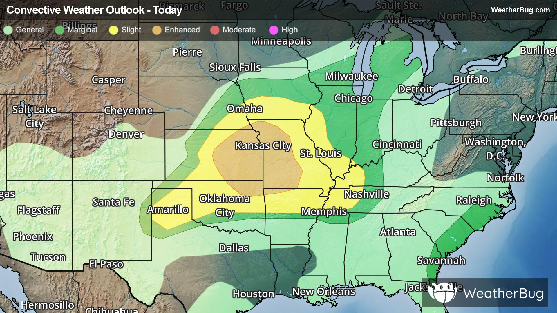
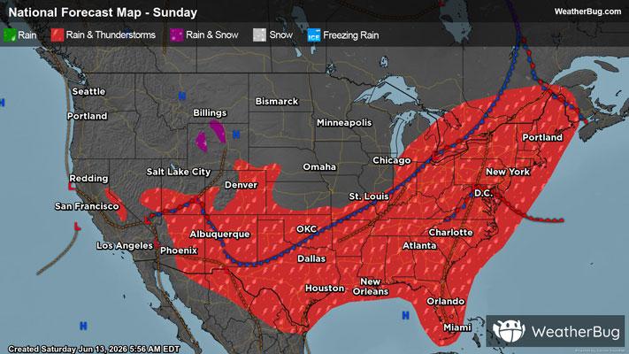
Weather Alerts For Lincoln, NE
Special Weather Statement
-Special Weather Statement National Weather Service Omaha/Valley Nebraska 817 PM CST Fri Jan 16 2026 Sarpy NE-Seward NE-Butler NE-Lancaster NE-Johnson NE-Richardson NE- Saunders NE-Cass NE-Otoe NE-Gage NE-Pawnee NE-Colfax NE-Saline NE- Nemaha NE- 817 PM CST Fri Jan 16 2026 ...BANDS OF MODERATE SNOW WILL AFFECT PORTIONS OF SOUTHEAST NEBRASKA THIS EVENING... HAZARDS...Bands of snow accompanied by winds of up to 40 MPH which can rapidly reduce visibility to less than one mile. LOCATION AND MOVEMENT...At 813 PM CST, a band of heavy snow was along a line extending from 4 miles north of Ulysses to 2 miles west of Raymond to 2 miles east of Walton to 4 miles south of Nehawka and moving southeast at 50 MPH. An additional similar band of snow stretched from near Beatrice to Auburn. LOCATIONS IMPACTED INCLUDE... Lincoln, Nebraska City, Seward, Wahoo, Falls City, Auburn, David City, Tecumseh, Pawnee City, Crete, Waverly, Ashland, Milford, Syracuse, Hickman, Louisville, Weeping Water, Eagle, Ceresco, and Humboldt. This includes Interstate 80 in Nebraska between mile markers 379 and 428. SAFETY INFO... Use extra caution if you must travel into or through these bands of snow. Rapid changes in visibility and potentially slick roads may lead to accidents. &&